More Humid Weekend Shower Thunderstorm Chances Through Monday
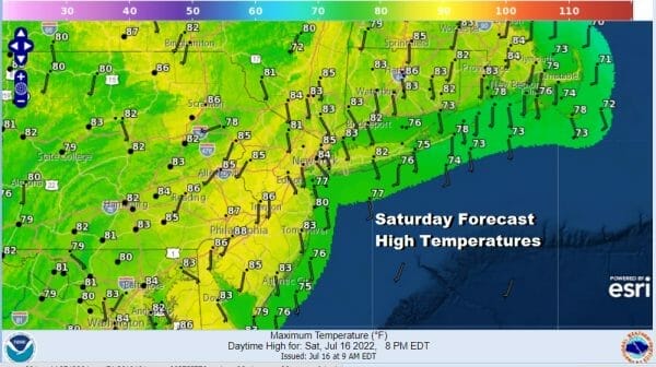
Today begins a slow climb in humidity that will take things to uncomfortable levels through next Thursday. The heat as represented by 90 degree plus daytime highs will hold off until Tuesday as two weather systems play through this weekend and Monday. We have some patchy clouds around today along with some areas of sunshine. This will boost temperatures up into the 80s. Late this afternoon and evneing some scattered thunderstorms will develop though not everyone will see them. Just be aware that the risk is there and act accordingly if threatening weather occurs.
WEATHER RADAR
As the humidity climbs the nights get warmer and more uncomfortable. We have been getting a fair share of comfortable nights in the last month but that comes to an end for awhile. Lows by morning will be in the mid 60s to lower 70s with clouds around. Leftover showers and thunderstorms from this evening will gradually wind down overnight.
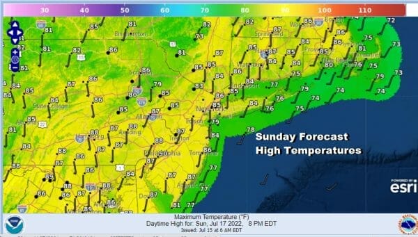
Sunday we will see any morning clouds give way to sunshine and the humidity climbs a little higher. It will be uncomfortable with dew points between 65 and 70 and afternoon highs will be in the middle to upper 80s. Once again we will see some scattered showers and thunderstorms during the late afternoon and evening and again, some of you will seem them and some of you won’t.
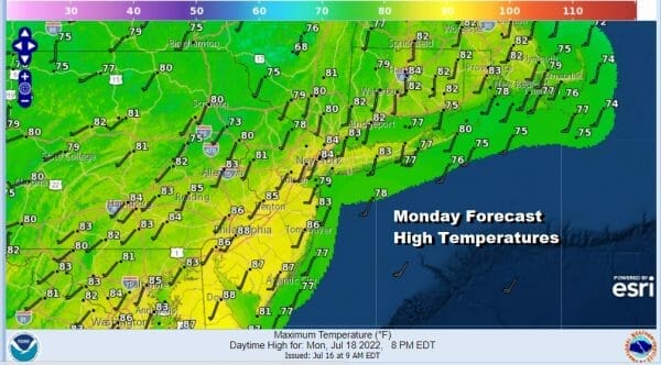
Sunday night sees a warm front go by with some showers and possible thunderstorms into Monday morning putting us squarely in the warm and very humid conditions Monday. A “cold front” will approach late Monday with a round of showers and thunderstorms late in the afternoon and evening. We put cold front in quotes because the the air behind the front is actually hotter than the air ahead of it so it really isn’t much of a cold front at all. The addition of clouds Monday will hold down temperatures in the low to middle 80s with 70s at the shore.
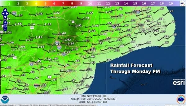
These showers and thunderstorms especially the ones late Sunday night and Monday morning and again late Monday could have the potential to produce a productive amount of rain. This will aleiviate the recent very dry conditions that have developed. There is the potential for some 2 inch plus rainfall in some places with the highest chances inland verses the coast.
After this system passes we have hot humid weather Tuesday through Thursday. This will mean highs each day into the 90s. Humidity levels will be high all three days. Thursday will be the last day of the 90 plus temperatures as a cold front arrives with showers and thunderstorms late in the day. This front has some cooler and drier air behind it so we could see some actual humidity releif behind that front going into next weekend.
BE SURE TO DOWNLOAD THE FREE METEOROLOGIST JOE CIOFFI WEATHER APP &
ANGRY BEN’S FREE WEATHER APP “THE ANGRY WEATHERMAN!
MANY THANKS TO TROPICAL TIDBITS & F5 WEATHER FOR THE USE OF MAPS
Please note that with regards to any severe weather, tropical storms, or hurricanes, should a storm be threatening, please consult your local National Weather Service office or your local government officials about what action you should be taking to protect life and property.


