
Milton Heading East Out To Sea
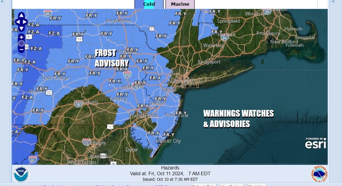
Dry Chilly Weather Continues Frosts Possible Inland

Milton Heading East Out To Sea
Dry Chilly Weather Continues Frosts Possible Inland
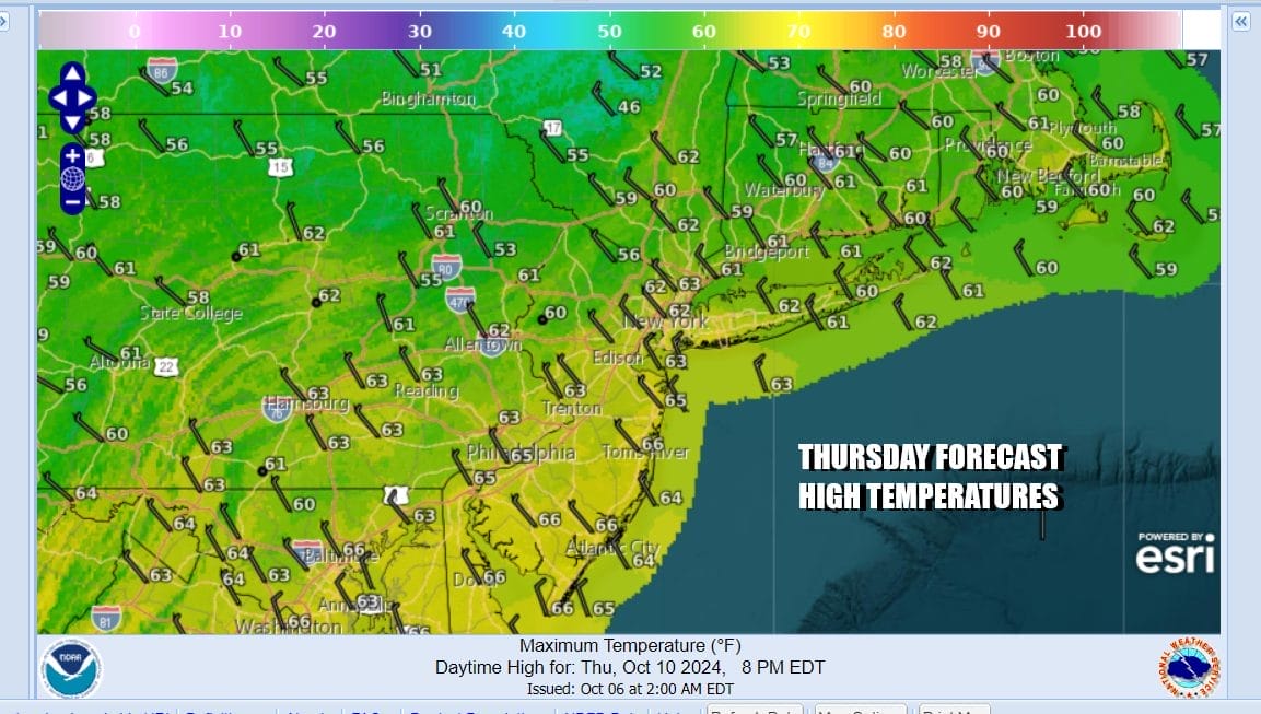
Hurricane Milton is now off the Florida East Coast and moving out to sea. It is not a risk to weather at all for the Eastern Seaboard. In the meantime we are in the center of a chilly air mass that covers the Northeast and Northern Mid Atlantic states. Dry weather continues and in fact, rain will be minimal for the next week to 10 days. As for today we will see sunshine with most highs in the low to mid 60s.
Satellite and radar loops show Milton moving away. They also show mostly cloud free conditions and nothing much on local radars. Tonight will be chilly with most lows inland north and northwest of warmer urban areas like NYC and Philadelphia will be in the 30s in the coolest spots (pine barrens, valleys) with frost. Most other areas will bottom in the 40s to around 50.
SATELLITE WITH LIGHTNING STRIKES

WEATHER RADAR

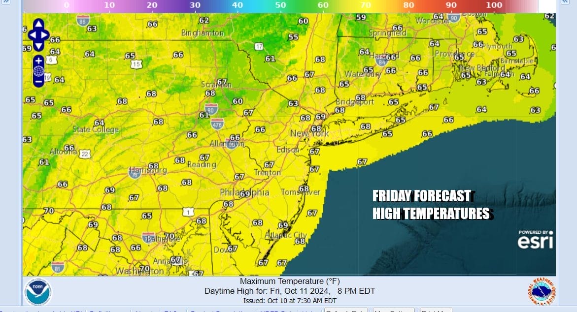
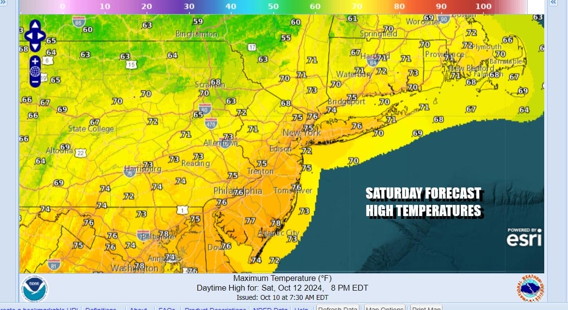
Friday we will start to warm up a bit as the core of this cool air mass moves out to the east. We will see sunshine and that will take afternoon highs to the mid and upper 60s. Over the weekend we will warm up a bit more with sunshine for Saturday. High temperatures Saturday will reach into the 70s.
We are in a pattern where weather systems are moving along but it is being driven by a northwest flow from Canada. This means cold fronts that will pass through from time to time but there is very little moisture around and these lows will produce showers or rain north of the low tracks which for now at least, happen to be across Upstate NY and Northern New England. Such is the case for the next front that arrives Sunday night.

There might be a few showers when the front passes Sunday night but behind the front comes a rather cold shot of air for this time of year and that will be the story for the first half of next week. Monday looks to be a windy and chilly day with highs in the lower 60s before we head down into the 30s and 40s Monday night. Tuesday will be a very chilly day indeed with partly sunny skies and highs just in the 50s! We will likely see frosts and freezes with this cold air masses. Parts of Northern NY and Northern New England could see their first snow showers and accumulating snow in higher elevations. The slow descent through Autumn continues!
BE SURE TO DOWNLOAD THE FREE METEOROLOGIST JOE CIOFFI WEATHER APP &
ANGRY BEN’S FREE WEATHER APP “THE ANGRY WEATHERMAN!
MANY THANKS TO TROPICAL TIDBITS FOR THE USE OF MAPS
Please note that with regards to any severe weather, tropical storms, or hurricanes, should a storm be threatening, please consult your local National Weather Service office or your local government officials about what action you should be taking to protect life and property.
(Amazon is an affilate of Meteorologist Joe Cioffi & earns commissions on sales.)


