A Warm Quiet Weekend Before Cold Air Arrives
Beginning Later Monday Lasting All Week

A Warm Quiet Weekend Before Cold Air Arrives
Beginning Later Monday Lasting All Week
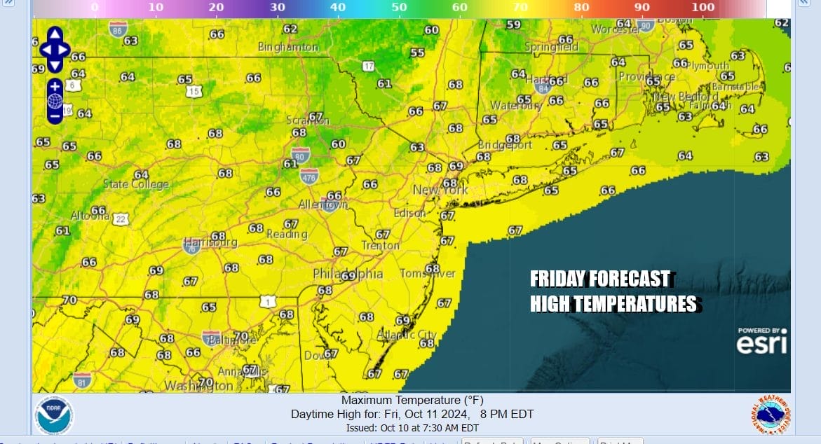
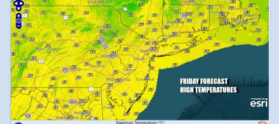
This has been a very turbulent week but with Hurricane Milton long gone the next round of weather changes are set to take place for the Northeast, Mid Atlantic, Ohio Valley, Great Lakes, and the Deep South. A very cold weather pattern is setting up for next week thanks to a very strong northwest flow from Canada. Before this chilly air mass arrives we have a warm up that gets underway. Satellite and radars are clear and quiet and we will have another day of sunshine. Highs this afternoon will reach the mid to upper 60s.
SATELLITE WITH LIGHTNING STRIKES

WEATHER RADAR

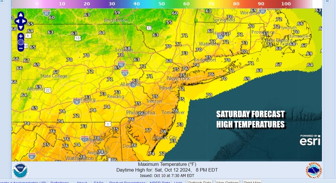
No rain is forecast through the daytime Sunday. We have low pressure and a cold front that will be setting up through upstate NY over the weekend and that likely brings some rain across Upstate NY and New England but for Eastern Pennsylvania to Southern New England we anticipate no rain. Saturday will be a day of sunshine with highs warming back up into the 70s.
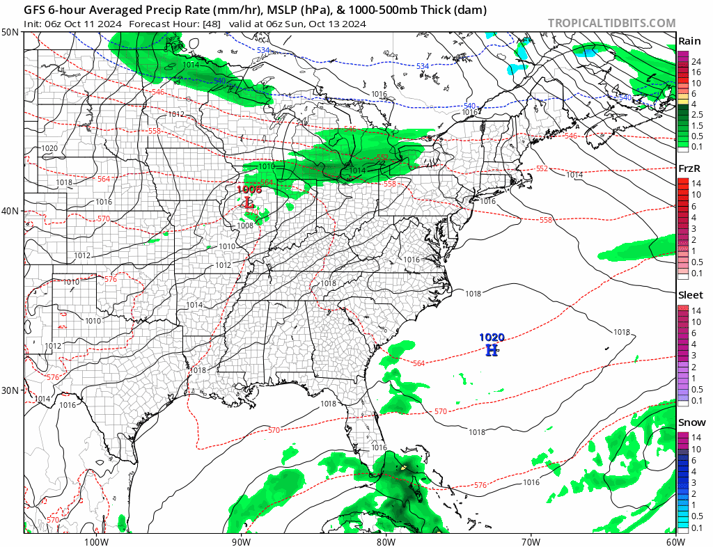
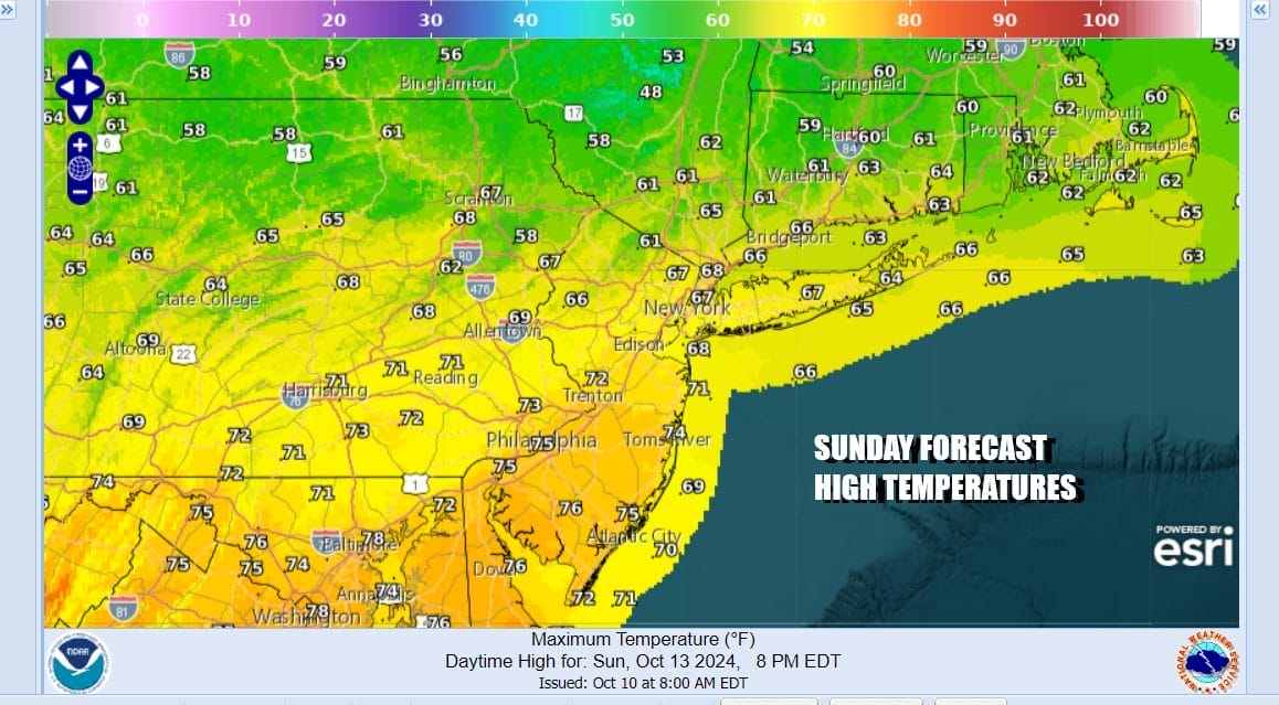
Sunday we will likely see temperatures a little lower due to perhaps more in the way of cloud cover around. Showers won’t become an issue until Sunday night into the first part of Monday as a low moves across Upstate NY and New England. Once that happens the cold front will pass offshore. This will be followed by a large high pressure area dropping down from Canada and into the Southeast US.
This is a rather impressive cold air mass coming down for the middle of October. It produces a widespread area of below average temperatures for everyone east of the Mississippi River and that includes the Deep South, the Gulf Coast and even into Northern Florida. This air mass is going to be with us all of next week.

Also some areas in Northern New York, Northern New England and Eastern Canada will see their first snows of the season ranging from just snow showers, to accumulating snow in Eastern Canada. Widespread frosts and freezes are going to be commonplace next week for 4 nights. Getting there we have sun and arriving clouds for Sunday with highs in the upper 60s north of NYC and low to mid 70s south of Philadelphia.
Showers will pass Sunday night into Monday afternoon from west to east and then it will turn colder. Monday temperatures will be in the 60s to near 70 until winds shift to northwest and colder air starts to arrive. We will see that Tuesday as the first day of temperatures not getting out of the 50s by day and dropping into the 30s in many inland areas Tuesday night into Wednesday morning. Get the firewood and fire places ready to go because this is real Autumn weather. For much of the area next week it will be bone dry.
BE SURE TO DOWNLOAD THE FREE METEOROLOGIST JOE CIOFFI WEATHER APP &
sANGRY BEN’S FREE WEATHER APP “THE ANGRY WEATHERMAN!
MANY THANKS TO TROPICAL TIDBITS FOR THE USE OF MAPS
Please note that with regards to any severe weather, tropical storms, or hurricanes, should a storm be threatening, please consult your local National Weather Service office or your local government officials about what action you should be taking to protect life and property.
(Amazon is an affilate of Meteorologist Joe Cioffi & earns commissions on sales.)


