Major Hurricane Milton Landfalls Tonight Florida West Coast
While Northeast Mid Atlantic Weather Remains Calm

Major Hurricane Milton Landfalls Tonight Florida West Coast
While Northeast Mid Atlantic Weather Remains Calm

Milton remained a category 5 hurricane overnight and during this morning but we are beginning to see the impacts of strong upper level winds that are developing in the Eastern Gulf of Mexico. This will cause some slow weakening as Milton heads northeast but it will be a major hurricane tonight when it makes landfall along the Florida west coast. It appears the landfall will be some where between Tampa and Port Charlotte. We expect it to be a strong category 3 or a low end category 4 at landfall. It really doesn’t matter what the category is. It is a major hurricane and it will landfall as a major hurricane.
SATELLITE WITH LIGHTNING STRIKES

WEATHER RADAR

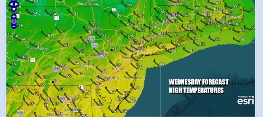
While all this is going on over Florida, the weather in the Northeast and Mid Atlantic has very much turned to autumn with chilly nights and pleasant though cool days. We have sunshine and clouds forecast today as a weak upper trough moves through. After a chilly overnight, afternoon highs today will reach the low and middle 60s. There are some showers on the radar to the north but they will likely stay in Upstate NY and New England.
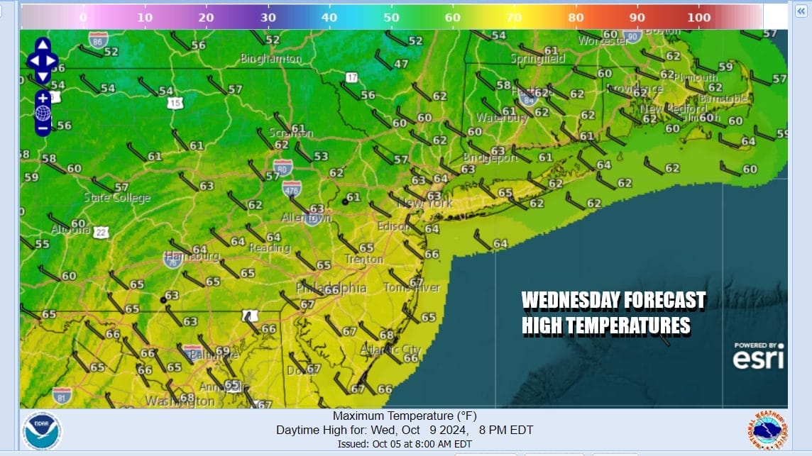
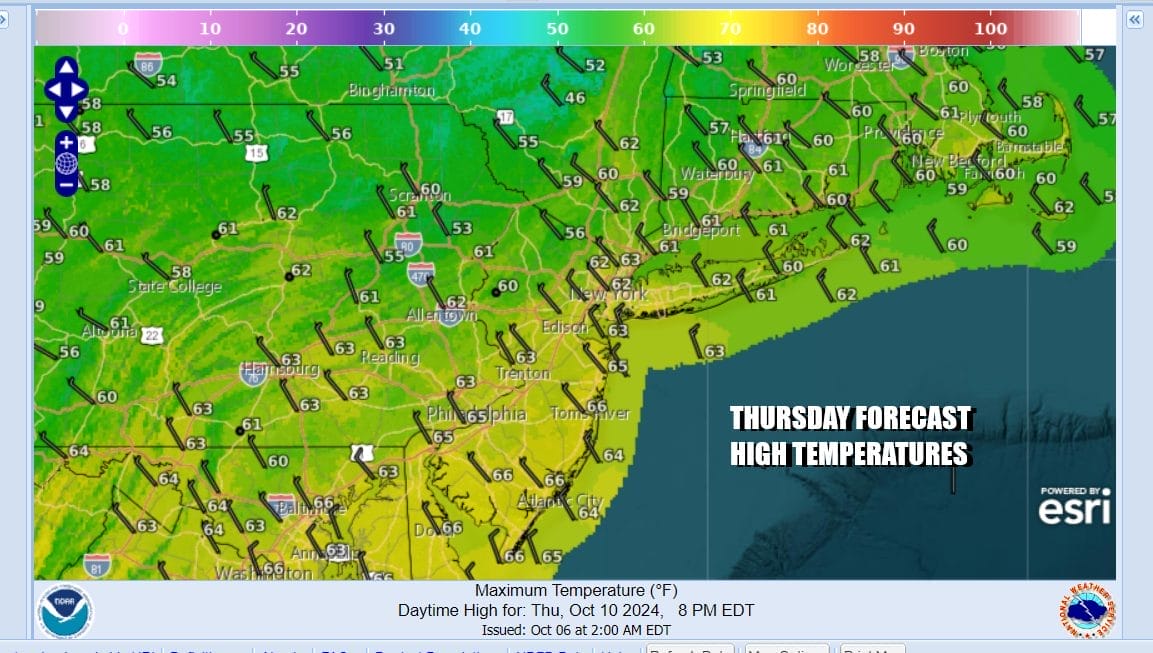
We do not see any important changes in the weather for Thursday and Friday as both days will remain on the cool side. High pressure will be overhead for the rest of the week. Over the weekend the high moves out to the east and we will see temperatures warm back into the 70s for Saturday and Sunday. The warm up however will be short lived as strong low pressure and a cold front will head east across the Great Lakes and into the Northeast.

A cold front will likely pass through Sunday night with little in the way of showers as most of those go by to our north. Behind the front however is the coolest air of the fall season so far and next week we could see the first frosts in areas inland north and northwest of the major urban areas of NYC and Philadelphia. It is also likely to be dry all of next week with no rain in the forecast.
The bottom line is that we will have a sunny Thursday and Friday with highs in the 60s. Sunshine is forecast for Saturday and no worse than partly sunny for Sunday with highs back into the 70s. Then we see the colder air arrive next week and I suspect we have a day or two next week where temperatures have a tough time getting much out of the 50s in some places.
BE SURE TO DOWNLOAD THE FREE METEOROLOGIST JOE CIOFFI WEATHER APP &
ANGRY BEN’S FREE WEATHER APP “THE ANGRY WEATHERMAN!
MANY THANKS TO TROPICAL TIDBITS FOR THE USE OF MAPS
Please note that with regards to any severe weather, tropical storms, or hurricanes, should a storm be threatening, please consult your local National Weather Service office or your local government officials about what action you should be taking to protect life and property.
(Amazon is an affilate of Meteorologist Joe Cioffi & earns commissions on sales.)


