
Midwest & South Prep For Major Severe Weather Outbreak
While We Bask In The Onshore Flow For Now
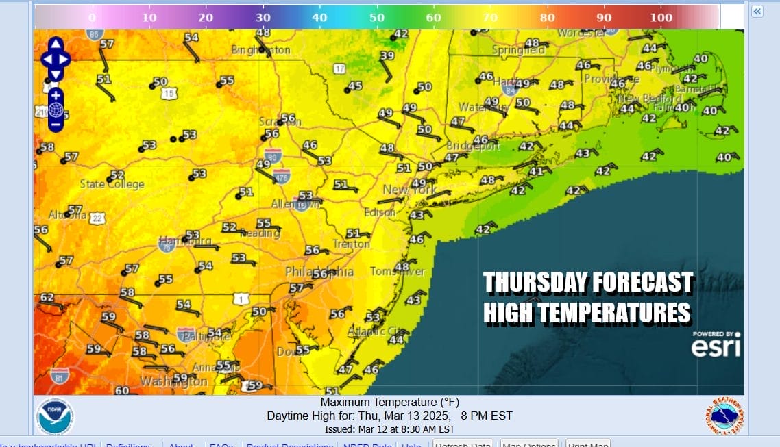
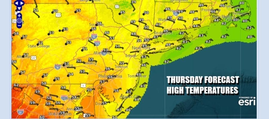
The onshore flow that began yesterday continues today. We do have some patchy clouds around but we also have areas of sunshine. The winds from the east and northeast will continue to keep temperatures from rising much today. Most highs will be in the 50s except for areas right along the immediate coast where temperatures may struggle to get out of the 40s. Radars are about as silent as they can get across the Eastern US.
SATELLITE WITH LIGHTNING STRIKES

WEATHER RADAR

Tonight we have a total lunar eclipse that will be visible after midnight and much will depend on the onshore flow and whether low clouds will become an issue. This is of greater concern for areas near the coast verses inland areas. Some models are indicating low clouds developing later today and tonight along coastal areas that will penetrate inland to some degree.
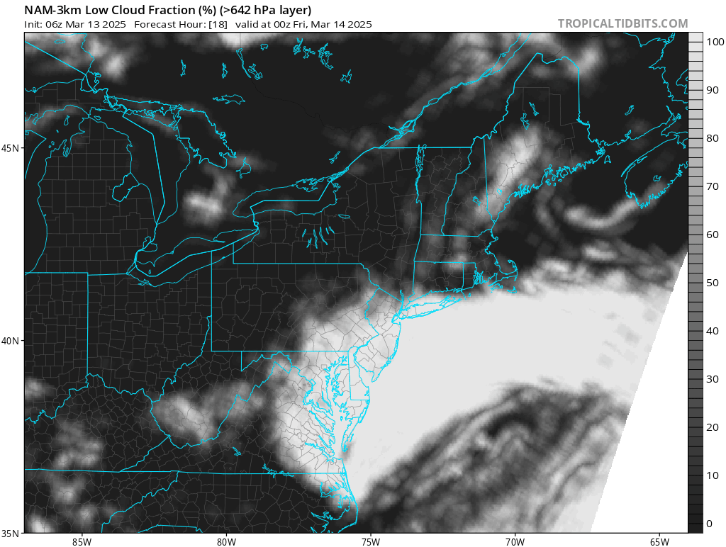
It would seem that ideal viewing conditions will be north of Route 84 in NY and Connecticut and west of I-81 in Pennsylvania. Areas closer to the coast will have to take their chances with low clouds and hope that the deck doesn’t completely obscure sky conditions. Once we get to sunrise the low clouds should slowly give way to a mix of sun and clouds Friday with highs again in the 50s.

Now to the weekend where we have a major storm developing in the Plains that will be heading to the upper midwest. Everyone from the Mississippi River Valley east to the East Coast could be dealing with severe weather risk from the approaching cold front. The East Coast will wait until Sunday before the front gets close enough for showers and thunderstorms. These will occur late Sunday into Sunday night.

The Storm Prediction Center has an implied slight risk (15% chance) for severe thunderstorms Sunday form Northern Florida to Northern New Jersey and Pennsylvania. It probably means the marginal risk will be further north into New York and Southern New England. Enhanced risk could be possible from Southern New Jersey southward.

Ahead of all this winds will turn south Saturday and south to southwest Sunday. The old back door front will fly northward and temperatures will warm into and through the 60s Saturday with clouds and some sun. Sunday will be windy with gusts over 30 mph and increasing clouds. Highs will be in the 60s to near 70. Showers and thunderstorms with possible severe storms in the mix will develop late in the day and last into Monday morning. We will have more on this system tonight on the Joe & Joe Weather Show Podcast LIVE at 7:35pm
BE SURE TO DOWNLOAD THE FREE METEOROLOGIST JOE CIOFFI WEATHER APP &
ANGRY BEN’S FREE WEATHER APP “THE ANGRY WEATHERMAN!
MANY THANKS TO TROPICAL TIDBITS FOR THE USE OF MAPS
Please note that with regards to any severe weather, tropical storms, or hurricanes, should a storm be threatening, please consult your local National Weather Service office or your local government officials about what action you should be taking to protect life and property.


