Mid Spring Snow Interior Northeast, Wind Rain Coast Monday Night Into Tuesday

Mid Spring Snow Interior Northeast, Wind Rain Coast Monday Night Into Tuesday
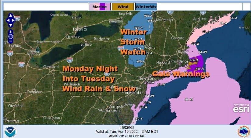
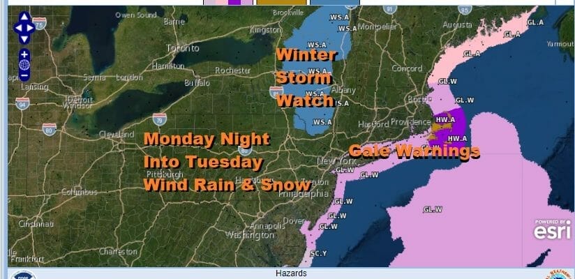
Easter and Passover in mid April is warmer more often than not but this has been a strange month so why not have a heavy snow threat on the table for the interior Northeast. Winter Storm Watches are up from the Catskills to the Adirondacks. We also have gale warnings in effect along the coast and high wind warnings for Southeastern New England. All of this is for the time frame of Monday night into Tuesday. In the meantime low pressure is pulling slowly away from Eastern Canada and the atmosphere is stabilizing. It was a chilly brisk Easter Sunday and now we turn our attention to the next storm system moving into the Western Great Lakes and redeveloping along the coast Monday night. Three are no issues tonight however as skies should go partially clear with lows by morning in the 30s. Frosts and freezes are likely in Southern New Jersey and Southern Pennsylvania where the growing season is now underway.
SATELLITE

WEATHER RADAR

Monday we will see sunshine giving way to arriving clouds. Even though the surface set up is one that would be a no brainer for snow in the dead of winter for most places, this time of year it is hard to prevent temperatures a low levels to reach the 50s. The air is cold aloft however as a strong upper trough cuts off over the Great Lakes and creates an intensifying storm moving up the coast Monday night into Tuesday morning.
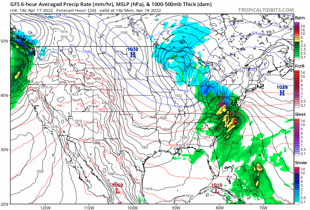
The coastal storm will become a tight gale center as it moves northward. Rain develops from south to north later Monday afternoon and evening. Along the coast rain will also come with winds gusting to gale force as the low coast hugs its way into New England Tuesday morning. However in elevated areas in Northern Pennsylvania, Upstate NY and New England, cold air aloft will mix down and bring heavy wet snow.
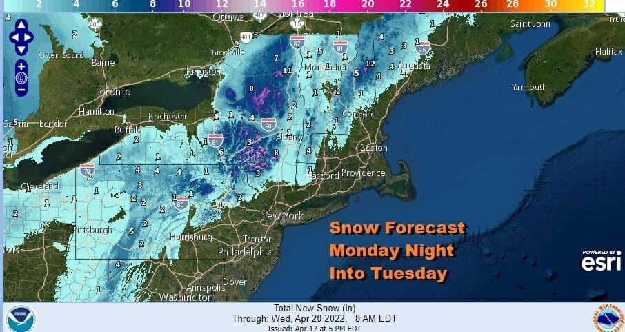
I would not be at all surprised to see some elevated areas in the Catskills and Adirondacks pick up 6 to 12 inches of snow from this. It might also mix with some wet snow as far south as Northwest New Jersey down to about Route 84 in the Hudson Valley and Connecticut. Temperatures will be down in the 30s and lower 40s Monday night into Tuesday morning. The storm moves northward Tuesday so rain at the coast will end before daybreak while snow continues to the north. Temperatures Tuesday will be in the 40s to lower 50s except where it might still be snowing to the north. Weather conditions should improve Wednesday into Thursday and temperatures should start to rebound mid and late week.
BE SURE TO DOWNLOAD THE FREE METEOROLOGIST JOE CIOFFI WEATHER APP &
ANGRY BEN’S FREE WEATHER APP “THE ANGRY WEATHERMAN!
MANY THANKS TO TROPICAL TIDBITS & F5 WEATHER FOR THE USE OF MAPS
Please note that with regards to any severe weather, tropical storms, or hurricanes, should a storm be threatening, please consult your local National Weather Service office or your local government officials about what action you should be taking to protect life and property.


