
DOWNLOAD MY NEW FREE JOESTRADAMUS WEATHER APP FOR ANDROID

THE APP IS ABSOLUTELY FREE TO ALL BUT CONSIDERING SUBSCRIBING TO PATREON FOR A WEATHER EXPERIENCE FREE OF ADS, EXCLUSIVE VIDEOS FOR MEMBERS ONLY AND MUCH MORE…STARTS AT $2 A MONTH..MESSAGE ME AT ANY TIME

Merry Christmas Cold Dry Sunshine Rain Warm Friday
Colder Weekend Chance Rain or Snow Sunday & New Year’s Day
Merry Christmas to all on this nice cold quiet Christmas Day We have some scattered clouds around but overall it is a nice day of sunshine. Some patchy clouds are showing up on the satellite to the north and west and they will slide through from time to time. Temperatures are going to top in the upper 30s to lower 40s. There are no weather issues travelling to wherever you are headed. There will also be no weather issues tonight with clear skies and temperatures in the 20s to lower 30s by Wednesday morning. Radars are nice and quiet all across the Northeast & Middle Atlantic states.
EASTERN SATELLITE

REGIONAL RADAR

Wednesday looks like a nice day with plenty of sunshine with just a few passing clouds and highs in the upper 30s and lower 40s. The high along the East Coast slides out to the east and the next weather system will approach on Thursday. We will see sunshine and arriving clouds with highs in the 40s. Then temperatures will hold steady or slowly rise Thursday night as low pressure heads for the Great Lakes and a warm fron heads our way from the southwest.
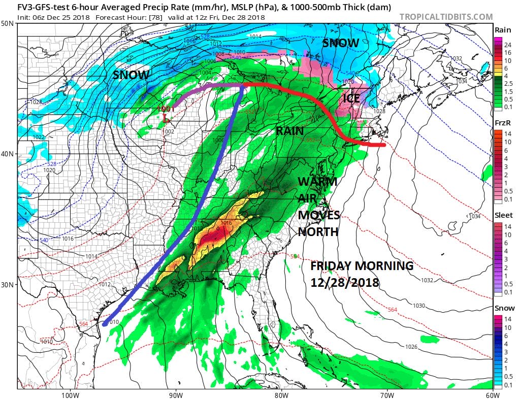
Friday looks like a warm rainy day with highs in the 50s. The rain could be heavy at times into Friday night before the cold front passes through. Then weather conditions will improve on Saturday. After a warm start Saturday temperatures will begin to fall as colder air returns for Saturday night and Sunday.
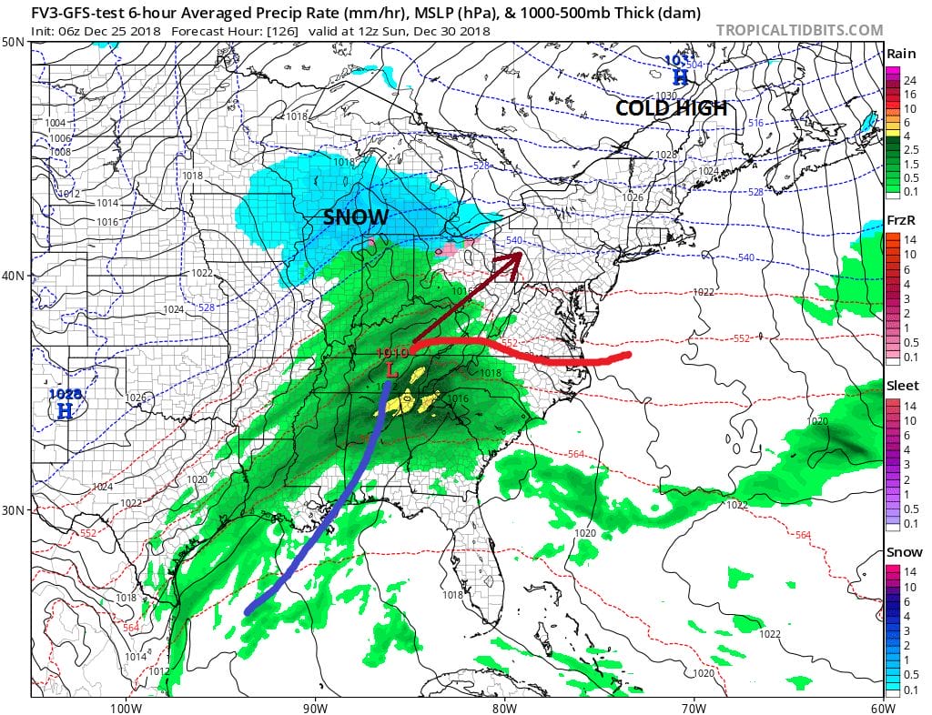
The pattern will be active into next week and there could be several systems in play. Each one that goes by will likely have more cold air to play with. The first one approaches Sunday with a marginal amount of cold air along the coast and more significant cold air inland. We see sunshine giving way to arriving clouds and the chance for rain or snow developing late in the day Sunday. The system is not a strong one so it should move along and it may be gone by Monday morning. Another system will follow for New Year’s day. The overall pattern on some models looks to be colder in the long range on some models but there is some disagreement here. We also are seeing a major stratospheric warming event that is beginning today across the polar regions. This could alter the pattern significantly as we head into January and make models even more unstable then they usually are. All of this will make for a lot of forecasting headaches going forward. In the meantime enjoy your Christmas Day and best wishes to all.
MANY THANKS TO TROPICAL TIDBITS FOR THE USE OF MAPS
Please note that with regards to any tropical storms or hurricanes, should a storm be threatening, please consult your local National Weather Service office or your local government officials about what action you should be taking to protect life and property.

