Memorial Day Weekend Sunday Monday Outlook
Memorial Day Weekend Sunday Monday Outlook
The Memorila Day weekend continues to move along on form with no big changes in the outlook for Sunday and Monday. Saturday we saw a weak disturbance move through that produced a lot of clouds but showers were widely scattered except in parts of South Jersey & Southeast Pennsylvania. Now as we move into Sunday we will see a bit of dry air trying to get in fighting against a weak onshore flow that will produce some clouds especially along coastal areas. I think the safe bet is for skies to become partly sunny on Sunday with highs reaching into the 70s inland but holding in the 60s along the coast. No rain is forecast for the daytime Sunday and the radars should remain quiet into the beginning of Sunday night.
SATELLITE LOOP

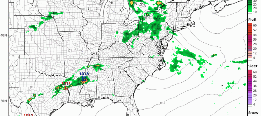
REGIONAL RADAR

LOCAL RADAR NEW YORK CITY

LOCAL RADAR PHILADELPHIA


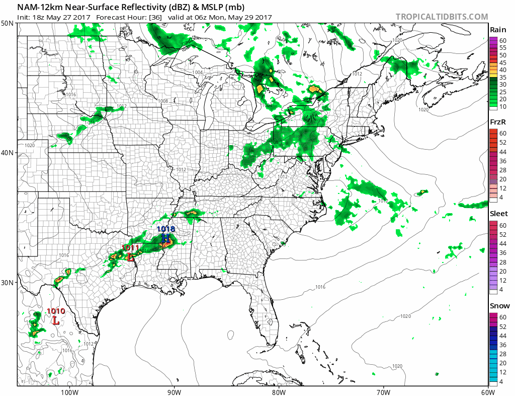
As for Monday Memorial Day we will see a cold front approaching and moving through and this will produce some showers and possibly a thunderstorm. The best chances look to be during the morning and early afternoon and there could be some drying later in the afternoon. Temperatures will reach into the 70s except again near the coast where clouds could be stubborn all day.
MEMORIAL DAY WEEKEND NAM MODEL MONDAY MORNING CLICK TO ANIMATE
Tuesday and Wednesday we will see a series of weak disturbances moving through which will probably leave us in a mix of sun and clouds and the chance for a shower or a thunderstorm each day. Not everyone will see showers on Tuesday and Wednesday. Temperatures will continue to be in the 70s for highs. No hot weather is in sight for this coming week.
 GET JOE A CIGAR IF YOU LIKE

LANDSCAPE COMPANIES FOR YOUR NEEDS
LONG ISLAND ROCKLAND COUNTY Connecticut

![]()

ROCKLAND COUNTY TRI STATE SNOW REMOVAL JOHNSTOWN PA


FiOS1 News Weather Forecast For Long Island
FiOS1 News Weather Forecast For New Jersey
FiOS1 News Weather Forecast For Hudson Valley
NATIONAL WEATHER SERVICE SNOW FORECASTS
LATEST JOESTRADAMUS ON THE LONG RANGE
Weather App

Don’t be without Meteorologist Joe Cioffi’s weather app. It is really a meteorologist app because you get my forecasts and my analysis and not some automated computer generated forecast based on the GFS model. This is why your app forecast changes every 6 hours. It is model driven with no human input at all. It gives you an icon, a temperature and no insight whatsoever.
It is a complete weather app to suit your forecast needs. All the weather information you need is right on your phone. Android or I-phone, use it to keep track of all the latest weather information and forecasts. This weather app is also free of advertising so you don’t have to worry about security issues with your device. An accurate forecast and no worries that your device is being compromised.
Use it in conjunction with my website and my facebook and twitter and you have complete weather coverage of all the latest weather and the long range outlook. The website has been redone and upgraded. Its easy to use and everything is archived so you can see how well Joe does or doesn’t do when it comes to forecasts and outlooks.
Just click on the google play button or the apple store button on the sidebar for my app which is on My Weather Concierge. Download the app for free. Subscribe to my forecasts on an ad free environment for just 99 cents a month.
Get my forecasts in the palm of your hand for less than the cost of a cup of Joe!


