Mardi Gras Cold Valentines Day Milder Thursday 60s
Mardi Gras Cold Valentines Day Milder Thursday 60s
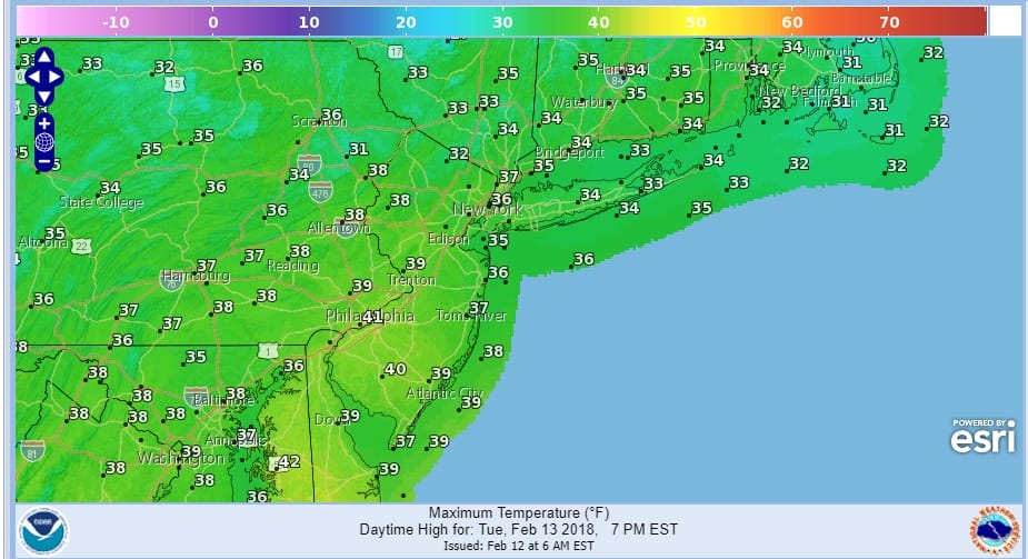
We continue to be on this roller coaster ride up and down in the temperatures as we have bottomed in the teens and 20s this morning. We have sunshine forecast today and other than the occasional passing clouds we will be in good shape. There isn’t much happening on the satellite picture this morning nor are the radars showing anything to worry about. Highs this afternoon will reach the 30s to near 40 degrees.
TODAY’S FORECAST HIGH TEMPERATURES
Out to the west we see the beginnings of the next weather system that will be impacting our weather. Clouds will come in tonight ahead of milder air so temperatures overnight won’t be falling much as they hold in the 20s to lower 30s. Then it is back to sunshine for Wednesday with milder afternoon highs in the upper 40s and lower 50s.
US SATELLITE

REGIONAL RADAR

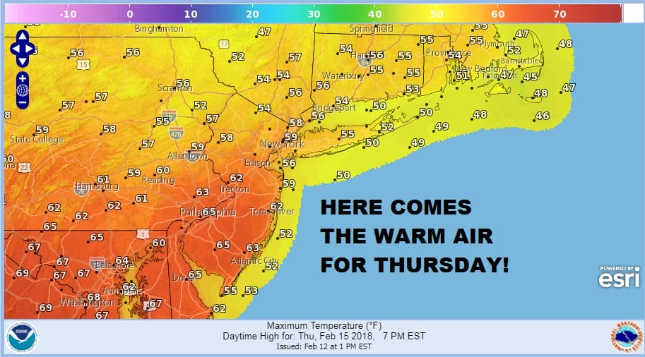
Thursday brings the next storm system going by to our north so Wednesday night a warm front approaches with some showers into Thursday morning. Then we will break out into some sunshine Thursday afternoon and temperatures will climb into the 60s and some places in Southern New Jersey and Southeast Pennsylvania could reach 70. Coastal areas may have to battle the sea breeze as the south wind will be developing off the cold ocean.
THURSDAY’S FORECAST HIGH TEMPERATURES
More showers will develop later Thursday night into Friday morning as a cold front approaches and moves through. Then temperatures head south from the 50s Friday back to the 20s Saturday morning.
GFS MODEL SATURDAY INTO SUNDAY CLICK TO ANIMATE
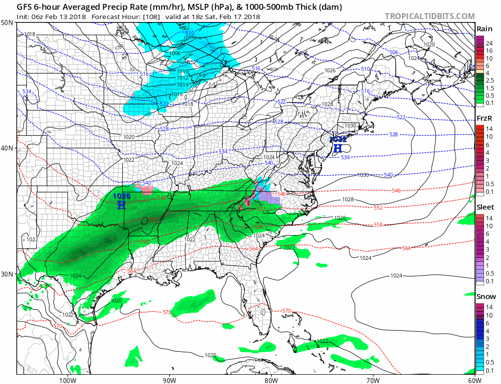
There are some questions regarding the weekend as there may be a wave developing on this front after it goes by with cold air coming in. We have been saying that the only way it snows in this pattern we have is if cold air times out perfectly with any leftover southern stream energy. Weather models all show this possibility for Saturday night into Sunday as low pressure develops on the front and heads to Southern Ohio with a wave redeveloping off the coast. Right now we are in watch and see mode here. Longer term the pattern of ups and downs continues next week however we are going to see a pattern change across the Atlantic as for the first time this winter, blocking may burst on the scene as we head toward the end of the month and into March. This may be an opportunity for winter to reassert itself in some fashion in the longer term.
 GET JOE A CIGAR IF YOU LIKE

FiOS1 News Weather Forecast For Long Island
FiOS1 News Weather Forecast For New Jersey
FiOS1 News Weather Forecast For Hudson Valley