

USE THE COUPON CODE “summer2026” AND GET 10 PERCENT OFF ON ANY PURCHASE

Major Coastal Storm Gets Underway Strong Winds
Heavy Rains Coastal Flooding Tonight Through Sunday
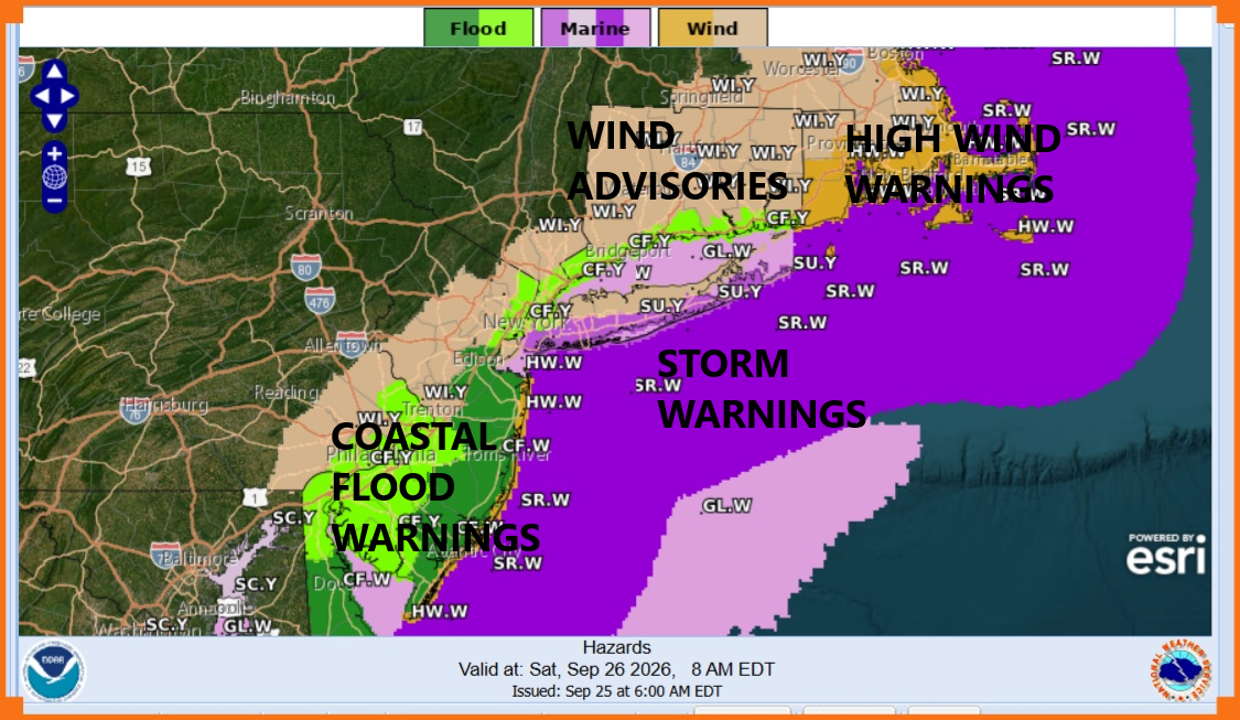
Satellite loops show a well defined intensifying coastal storm moving northward up the East Coast. We have coastal flood warnings posted from Virginia to Long Island and Southern New England. Storm warnings for the coastal waters for winds in excess of 50 knots. Wind Advisories are up for most areas inland, and high wind warnings are up for the New Jersey shore as well as Southeastern New England. Other areas in between will likely see high wind warnings go up for coastal areas.
SATELLITE WITH LIGHTNING STRIKES

WEATHER RADAR
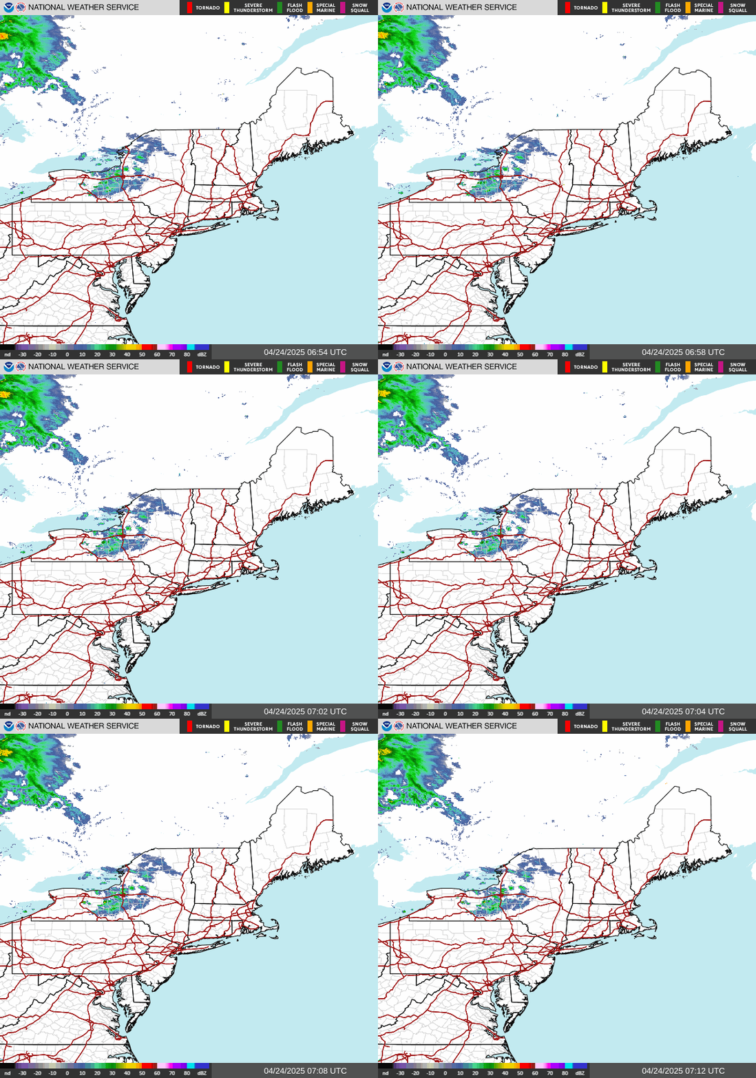
Since this storm is coming up from the southeast, we are seeing radar echos offshore. The first band of rain will move in later this afternoon and evening but it is going to hit some dry air and that first band is likely to weaken once inland. However more rain and a moister atmosphere will mean overspreads the area tonight and Saturday morning. Then we get in to the nasty part of the storm. Strong winds along the coast from New Jersey to Long Island and Southern New England will gust to 50 mph or more Saturday into Sunday morning. Inland wind gusts will be lower but we could see gusts over 40 mph. Bands of heavy rain will be coming in from the east but there will be some breaks between bands where the rain lightens up or even stops for awhile.
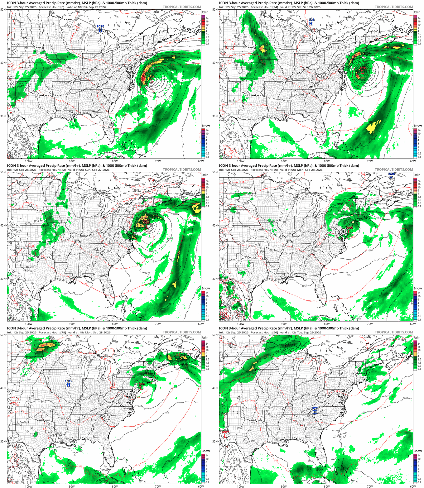
The storm center will reach peak intensity Saturday afternoon and then takes a hook to the left moving westward. The center will pass south of Long Island and then head close to coastal New Jersey by Sunday morning. It will move southward from there and then turn east, completing a full counterclockwise loop. Saturday night into Sunday morning will be quite nasty. Inland areas will see less intense conditions.
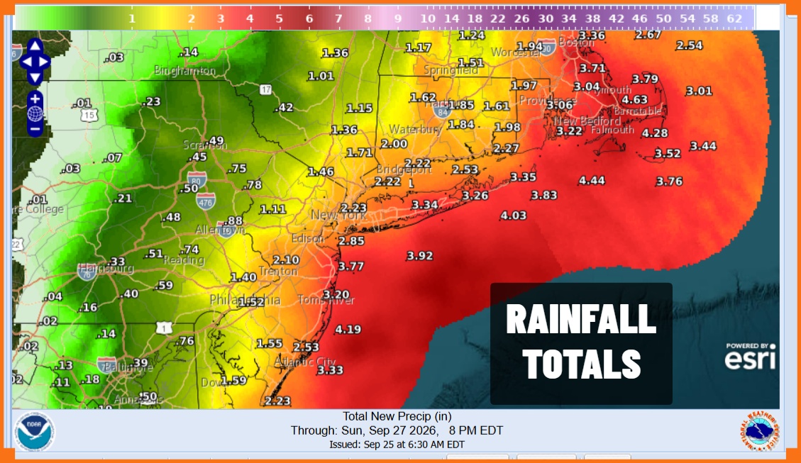
While there could be be some local street flooding, rain will be spread out over the course of 72 hours so I think the risk for flash flooding is low except for perhaps vulnerable low lying areas with clogged storm drains. The storm weakens slowly Sunday so winds will start to come down some Sunday afternoon and Sunday night. It will take another day for the storm center to exit so Monday will be cloudy with some showery rains from place to place and from time to time. Through all of this temperatures will be in the cool 60s. Finally by Tuesday some sunshine returns. Coastal flooding at high tides will continue through the weekend. The intensity of coastal flooding will depend on location and wind direction. Moderate coastal flooding is likely and some vulnerable areas on Long Island and in New Jersey could see pocket of major coastal flooding and beach erosion at times of high tide.
MANY THANKS TO TROPICAL TIDBITS FOR USE OF MAPS
Please note that with regards to any severe weather, tropical storms, or hurricanes, should a storm be threatening, please consult your local National Weather Service office or your local government officials about what action you should be taking to protect life and property.
