

USE THE COUPON CODE “summer2026” AND GET 10 PERCENT OFF ON ANY PURCHASE

Major Storm Strong Winds Heavy Rain
Coastal Flooding Into Sunday
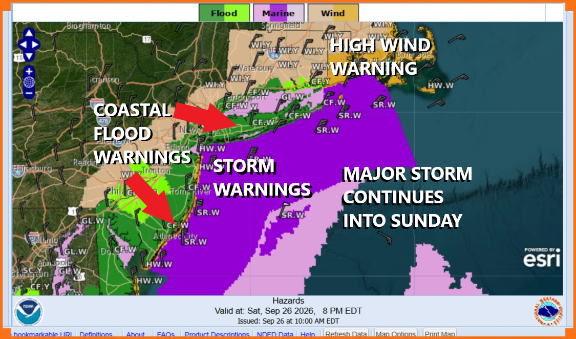
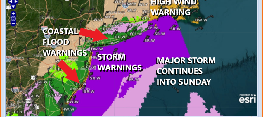
Our major coastal storm or as it is often referred to as a nor’easter continues to batter the shoreline from Delaware to Southeastern New England. Various warnings are up including storm warnings for the coastal waters for sustained winds of 50 mph or higher, heavy rains, and widespread coastal flooding. This storm still has a long way to go as these conditions will continue into Sunday. Overnight winds gusted to hurricane force (75 mph) over Eastern Long Island and parts of the Central New jersey coast. There has been widespread coastal flooding in some areas and we have several more high tide cycles to go.
SATELLITE WITH LIGHTNING STRIKES

WEATHER RADAR

Satellite loops show an impressive cyclone offshore with a well defined circulation both surface and aloft. The strong upper air storm system has captured the surface low. The storm is moving north and tonight it will begin a counterclockwise loop hooking left south of Long Island and then reaching the coast of New Jersey Sunday morning. The storm is stronger than modeled and looks to hold on to that strength longer than previously shown. The worst of this storm will be this afternoon, overnight and into Sunday morning.
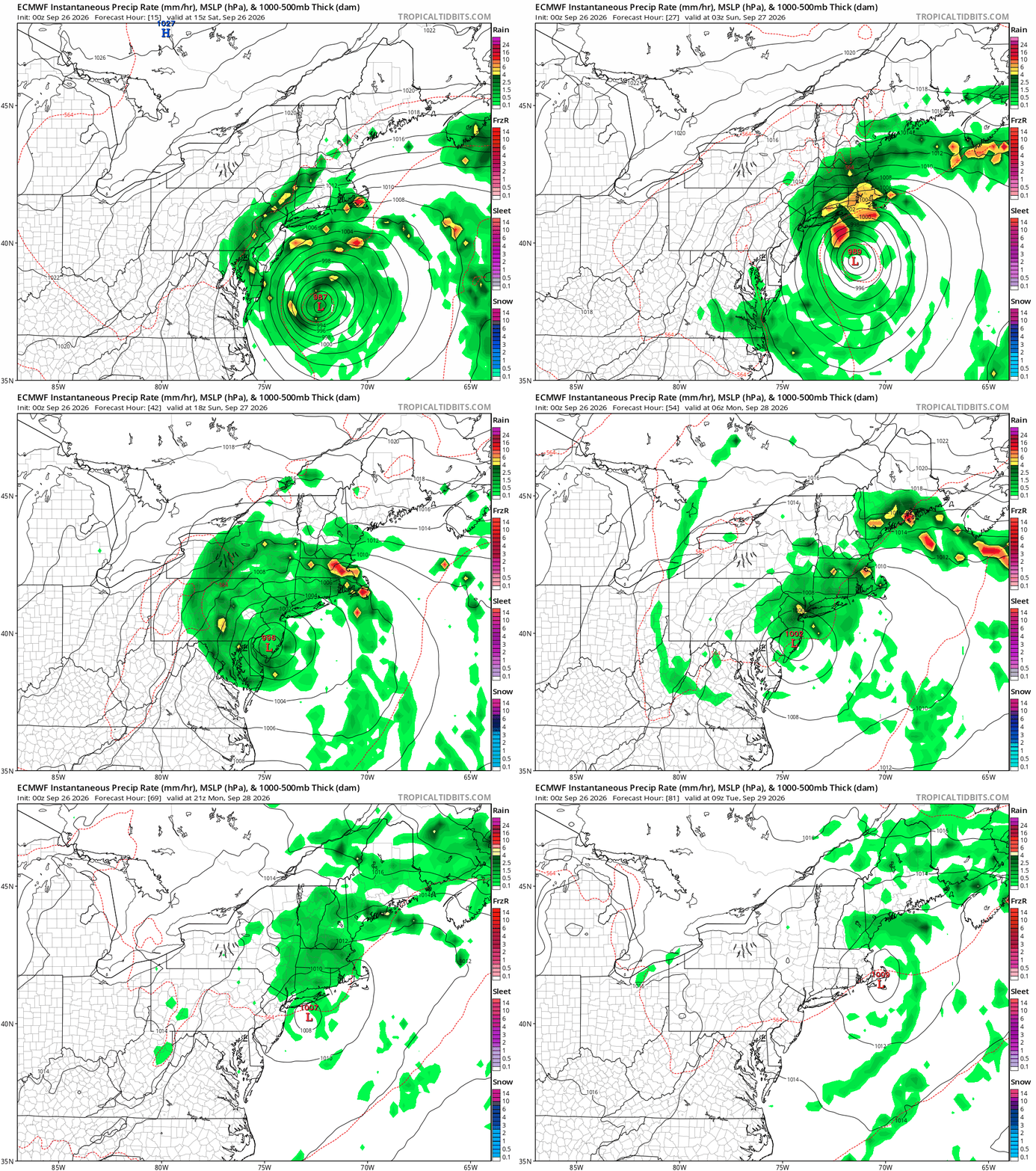
Winds along the coast will continue to gust to 50 to 60 mph at times but there will be periods when winds will slacken. Rain will come in waves, heavy at times, lighter at other times, and it could even stop for short intervals. Bands of heavy rain and thunderstorms will come through form time to time and this is when you likely see some of the strongest wind gusts. There have been thunderstorms in the mix as well thanks to the strong upper air dynamics. After Sunday morning the low moves south and weakens so winds will start to subside Sunday afternoon. Inland area wind gusts will be in the 30 to 40 mph range into Sunday morning. The storm will linger offshore Monday leaving us in clouds and some patchy areas of light rain. It finally exits Monday night leaving us with improving weather conditions Tuesday. The Joe & Joe Weather Show podcast will be live Saturday night at 7:30pm We will also add coverage Sunday.
MANY THANKS TO TROPICAL TIDBITS FOR THE USE OF MAPS
Please note that with regards to any severe weather, tropical storms, or hurricanes, should a storm be threatening, please consult your local National Weather Service office or your local government officials about what action you should be taking to protect life and property.
