Lower Humidity & Sunshine Friday Through The Weekend
No Shower or Thunderstorm Risk

Lower Humidity & Sunshine Friday Through The Weekend
No Shower or Thunderstorm Risk
A cold front is approaching and moving through the Northeast today. It is coming through a bit faster than advertised a few days. This means that drier air and lower humidity will spread across NY state and Northern Pennsylvania during the day and then gradually spread southward through New Jersey and the rest of Pennsylvania and points southward. It also means that the risk for rain and thunderstorms today shifts further south and if you are north of a line from Philadelphia to NYC to Providence, you probably won’t see any rain. Even the severe weather risk for Southeastern Pennsylvania and Southern New Jersey has been shifted much further south into Southeast Virginia and North Carolina.
SATELLITE WITH LIGHTNING STRIKES

WEATHER RADAR

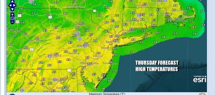
This leaves Eastern Pennsylvania to Southern New England in a place where we will experience indifferent weather conditions with clouds, some breaks of sun, and not much in the way of rain. We will watch the radar today but with the dry push from the north, the rain air should shift to the south as the day wears on. High temperatures today will be generally in the low to a few middle 80s.
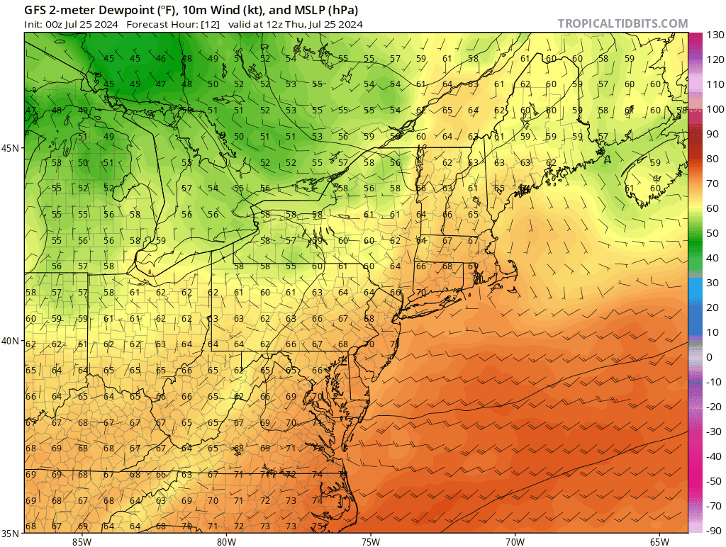
This is one of those set ups in the summer months where the air behind the cold front is actually warmer than the air ahead of it. This is due to the fact that we will see plenty of sunshine Friday through Sunday and no clouds means higher temperatures. The dew points will drop into the 50s which means reasonable humidity right through Sunday and possibly even lingering into Monday of next week.
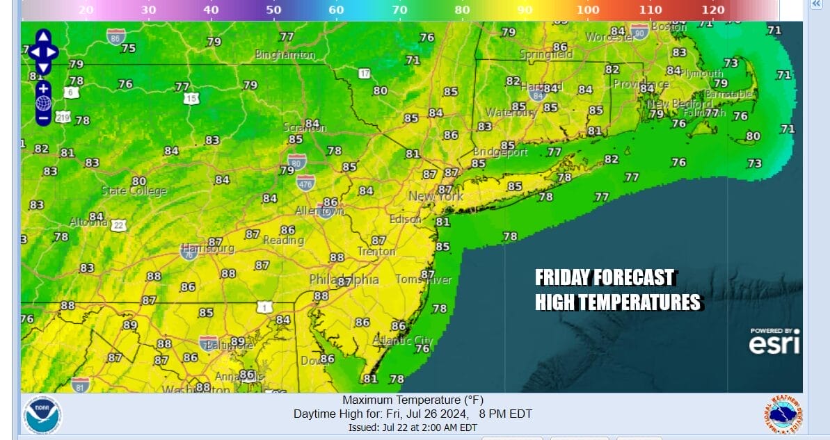
Friday we will see lots of sunshine. Most highs will be in the middle to a few upper 80s. Saturday we will also see plenty of sunshine with highs in the mid to upper 80s. Sunday will be a nice day too though highs will be a shade higher, reaching the upper 80s to around or even slightly over 90 degrees in some places. It is a nice way to finish up the last weekend of the month of July. Hot and more humid weather return next week however we do not see extreme heat coming. Shower and thunderstorm risk doesn’t return until late next Tuesday at the earliest.
BE SURE TO DOWNLOAD THE FREE METEOROLOGIST JOE CIOFFI WEATHER APP &
ANGRY BEN’S FREE WEATHER APP “THE ANGRY WEATHERMAN!
MANY THANKS TO TROPICAL TIDBITS FOR THE USE OF MAPS
Please note that with regards to any severe weather, tropical storms, or hurricanes, should a storm be threatening, please consult your local National Weather Service office or your local government officials about what action you should be taking to protect life and property.
(Amazon is an affilate of Meteorologist Joe Cioffi & earns commissions on sales.)


