Lower Humidity High Clouds And Sun Warmer More Humid Thursday

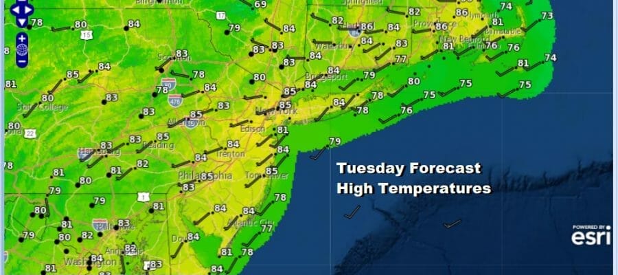
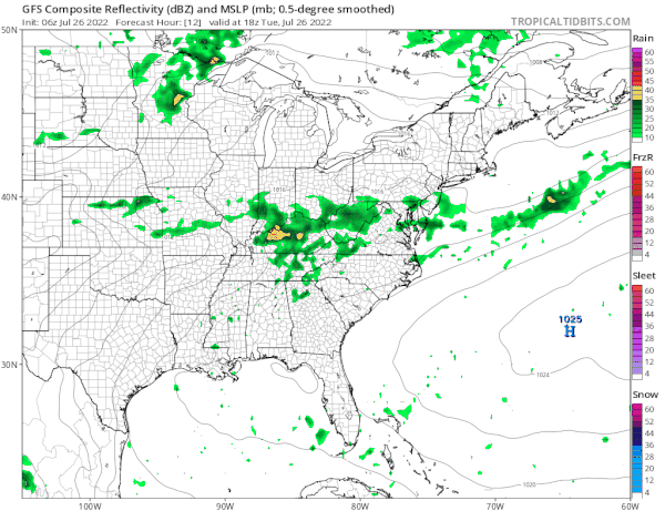
We are getting our humidity break today as dew points will be in the 50s today We also have yesterday’s cold front stalled to our south from Central Virginia westward into Tennessee. There is a wave moving along that front that will bring heavy rain to the Tennessee and lower Ohio Valley later today and into West Virgnia and Virginia. That rain is not coming here but we will have clouds veiling the sunshine today because of that front to the south. Highs today will be in the more seasonal low to middle 80s. Some rain showers could reach into Southern Pennsylvania or even into Southernmost New Jersey for a brief time but it will not get further north than that.
SATELLITE

WEATHER RADAR

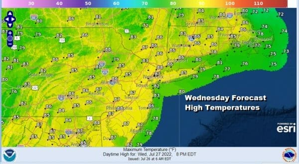
Tonight we will see clear skies from NYC northward and some clouds southward with most lows in the 60s to around 70. Wednesday our short lived humidity break comes to an end as it will start to turn more humid. The old front will start backing northward as a warm front so humidity will be coming up especially in Southern Pennsylvania and Southern NJ south where it goes over 70. North of there it will hold in the lower 60s which isn’t unreasonable but the trend is higher. Also we will see enough sun to take temperatures up into the middle and upper 80s.
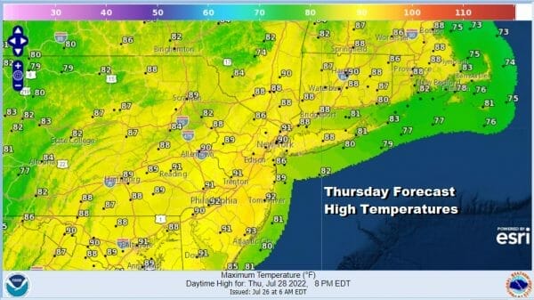
Thursday will be a hot humid day as winds turns southwest ahead of an upper trough later in the day. We will throw in the chance that there could be some scattered thunderstorms Thursday afternoon and evening but we are not expecting any severe weather risk. High temperatures will once again visit the lower 90s in many locations.
Friday we will have another cold front approach and it may wind up being a day much like yesterday with more clouds around, very humid conditions and highs in the 80s to near 90 degrees. The front will likely trigger off a few thunderstorms late in the day but behind the front we see another dry air mass moving in.
The front and upper trough moving through Friday will bring in a slightly more robust dry air mass for the weekend. Saturday and Sunday look like two sunny days with low humidity and seasonal temperatures with highs in the 80s. Next week August begins and that could bring a transition to hot and humid weather again but that will depend on an upper ridge in the Mississippi Valley and Plains and how far into the east does that ridge nudge in. It should lead to at least a few days of heat and humidity with highs in the 90s but it is uncertain whether this could be another 5 or 6 day streak of 90 degree plus weather.
BE SURE TO DOWNLOAD THE FREE METEOROLOGIST JOE CIOFFI WEATHER APP &
ANGRY BEN’S FREE WEATHER APP “THE ANGRY WEATHERMAN!
MANY THANKS TO TROPICAL TIDBITS & F5 WEATHER FOR THE USE OF MAPS
Please note that with regards to any severe weather, tropical storms, or hurricanes, should a storm be threatening, please consult your local National Weather Service office or your local government officials about what action you should be taking to protect life and property.


