Low Humidity Sunshine Today & Wednesday
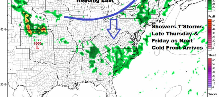
Showers Thunderstorms Late Thursday & Friday

Low Humidity Sunshine Today & Wednesday
Showers Thunderstorms Late Thursday & Friday
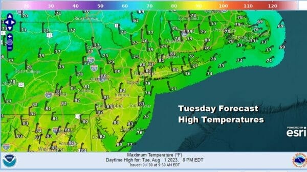
Our nice stretch of weather continues for a third day. A weak cold front passed through last night with little fanfare and behind it we have a re-enforcement of dry air into the Eastern US extended back to the Great Lakes and Ohio Valley. It is a another day of low humidity and lots of sunshine. Dew points will be in the low 50s and even a few upper 40s which is very dry. High temperatures this afternoon will be in the pleasant upper 70s to lower 80s. There are no issues showing up on the satellite and radar.
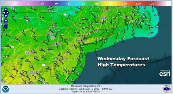 Nights have been cool comfortable and skies have been mostly clear. That continues tonight with lows in the low to mid 60s in coastal and warmer urban areas while inland and more rural areas will bottom out in the 50s. Wednesday we are going to have another terrific day of sunshine and low humidity. Highs will be in the upper 70s and lower 80s.
SATELLITE WITH LIGHTNING STRIKES

WEATHER RADAR

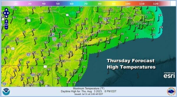
Winds Wednesday night and Thursday will be southeast to south as high pressure moves offshore. Then we have a cold front that will be moving eastward across the Great Lakes and Ohio Valley. Thursday we will see humidity levels rise as the day wears on and we will see some sunshine early though clouds will be around in the afternoon.

The transition to a more humid air mass likely leads to some showers and thunderstorms late Thursday into Thursday night though it is hard to say at this point to what extent and how widespread the shower and thunderstorm risk will be. It seems the risk will be greater north and northeast of NYC rather than south. Highs Thursday will be in the low to mid 80s but it will also be more uncomfortable with dew points rising through the 60s.
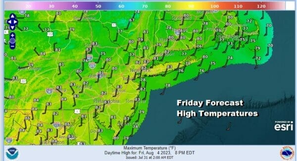
Right now it appears that the risk for severe weather witht his cold front is not elevated at least for Thursday and Thursday night. Friday the cold front and upper trough will be moving through so this sets up again for showers and thunderstorms along with perhaps an isolated stronger thunderstorm or two. Friday highs will reach into the 80s.
This cold front will move to the east and offshore Friday night and in comes another dry air mass for the weekend. This time around however the dry air will only make it so far south as upper air winds will be westerly across the Northeast and Middle Atlantic states. The push of what I would call reasonable dry air makes it as far south as Maryland, Delaware and Southern New Jersey but just barely.

This dry air mass is not going to be around as long as the current one. It will be a two day affair but it does make for a nice sunny weekend. Saturday highs will be in the upper 70s to lower 80s. Sunday highs could be a touch here at 80 to 85. Humidity levels will begin to increase Monday and next week looks to be a warmer and more humid week along with the risk for downpours and thunderstorms along the way.
BE SURE TO DOWNLOAD THE FREE METEOROLOGIST JOE CIOFFI WEATHER APP &
ANGRY BEN’S FREE WEATHER APP “THE ANGRY WEATHERMAN!
MANY THANKS TO TROPICAL TIDBITS FOR THE USE OF MAPS
Please note that with regards to any severe weather, tropical storms, or hurricanes, should a storm be threatening, please consult your local National Weather Service office or your local government officials about what action you should be taking to protect life and property.
(Amazon is an affilate of Meteorologist Joe Cioffi & earns commissions on sales.)


