Low Humidity Mainly Nice Weather Into Thursday
Before Showers Thunderstorms Return Late Week

Low Humidity Mainly Nice Weather Into Thursday
Before Showers Thunderstorms Return Late Week
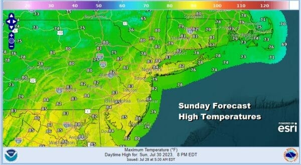
Yesterday’s heat humidity and thunderstorms are now history and we can sit back and enjoy some very nice weather for more than just a day. In fact this low humidity and cooler than average temperature pattern is going to last into Thursday before the next round of changes takes place. Skies on the satellite are crystal clear for the most part with nothing more than a few minor patcheds of cloud cover here and there. The front has pushed its way south into North Carolina and low dew points cover much of the Midwest, Ohio Valley, the Northeast and Mid Atlantic states. Enjoy the break with sunshine taking highs into a range of 80 to 85 degrees this afternoon for highs. Radars are taking a much needed break.
SATELLITE WITH LIGHTNING STRIKES

WEATHER RADAR

High pressure from the Great Lakes and Eastern Canada is going to take its time building into the Eastern US thanks to a blocky pattern in the Atlantic holding up weather traffic to some degreee. This means that the low humidity below normal temperature scheme will last more than just a day or two. It will likely last into Thursday. We do have some weak upper troughs that will being moving southeast in the northwest flow that might produce some clouds from time to time and the odd brief shower or two in some places. However each of these troughs basically re-enforeces the dry air.

Skies tonight should be mainly clear though there may be some clouds to the south across Southern Pennsylvania and Maryland. Lows will be in the 50s inland and north of the coast while lows along the coast will be in the low to mid 60s Monday will be no worse than partly sunny and at times mostly sunny. Highs Monday will be in the upper 70s north and west of the coast and lower 80s just about everywhere else.

Tuesday looks good with sunshine and low humidity continuing with highs again in the upper 70s to lower 80s with low humidity. We will wash rinse and repeat this with on Wednesday with lots of sunshine. High pressure will be settled in New England and points southward. Highs Wednesday again will be in the upper 70s and lower 80s.

Thursday morning should start out nice and comfortable but as the high starts to move out to the east, and a cold front begins to swing eastward from the Great Lakes and Ohio Valley, humidity will start to rise and we will see temperatures move a little higher. Highs Thursday will reach the low to a few middle 80s. We will probably have a sunny start to the day though some clouds will come into the mix later on. We could see some showers and thunderstorms late Thursday or Thursday night and this front could linger for awhile on Friday. Models have at least temporarily backed off from a more vigorous systems which would mean more rain to deal with but we will keep the door open to the idea that there may be more numerous showers and downpours Friday before the front moves offshore and another shot of dry air comes in for next weekend.
BE SURE TO DOWNLOAD THE FREE METEOROLOGIST JOE CIOFFI WEATHER APP &
ANGRY BEN’S FREE WEATHER APP “THE ANGRY WEATHERMAN!
MANY THANKS TO TROPICAL TIDBITS FOR THE USE OF MAPS
Please note that with regards to any severe weather, tropical storms, or hurricanes, should a storm be threatening, please consult your local National Weather Service office or your local government officials about what action you should be taking to protect life and property.
(Amazon is an affilate of Meteorologist Joe Cioffi & earns commissions on sales.)


