DOWNLOAD MY NEW FREE JOESTRADAMUS WEATHER APP FOR ANDROID

THE APP IS ABSOLUTELY FREE TO ALL BUT CONSIDERING SUBSCRIBING TO PATREON FOR A WEATHER EXPERIENCE FREE OF ADS, EXCLUSIVE VIDEOS FOR MEMBERS ONLY AND MUCH MORE…STARTS AT $2 A MONTH..MESSAGE ME AT ANY TIME

Long Range Weather Quiet Colder Week Ahead
After sitting through a day where the warm front just could not make much progress northward we turn our attention to the week ahead which looks to be a quiet one from the standpoint of storminess across much of the Eastern US. The upper pattern is going to be governed by a split flow with the northern half of the jet stream (which is not all that strong) will tend to keep things rather suppressed and weak.
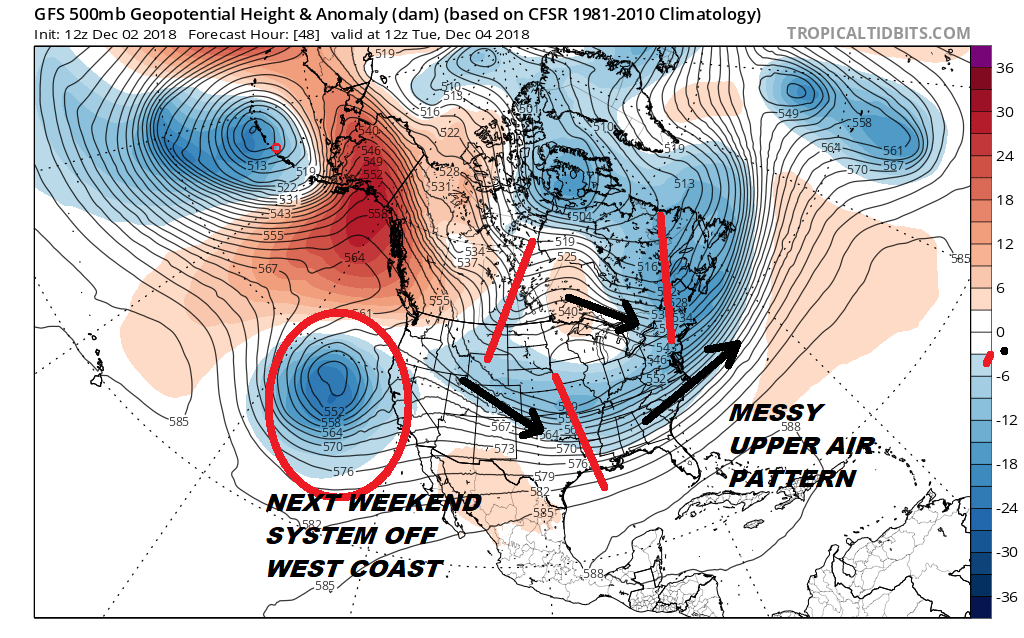
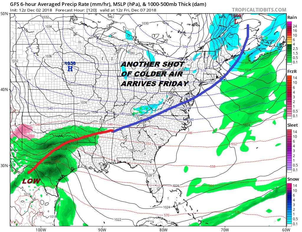
There really isn’t very much that you can do with this upper air pattern. We still see shortwave troughs all over the place. The first short wave in the southern half came into the west yesterday and that will just be content to move along and head offshore with no consequence as it goes by to our south and east. The northern jet stream has systems moving along with no ability to draw moisture or hook up with the southern stream energy. Cold fronts will be the story. The first comes late Monday into Monday night with a cold dry air mass behind it. A second one arrives on Friday with another cold dry air mass behind it.
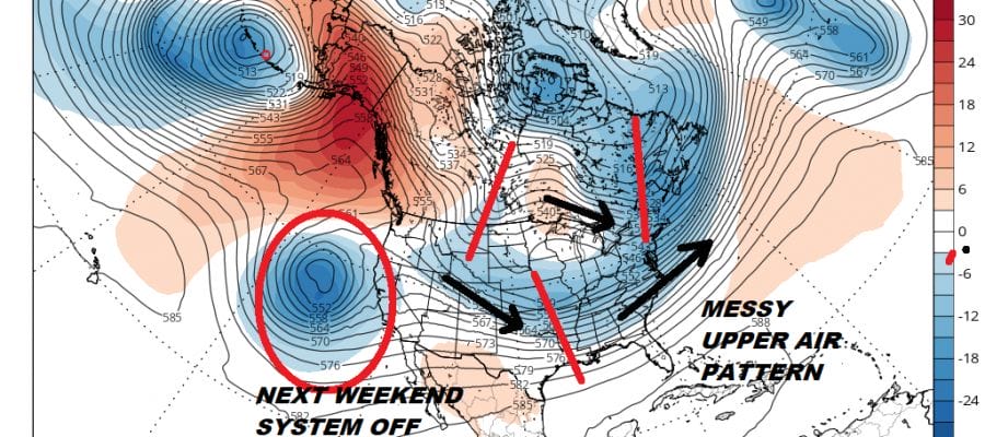
In the lower left corner we see low pressure. This is a result of the system in the Pacific ocean on the upper air map above. With the cold air mass building in, it would seem that we have what could be a rather ominous set up for the Eastern US over next weekend. However the jet stream pattern overall remains an issue.
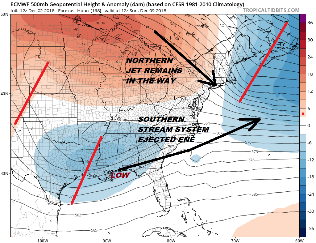
Models continue to have difficulty with a persistent northern jet stream that just doesn’t get out of the way. The European model today suggests there is no room for any system to come much further north than say Southern Virginia as the energy gets pushed out well to our southeast. it really isn’t that much different from what we are going to see Tuesday & Wednesday with a weaker lead system moving eastward from the Rockies. This idea could mean snow for areas to the south in the Caorlinas down to North Georgia especially away from the coast, but it will keep snow out of the major cities north of Baltimore.
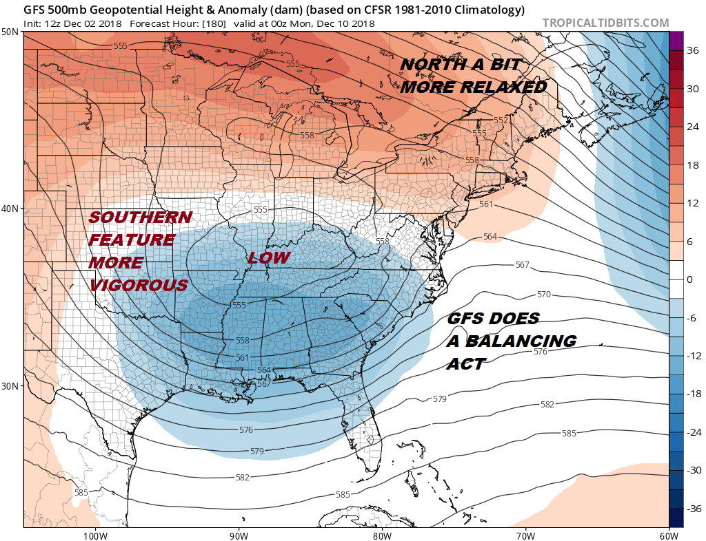
There is room for models to maneuver here over the coming days and this is way we are not really getting all worked up over this system for next weekend at the moment. We want to see models correct first with a weaker norther stream perhaps creating more room for the southern energy to lift northward. This is the picture the GFS paints to some degree. It relaxes the north and has a more vigorous system in the southern stream. There is more room here for the surface storm to move further north. The problem is what is going on now and the recent history of the weather models under doing that northern stream of energy and perhaps over doing the southern energy. The bottom line is we will continue to watch models carefully. If I had to stick my neck out at this point I would favor the European’s idea which would a threat for snow from North Carolina southward.
LATEST JOESTRADAMUS VIDEO
MANY THANKS TO TROPICAL TIDBITS FOR THE USE OF MAPS
Please note that with regards to any tropical storms or hurricanes, should a storm be threatening, please consult your local National Weather Service office or your local government officials about what action you should be taking to protect life and property.