
The promised cold front has finally passed through Long Island with some showers and radars below show some showers around. Temperatures were in the upper 50s and lower 60s but they have now dropped into the upper 40s and lower 50s.
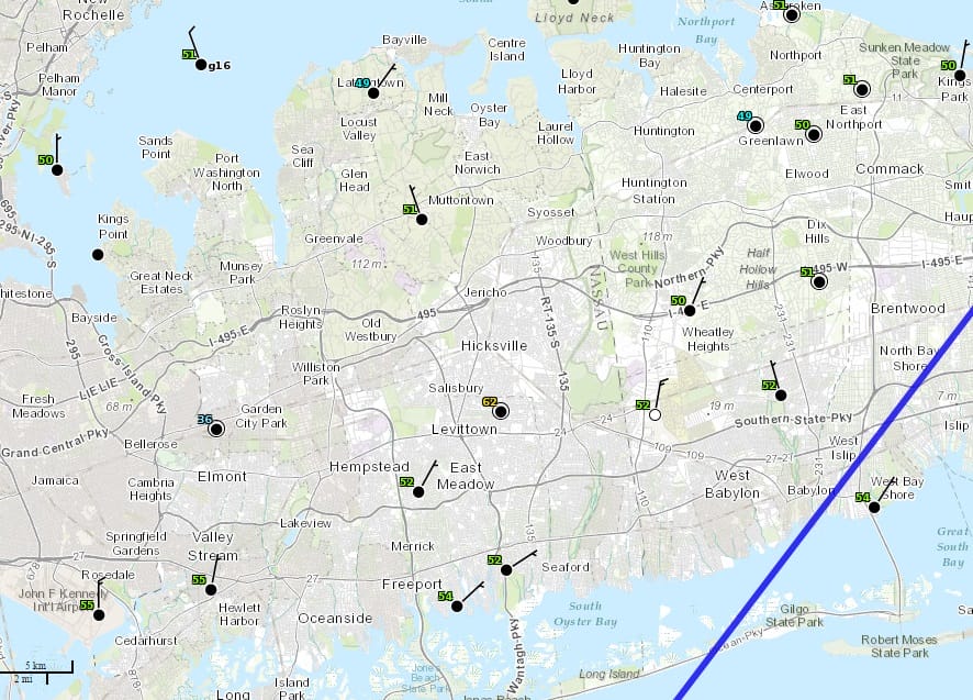
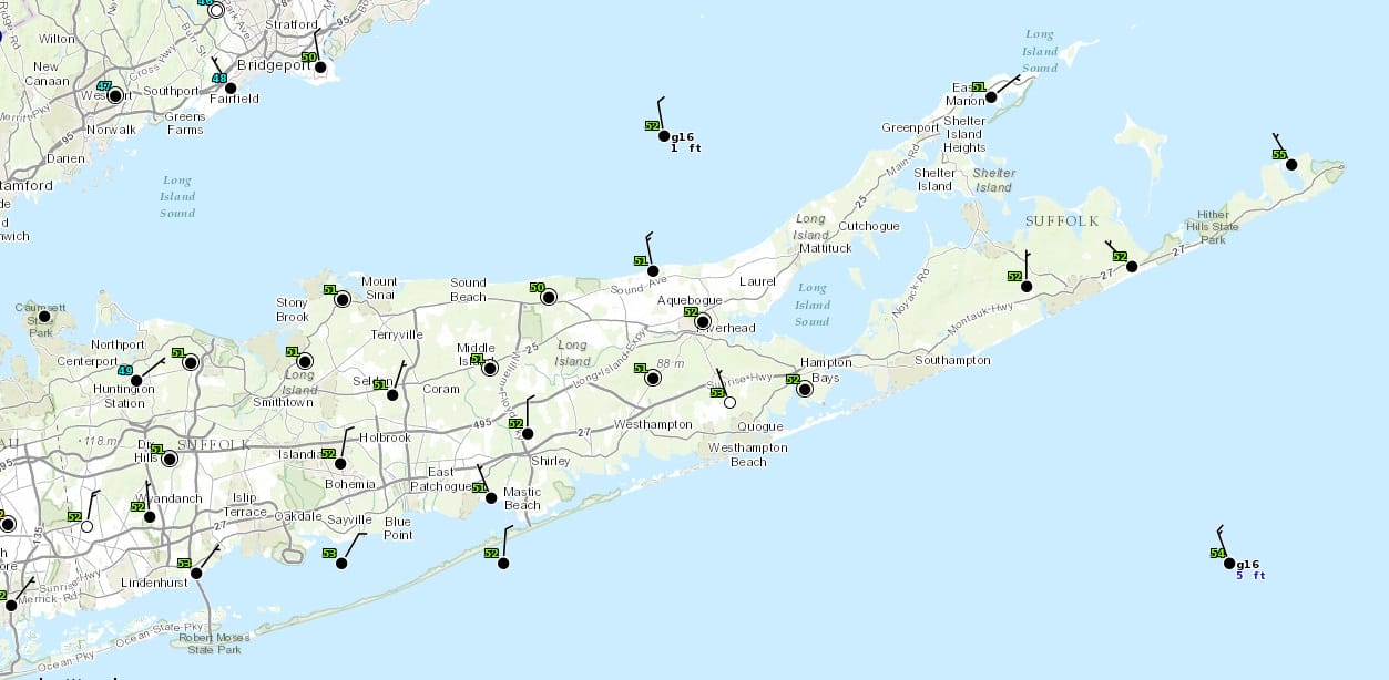
Both maps show the current temperatures and winds across Long Island as they have turned to the north or northeast. This front has taken its time sinking southward today and will continue to slowly sink southward. The showers may linger around into tonight but gradually dry air from upstate New York will continue to work its way southward and we should break out into sunshine on Sunday though temperatures will probably not get out of the 40s. Sunday night will be cold and clear with lows in the upper 20s to lower 30s. Monday looks like a nice day with sunshine and highs back into the 40s. The next chance for rain will come during Tuesday as low pressure heads to the Great Lakes and a cold front begins its approach to the coast. Some showers will linger into Wednesday however we will see improving conditions for the second half of the week. No real cold air is in sight as the pattern is keeping cold air locked away in Northernmost Canada and across the Arctic. There is no sign of that pattern changing anytime during at least the next 10 days. Even though December is almost here, it looks like winter will be delayed for awhile. This is how last winter began with midler than normal temperatures through December into mid January before the pattern flipped into the unrelenting cold and snow.
VIDEO ANALYSIS ON WHY THE COLD AIR IS TRAPPED. VIEW OF NORTH AMERICA TEMPERATURES
WARMEST NOVEMBER ON RECORD AND WHAT IT MEANS (OR DOESN’T MEAN)
DO WARM NOVEMBERS MEAN SNOWLESS WINTERS?
JOESTRADAMUS WINTER FORECAST 2015-2016
DO YOUR HOLIDAY SHOPPING ON MY WEBSITE AND AVOID MALLS AND TRAFFIC