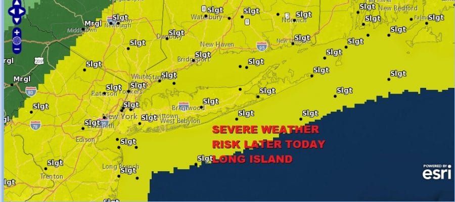
Long Island Severe Weather Risk Later Today
Low Humidity Thursday Into Saturday

Weather in 5/Joe & Joe Weather Show Latest Podcast
Long Island Severe Weather Risk Later Today Low Humidity Thursday Into Saturday
This is the last day of humidity and the last day of wildfire smoke as a cold front will move through Long Island from the northwest this afternoon. This front will arrive sooner rather than later and threat time looks to be around 2pm to 5pm rather than the evening. There will be a land based wind ahead of it which means the marine layer won’t impact these storms.

The Storm Prediction Center has all of Long Island at a slight risk for severe weather this afternoon. Strong winds and hails are the primary impacts with a 15% chance of seeing either one. Ahead of it this morning sunshine should take temperatures up into the 80s.
SATELLITE

WEATHER RADAR


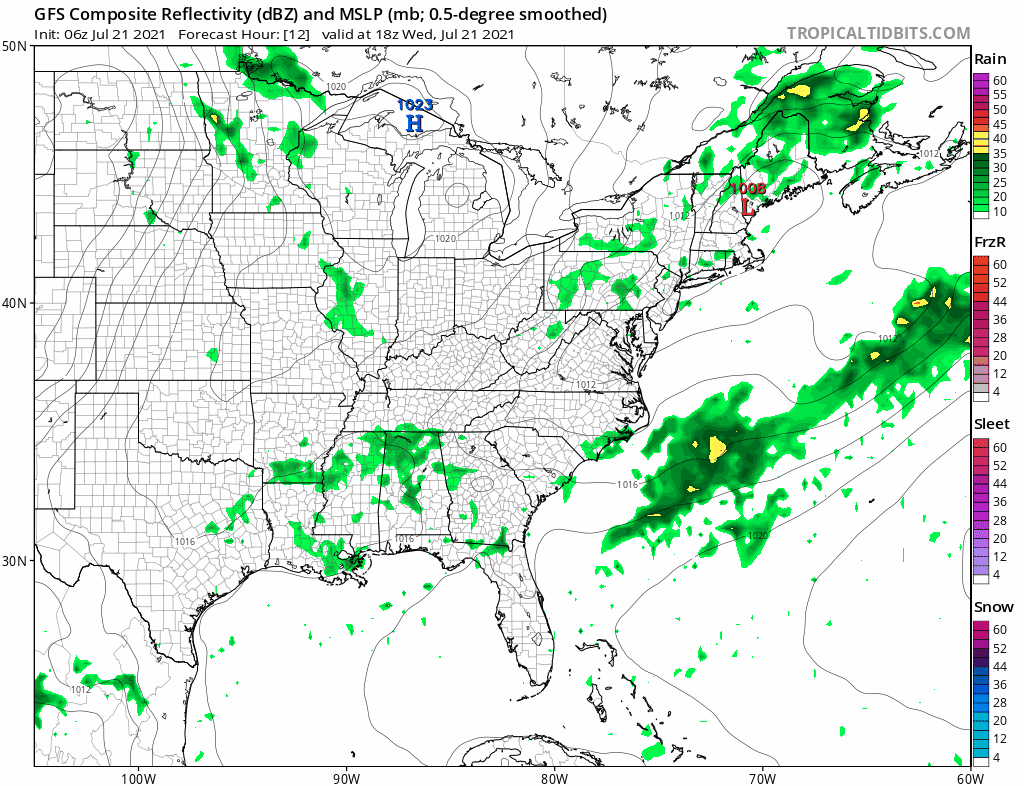
Short range models aren’t of much use as they have not performed well this summer when it comes to thunderstorm development. They seem to miss most of it. Some models are showing very little in the way of thunderstorms but the FV3 model which has been better than the others (and that isn’t saying much), paints a rather active picture for this afternoon as the thunderstorms move through between 2 and 4pm. We would also be catching these storms in the development phase which is often times when they are at the worst.

The best way to approach these things is to watch the radars. There is really no magical way to deal with these storms. The radars will tell you everything you need to know. Once the storms are done we get rid of the smoke and humidity and move on to what should be 3 nice days of weather ahead of us.
Skies will clear tonight with lows in the 60s. Humidity levels will drop rather quickly and we set up for some nice dry weather Thursday into Saturday. Look for sunshine Thursday and Friday though there could be some patchy clouds. Highs will be in the low to mid 80s both days. Most importantly the dew points will be down in the 50s making it feel terrific.
Thanks to an upper trough hanging along the coast we will hold on to the low humidity into Saturday though a warm front will be heading our way from the west. Look for sunshine giving way to some high clouds later in the day. Highs Saturday should be in the low to mid 80s though it will still be reasonably comfortable. The warm front passes late Saturday night into Sunday morning with some showers or perhaps a thunderstorm. Then we transition to warm and humid conditions for Sunday with some sunshine. There is the chance for a late day shower or thunderstorm. Highs will be in the 80s. Overall the weekend will be okay despite the interruptions late Saturday early Sunday. Saturday will be the better of the two weekend days due to the lower humidity.
BE SURE TO DOWNLOAD THE FREE METEOROLOGIST JOE CIOFFI WEATHER APP &
ANGRY BEN’S FREE WEATHER APP “THE ANGRY WEATHERMAN!

MANY THANKS TO TROPICAL TIDBITS & F5 WEATHER FOR THE USE OF MAPS
Please note that with regards to any severe weather, tropical storms, or hurricanes, should a storm be threatening, please consult your local National Weather Service office or your local government officials about what action you should be taking to protect life and property.