
Severe Weather Risk Late Today Thursday Last Day of 90 Plus Highs

Weather in 5/Joe & Joe Weather Show Latest Podcast
Severe Weather Risk Late Today Thursday Last Day of 90 Plus Highs
Today marks the last day of 90 degree plus highs for Long Island. Not all areas have been seeing highs in the 90s the last few days. In fact Islip only reached 88 degrees for a high yesterday and South Shore and East End areas have fared a bit better during this 3 day heatwave. Inland Nassau and Northwest Suffolk County have seen temperatures reach 90 to 95 and that will again be the cast today.

Late today an upper trough will approach and that will set off some thunderstorms inland. Whether they reach the coast will depend on timing. The Storm Prediction Center has Long Island at a marginal risk for severe weather late this afternoon and evening. It is possible that thunderstorms will peak in intensity to the northwest and then fall apart as they head southeast after 8pm. Keep an eye to the sky nonetheless and perhaps the force field for Long Island thunderstorms will continue to hold.
SATELLITE

Activity on local and regional radars should be minimal until later this afternoon and evening. The satellite picture shows mostly cloud free conditions from Central New England to the Southeast US.
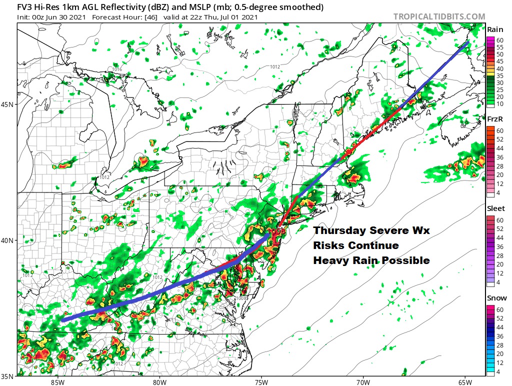
WEATHER RADAR


Thursday we will have a cold front stalled very close by. The heat will be over but it will still be a very warm and very humid day. Thursday afternoon and evening we see a good chance for thunderstorms. The Storm Prediction Center has a marginal risk for severe weather for Thursday but I think the biggest risk here could be more from heavy rains.
I’m growing a little more optimistic for the July 4th holiday weekend. Friday we will have shower risk as low pressure will be offshore but the cold front will will still be close enough to produce some shower issues. However the upper trough looks to swing eastward and push everything out to the east over the weekend. This could leave us with instability clouds and sun for Saturday and Sunday. There is the risk for a passing shower on Saturday but Sunday and Monday could very well be dry for the most part. Also there will be a nice break from the humidity beginning late Friday and lasting through the weekend and into Monday! Right now highs will be in the 70s each day with nights in the mid 50s to lower 60s. We should be back into the 80s next Monday. Cautious optimism is warranted for the holiday weekend.
BE SURE TO DOWNLOAD THE FREE METEOROLOGIST JOE CIOFFI WEATHER APP &
ANGRY BEN’S FREE WEATHER APP “THE ANGRY WEATHERMAN!

MANY THANKS TO TROPICAL TIDBITS & F5 WEATHER FOR THE USE OF MAPS
Please note that with regards to any severe weather, tropical storms, or hurricanes, should a storm be threatening, please consult your local National Weather Service office or your local government officials about what action you should be taking to protect life and property.