Long Island Going Into Gloom & Doom Mode Clouds Rain Friday Through Sunday
 USE COUPON CODE JOEANDJOEWEATHERSHOW GET 10 PERCENT OFF ANY PURCHASE

Long Island Going Into Gloom & Doom Mode Clouds Rain Friday Through Sunday
We are setting up for a gloom and doom pattern for Friday and through the weekend. Before we get there we are still trying to scour out some of the leftover clouds from last night’s cold front. Most of the showers are gone except for one patch exiting Eastern Long Island early this afternoon but clouds should give way to some breaks of sunshine as the afternoon wears on with highs in the mid to upper 50s. This will be short lived because the winds will be turning to the east and southeast and that will bring in ocean moisture in the form of some low clouds tonight. Lows will be in the 40s.
SATELLITE

WEATHER RADAR


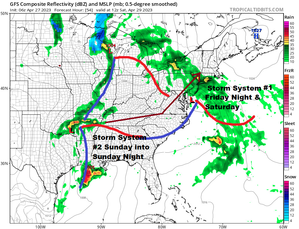
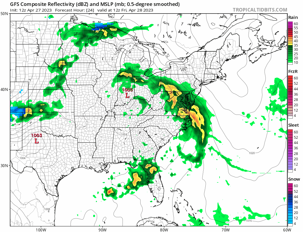
Friday look for clouds to increase as the first of two low pressure systems head our way. The first heads to the Ohio Valley and reforms weakly off the Mid Atlantic coast. This pins high pressure from Eastern Canada down the coast creating an easterly flow of moist air. Rain develops late Friday afternoon and lasts into at least part of Saturday. HIghs Friday will be in the upper 50s to around 60 but once it starts raining temperatures will settle into the lower 50s and then hold in the 50s through Saturday. Rain should last into Saturday afternoon before tapering off.
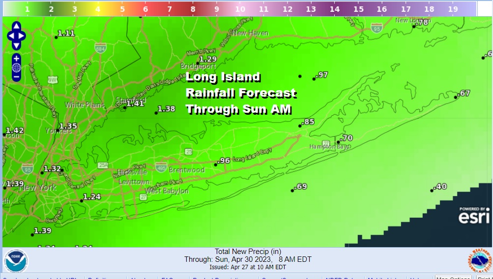
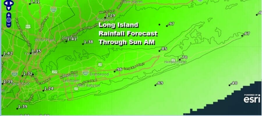
Rainfall amounts from the first round of rain should average around an inch or so with slightly lower amounts to the east and slightly higher amounts to the west. We will catch a break from the rain Saturday night into Sunday morning but then another round of rain will come Sunday afternoon and should be mostly gone by early Monday morning. This is will likely produce another inch or so of rain as low pressure heads up the coast, probably tracking just inland. That slightly inland track should allow temperatures Sunday to get into the 60s.
Rain should be done by Monday morning and that will leave us in a drier cooler air mass to start of next week. It will be on the breezy to occasionally windy side Monday and Tuesday but some sun should be able to break out again. Monday and Tuesday highs will likely be in the 50s to around 60s degrees.
BE SURE TO DOWNLOAD THE FREE METEOROLOGIST JOE CIOFFI WEATHER APP &
ANGRY BEN’S FREE WEATHER APP “THE ANGRY WEATHERMAN!
MANY THANKS TO TROPICAL TIDBITS & F5 WEATHER FOR THE USE OF MAPS
Please note that with regards to any severe weather, tropical storms, or hurricanes, should a storm be threatening, please consult your local National Weather Service office or your local government officials about what action you should be taking to protect life and property.