
2 Storm Systems Rain Late Friday Into Saturday & Late Sunday Into Sunday Night

2 Storm Systems Rain Late Friday Into Saturday & Late Sunday Into Sunday Night
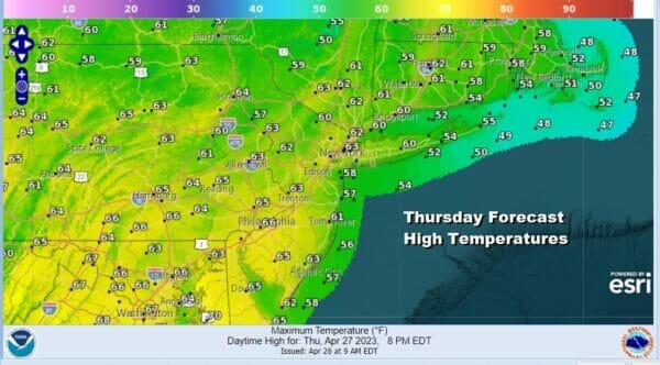
We still have some lingering clouds and lingering showers from last night’s cold front but there should be some improving weather conditions later today as the front moves further offshore and high pressure starts to build in from New England. Take advantage of any decreasing clouds and increasing sunshine that we have today because it will be short lived. High temperatures this afternoon will be in the low to middle 60s. Temperatures will be in the cooler 50s along south and east facing shorelines as winds begin to turn to the southeast later today.
SATELLITE

WEATHER RADAR

The flow around a high that finds its way to the Gulf of Maine and the Canadian Maritime Provinces will be a marine flow and that means clouds rolling in tonight. Most lows in Eastern Pennsylvania to Southern New England will be in the 40s. Gloom and doom begins Friday with lots of clouds and an ocean wind. Then we watch the first of two storm systems head up inland of the East Coast.
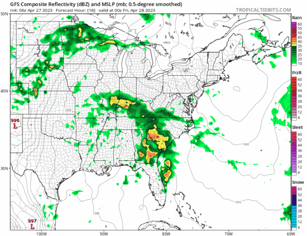
The first low heads into the Ohio Valley and then redevelops off the coast of Delaware. It is going to be a weak system but will have enough moisture to up down up to an inch or so of rain in some places. Rain moves southwest to northeast Friday afternoon advancing up the coast and it looks to be a rainy Friday night into Saturday afternoon.
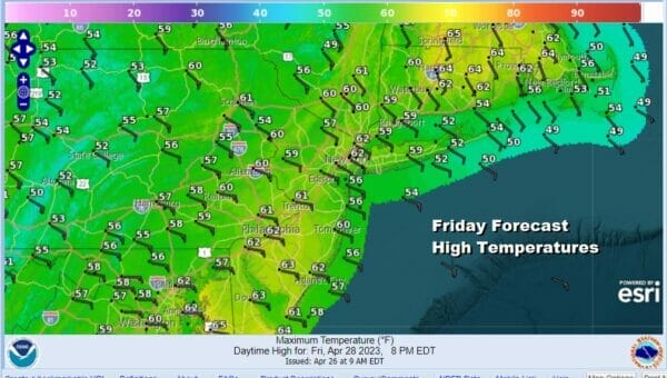
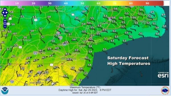
The onshore flow will keep temperatures in check with Friday highs into the 60s before the rains come. Once the rains start temperatures will fall back into the 50s late in the day. The onshore flow strengthens further for Friday night and Saturday. Saturday will likely be a downright miserable day of rain and an east wind with highs just in the 50s at best.
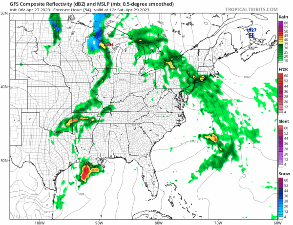
Normally we would be done however as the first system moves out a second system moves across the deep south and that hooks up with another system in the Great Lakes. rain and thunderstorms will develop across the deep south with a low in the Gulf States and then that low will head northward up the east side of the Appalachians Sunday. That means that while the rain takes a pause Satuday night into Sunday morning, another round of an inch or so of rain comes in Sunday afternoon into Sunday night.
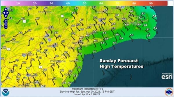
Sunday highs could be at least in the 60s and we might even see temperatures reach 70 inland as the low takes a track to the west, and winds turn more south southeast during Sunday. This system should be gone by Monday morning with leftover clouds giving way to some sun and a gusty northwest wind. Highs Monday will be in the upper 50s and lower 60s. Much of next week looks to be cool and the first half of the week could be on the breezy to windy side as the blocking pattern continues across the Eastern US with below average temperatures.
BE SURE TO DOWNLOAD THE FREE METEOROLOGIST JOE CIOFFI WEATHER APP &
ANGRY BEN’S FREE WEATHER APP “THE ANGRY WEATHERMAN!
MANY THANKS TO TROPICAL TIDBITS & F5 WEATHER FOR THE USE OF MAPS
Please note that with regards to any severe weather, tropical storms, or hurricanes, should a storm be threatening, please consult your local National Weather Service office or your local government officials about what action you should be taking to protect life and property.


