Long Island Dry Friday Scattered Showers Saturday Rain Late Mother’s Day

Weather in 5/Joe & Joe Weather Show Latest Podcast
Long Island Dry Friday Scattered Showers Saturday Rain Late Mother’s Day
We managed to get a good day in this week and this certainly was the best day of the week so far. The satellite picture going into this evening is showing mainly clear skies. Highs reached into the 60s today and we kept the sea breeze at bay as well with a northwest breeze. We should be clear for most of the night with just some scattered high clouds coming in from time to time. Lows by morning will be in the mid to upper 40s. Radars are nice and quiet as well.
SATELLITE

Friday will be dry during the day time. We may start with some sun but clouds will move in quickly as Long Island sits in between a developing offshore storm and a strong upper trough to the west. Temperatures should be able to make it into the 60s. The coastal storm is not a direct problem however indirectly it is slowing down the movement of systems to the northwest. Showers will reach Eastern Pennsylvania and Western New Jersey Friday evening and some might sneak in during the overnight.

Saturday we will be spending our time with the storm well to the northeast and the upper trough overhead. This will likely produce limited if any sun, plenty of clouds, and the risk for scattered light nuisance showers. Temperatures Saturday will be quite cool with highs just in the upper 50s to near 60. Skies may clear for a short time Saturday night before the next system heads our way for Sunday.
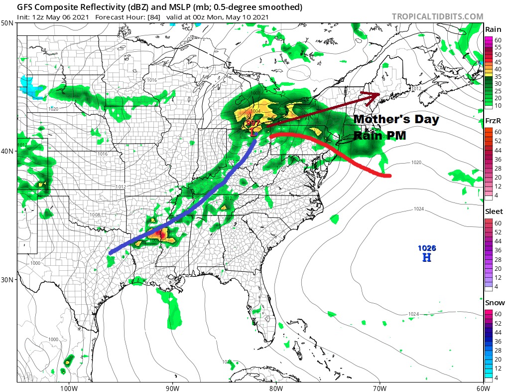
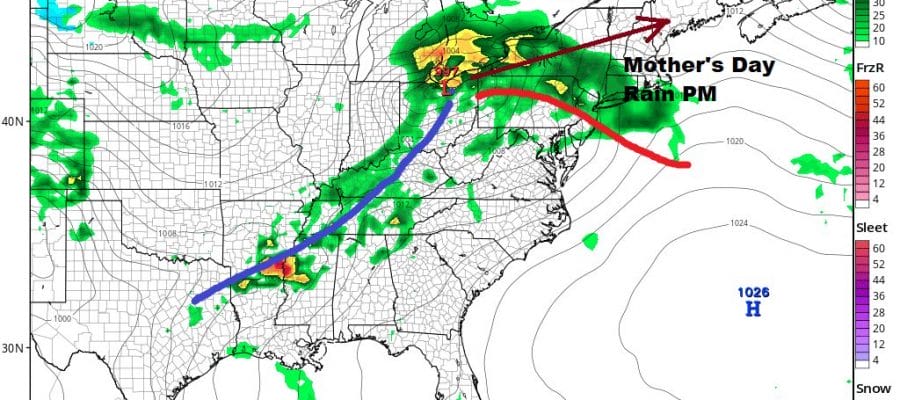
Sunday Mother’s Day will cloud up quickly and rain will arrive by afternoon lasting into Sunday night. Temperatures Sunday should make it into the 60s though barely. This low is now forecast to track to our north so once the warm front goes by later Sunday evening the rain should end followed by the cold front Monday morning. It doesn’t appear to have much with it so we should see improvement Monday with clouds giving way to some sun. It will be breezy with highs reaching the mid to upper 60s before it turns cooler for Tuesday and Wednesday of next week.
BE SURE TO DOWNLOAD THE FREE METEOROLOGIST JOE CIOFFI WEATHER APP &
ANGRY BEN’S FREE WEATHER APP “THE ANGRY WEATHERMAN!

MANY THANKS TO TROPICAL TIDBITS & F5 WEATHER FOR THE USE OF MAPS
Please note that with regards to any severe weather, tropical storms, or hurricanes, should a storm be threatening, please consult your local National Weather Service office or your local government officials about what action you should be taking to protect life and property.