Lingering Severe Weather Risks As Cold Front Passes

Lingering Severe Weather Risks As Cold Front Passes

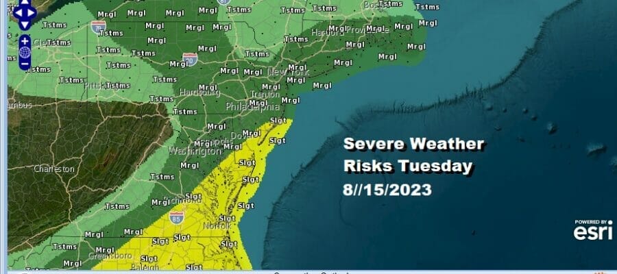
We have lingering severe weather risks today that will be mainly confined to the areas closer to the coast in the Eastern US. The risk zone extends from Southern New England southwest through New Jersey, It does extend west into Pennsylvania and parts of Western NY. Higher risk exists from Southern New Jersey southward into the Carolinas.

The Storm Prediction Center is also indicating slightly elevated risk for tornadoes for Southern New England and lsland as well as the Delmarva Peninsula back to Chesapeake Bay ana a small portion of Southeast Virginia. The overnight warm front continues to push northward and the rains with that continue to shift to the east. Then later today a cold front will be approaching bringng with it the chance for showers and thunderstorms.
SATELLITE WITH LIGHTNING STRIKES

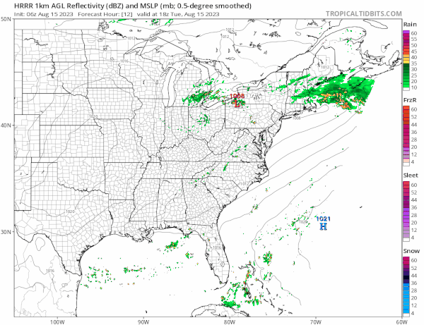
WEATHER RADAR

In between we will see clouds break out to some sunshine which will determine how much daytime heating occurs. This probably will be key to thunderstorm development. Also with the position of the upper feature this morning and the cold front, development occurs closer to the coast and that limits the coverage of thunderstorms and severe weather risk.
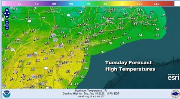
As for temperatures today they will be in a wide range. The stubborn warm front not clearing Southern New England will keep temperatures north and northeast of NYC in the 70s to near 80 or so for highs. Clouds will be stubborn to get out of the way. South and southwest of Philadelphia we could see highs well into the 80s to near 90 degrees and this is where thunderstorm activity will be more active.
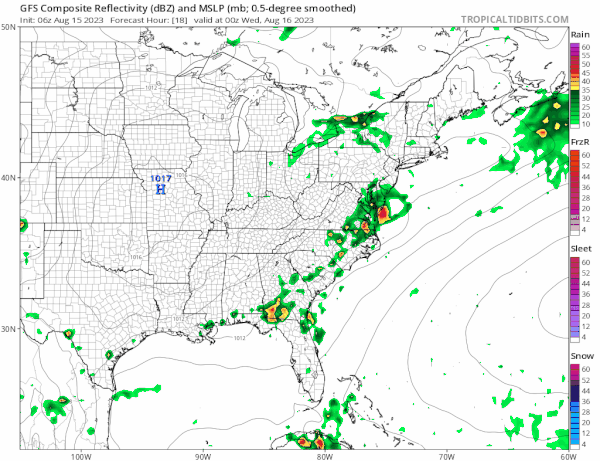
Thanks to the upper torugh not getting out of the way, the cold front will stall out offshore and we will have to wait until Friday to get far enough east. Humidity levels will remain stubbornly higher along the coast verses areas well inland. Wednesday we see some sunshine in the mix but there still will be lingering clouds around. Most highs will be in the 80s except a little lower north and northeast of NYC.

Thursday looks to be a decent day with sunshine and highs in the 80s. Humidity levels will likely be borderline. Another front will pass Thursday night into Friday and there could be the chance for a few showers or a thunderstorm as that front goes by. This front will finally push everything offshore and a dry air mass will come in for later Friday and for the weekend. Friday highs will be in the upper 70s and lower 80s.
It is very much looking like a nice weekend for much of the Northeast and Northern Mid Atlantic states. Both Saturday and Sunday will feature sunshine with highs in the upper 70s to lower 80s for Saturday and highs in the 80s for Sunday. We could see a couple of hot days early next week in the Eastern US but another cold front might limit the length of any hot and humid weather.
BE SURE TO DOWNLOAD THE FREE METEOROLOGIST JOE CIOFFI WEATHER APP &
ANGRY BEN’S FREE WEATHER APP “THE ANGRY WEATHERMAN!
MANY THANKS TO TROPICAL TIDBITS FOR THE USE OF MAPS
Please note that with regards to any severe weather, tropical storms, or hurricanes, should a storm be threatening, please consult your local National Weather Service office or your local government officials about what action you should be taking to protect life and property.
(Amazon is an affilate of Meteorologist Joe Cioffi & earns commissions on sales.)


