Light Smokey Haze From Time To Time Marginal Severe Weather Risk Northeast

Light Smokey Haze From Time To Time Marginal Severe Weather Risk Northeast
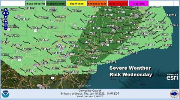
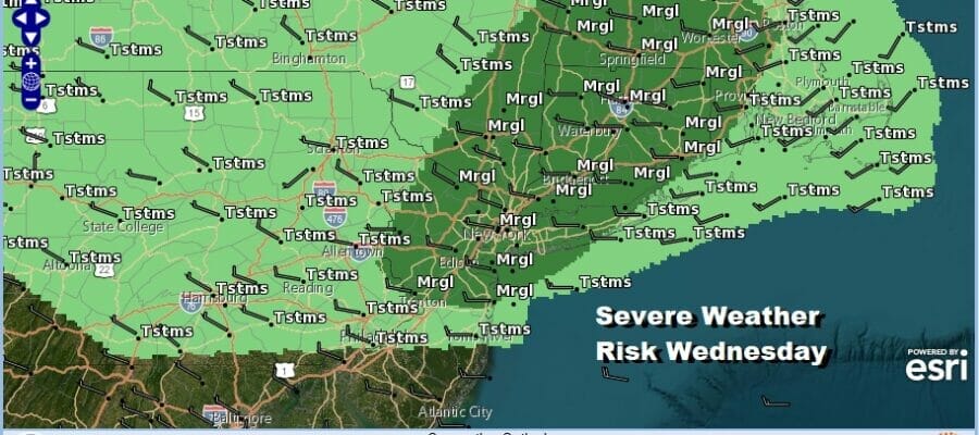
We have a rather strong upper air low over the Great Lakes which stands out on the satellite loop with its obvious hook signature. This upper low will cross the Northeast today creating a cold unstable atmosphere and setting off showers and some thunderstorms. In fact the Storm Prediction Center has indicated a marginal risk for severe weather from Northern New Jersey to Southern and Central New England. This means that there is the risk for isolated severe thunderstorms and the main risk time will be this afternoon into tonight.
SATELLITE

WEATHER RADAR

The other issues today and for the next several days will be occasional plumes of smoke from Canada wildfires. However according to the forecast from Firesmoke.ca, the amount of smoke will not be enough to raise National Weather Service Air Quality alerts at least through Thursday.

Short range weather models show lines of showers and thunderstorms moving from west to east across Pennsylvania and into New England this afternoon into the evening hours. Once the last line passes weather conditions should improve. Temperatures today will be on the cool side of average with highs mostly in the low to middle 70s.

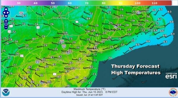
The rest of the week and into the weekend, our weather will be dictated by another stubborn upper air storm system that will not get out of the way. Thursday we will be in between upper air troughs so it should be a decent day of sunshine with most highs in the 70s.
Friday brings yet another upper air trough which looks a lot like today’s system. This will lead to clouds, showers and possible thunderstorms with high temperatures in the 70s. It would not be a shock if we severe weather risk again Friday afternoon for isolated severe thunderstorms.

The weekend brings Father’s Day and we will see some improvement. The upper air storm system over the Northeast will start to give way to the east. Saturday we will see a mix of sun and clouds. We can’t rule out a shower or a thunderstorm inland. The upper air trough should pull out and allow higher pressures and warmer air to move in for Sunday.

As far as temperatures are concerned, Saturday highs from Eastern Pennsylvania to Southern New England will be in the mid 70s to lower 80s. Sunday should turn out to be a warmer day with sunshine taking highs into the 80s in most places except perhaps for the immediate coast. We are not putting any showers or thunderstorms in the forecast for Sunday.
BE SURE TO DOWNLOAD THE FREE METEOROLOGIST JOE CIOFFI WEATHER APP &
ANGRY BEN’S FREE WEATHER APP “THE ANGRY WEATHERMAN!
MANY THANKS TO TROPICAL TIDBITS FOR THE USE OF MAPS
Please note that with regards to any severe weather, tropical storms, or hurricanes, should a storm be threatening, please consult your local National Weather Service office or your local government officials about what action you should be taking to protect life and property.
(Amazon is an affilate of Meteorologist Joe Cioffi & earns commissions on sales.)


