Lee Moving Away A Nice Saturday Showers Late Sunday into Early Monday

Lee Moving Away A Nice Saturday Showers Late Sunday into Early Monday
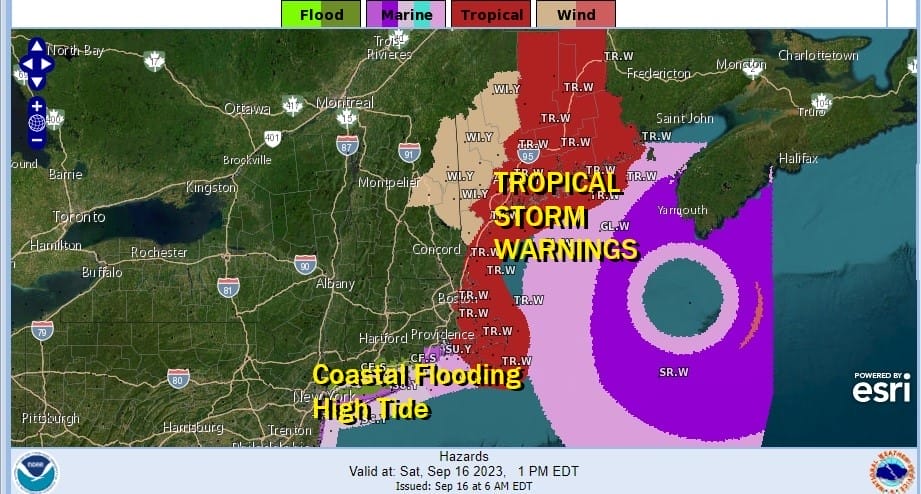
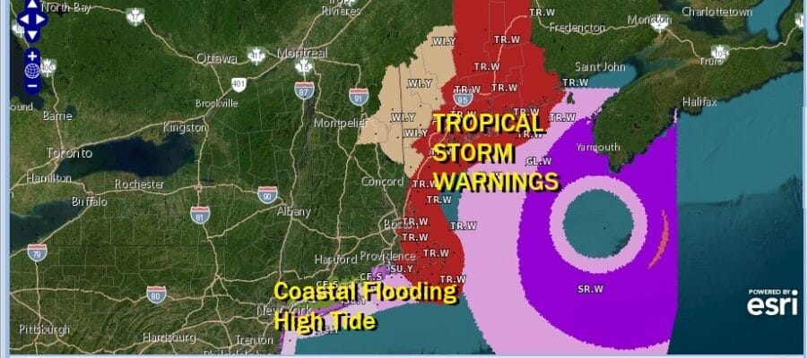
Hurricane Lee is now considered a post tropical cyclone which means it doesn’t have a well defined core. However it really makes no difference since the storm is till producing heavy rains and 80 mph winds. Tropical Storm Warnings continue for Eastern New England from Massachusetts to Maine as well as for Atlantic Canada from New Brunswick to Nova Scotia. Coastal flooding remains an issue at high tide in Southern New England today into Sunday. Minor coastal flooding is expected in some areas of Coastal Connecticut, Long Island, and in and around New York Harbor.

Lee has hooked back a bit to the northwest today as it moves through the Gulf of Maine. Rain has backed into Southeastern New England as far west as Block Island and Eastern Long Island at least on the radars. Heavier bands are in Massachusetts and Maine and that will continue today. Lee is forecast to turn back to the northeast later today and either move into the Bay of Fundy or Western Nova Scotia this evening.
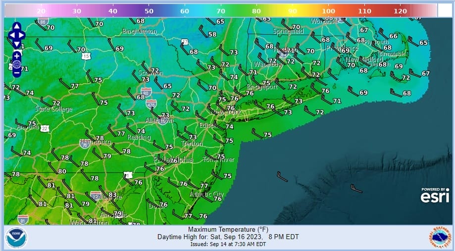
In the meantime today it is cloudy from the Hudson River and NYC eastward to start the day but we will see clouds decrease later this morning and this afternoon from west to east. West of the Hudson River and NYC, across New Jersey and Eastern Pennsylvania to the Catskills, it is a partly to mostly sunny day. It will be breezy at time especially along the coast and over Long Island and Southern Connecticut with gusts to 30 mph or more possible. Most highs will be in the upper 60s to middle 70s.
SATELLITE WITH LIGHTNING STRIKES

WEATHER RADAR

While there might be a little light rain over Eastern Long Island and Eastern Connecticut it won’t last long, if it reaches the ground at all and then the radar echos will pull out this afternoon as Lee moves northward. Skies will be clear tonight with lows in the 50s to lower 60s, some 40s in cool spots.
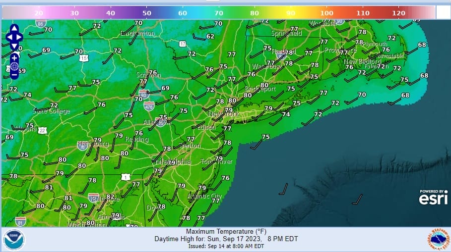
Sunday winds will turn southwest and we will have sunshine to start the day. However clouds will arrive in the afternoon as we do have a cold front approaching. The air will still be relatively dry so we are looking for a few showers or perhaps the odd thunderstorm late Sunday into Sunday night but no severe weather is forecast, and not everyone will see showers. Highs Sunday will be in the mid to upper 70s.

A wave of low pressure will develop on the front and that will bring rain later Sunday night into Monday afternoon before the low moves northeastward into New England. Between the clouds and the rain, Monday highs will be just in the 60s. We should see improving weather conditions with sunshine returning for Tuesday and Wednesday with highs mostly in the 70s.
BE SURE TO DOWNLOAD THE FREE METEOROLOGIST JOE CIOFFI WEATHER APP &
ANGRY BEN’S FREE WEATHER APP “THE ANGRY WEATHERMAN!
MANY THANKS TO TROPICAL TIDBITS FOR THE USE OF MAPS
Please note that with regards to any severe weather, tropical storms, or hurricanes, should a storm be threatening, please consult your local National Weather Service office or your local government officials about what action you should be taking to protect life and property.
(Amazon is an affilate of Meteorologist Joe Cioffi & earns commissions on sales.)


