Coastal Lows To Drive Weather Next 7 Days As Summer Comes to a Close

Coastal Lows To Drive Weather Next 7 Days As Summer Comes to a Close
Post tropical cyclone Lee continues to move away to the northeast over Atlantic Canada today and this opens the door for the next cold front to approach. This Sunday will start with sunshine before clouds arrive this afternoon. We can already see clouds to the west across Pennsylvania southward into the Appalachians making eastward progress. Temperatures today will be mostly in the 70s.

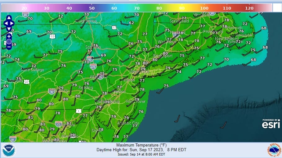
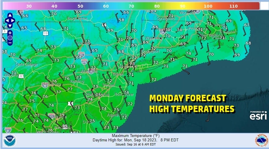
This cold front will be slowing down as it approaches today and a wave is developing on the front which will ultimately force it offshore. However this will mean rain will arriving late this afternoon and evening and continue overnight into early Monday before it ends from west to east. The low will go by and we should see some improvemnet Monday afternoon.
SATELLITE WITH LIGHTNING STRIKES

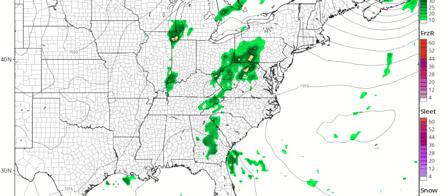
WEATHER RADAR

The rain is already showing up on the regional radar and we have some heavier downpours in the mix. We think that rainfall amounts Sunday night into Monday morning will be on the order of a half to as much as three quarters of an inch. Monday high temperatures will be in the 70s.
High pressure and dry air will build in for Tuesday through Thursday. The high will settle in Southeastern Canada and eventually move east and offshore Atlantic Canada late in the week. The flow will be cool and dry northeast for Tuesday through Thursday. Each day should be dry with highs in the 70s and nights in the 50s to near 60. No rain is forecast through Thursday.
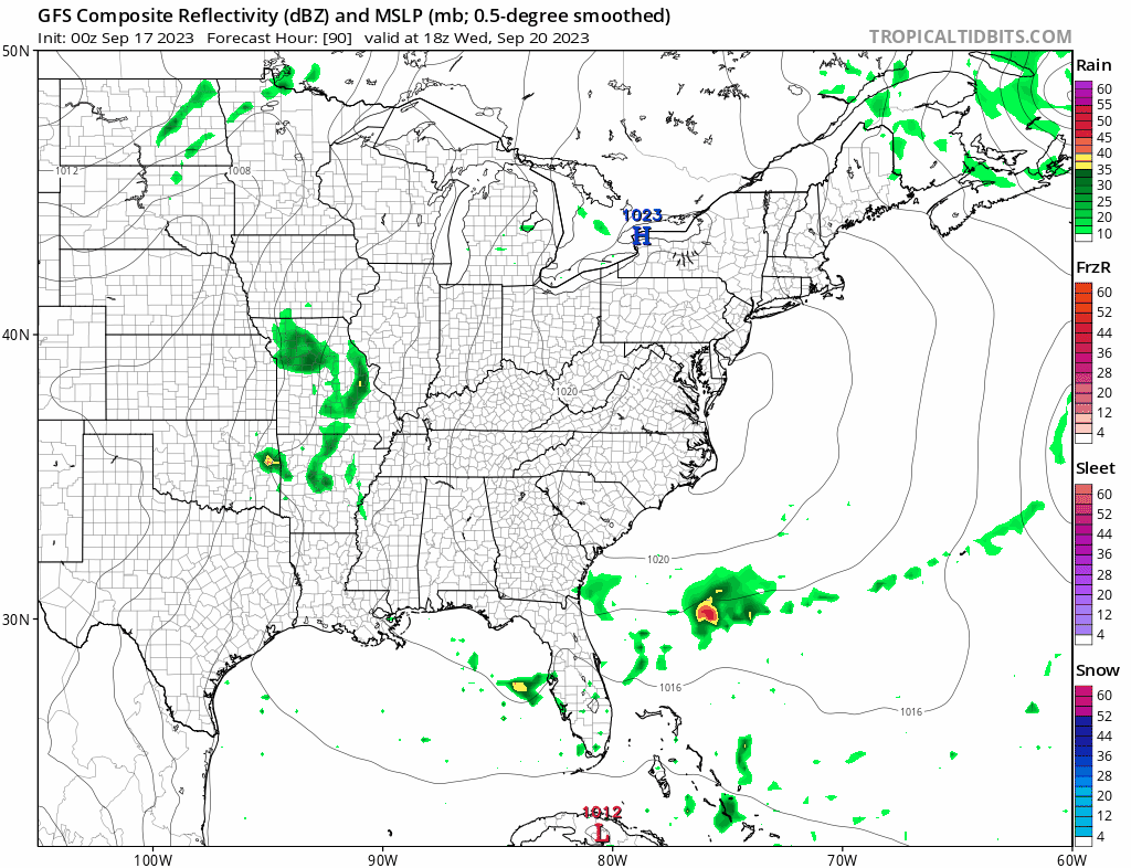
The set up in the Eastern US creates a situation where pressures are going to be low off the Southeast US Coast late this week and this condition, coupled with an onshore flow (east wind) will allow low pressure to develop off the Florida East Coast. Initiallyt this is likely to be a non tropical system however there is the possibility that as this low develops, it could acquire subtropical or even tropical characteristics. We will be watching the prospects for this low as there is a chance it could spread rain up the coast Friday and into the Northern Mid Atlantic to Southern New England sometime Saturday.
BE SURE TO DOWNLOAD THE FREE METEOROLOGIST JOE CIOFFI WEATHER APP &
ANGRY BEN’S FREE WEATHER APP “THE ANGRY WEATHERMAN!
MANY THANKS TO TROPICAL TIDBITS FOR THE USE OF MAPS
Please note that with regards to any severe weather, tropical storms, or hurricanes, should a storm be threatening, please consult your local National Weather Service office or your local government officials about what action you should be taking to protect life and property.
(Amazon is an affilate of Meteorologist Joe Cioffi & earns commissions on sales.)


