Last Summer Weekend Sunshine Beach Days Autumn Monday Chance Showers
Another beautiful day that started with temperatures in the 40s this morning. My personal low was 43 in Central Long Island! Temperatures rebounded quickly though with sunshine from Maine to Georgia. We pushed temperatures up into the mid and upper 70s this afternoon. Now it is on to a clear night. Temperatures overnight won’t be as cool as past nights now that the west southwest wind has taken over. Lows will be in the 50s in cools spots with warmer urban areas bottoming in the lower 60s.
SATELLITE

REGIONAL RADAR

The last weekend of summer has no issues. We will see plenty of sunshine and warm temperatures making for ideal beach days. Just beware of some remnant rough surf and rip tides leftover when Hurricane Humberto passed to our east a few days ago. Highs both days will be in the low to mid 80s. The humidity will be subdued on Saturday but it will come up a bit on Sunday. You may notice it but it won’t be oppressive.
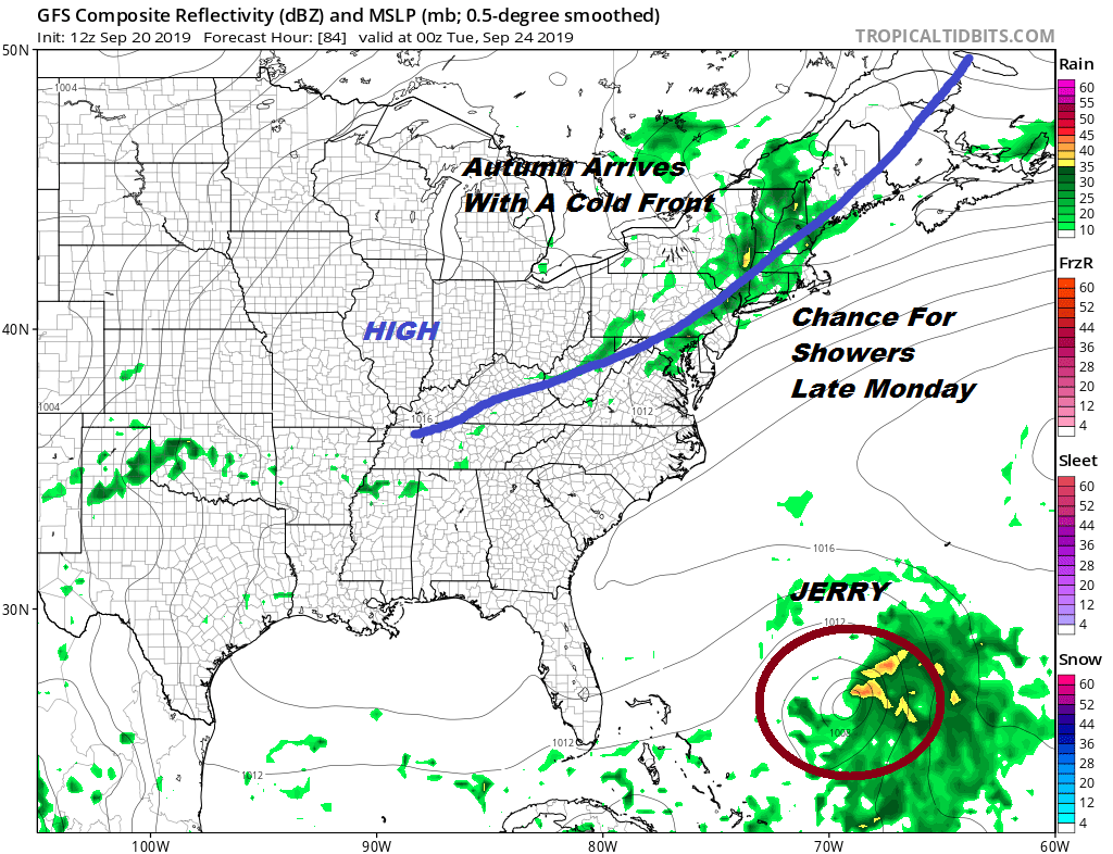
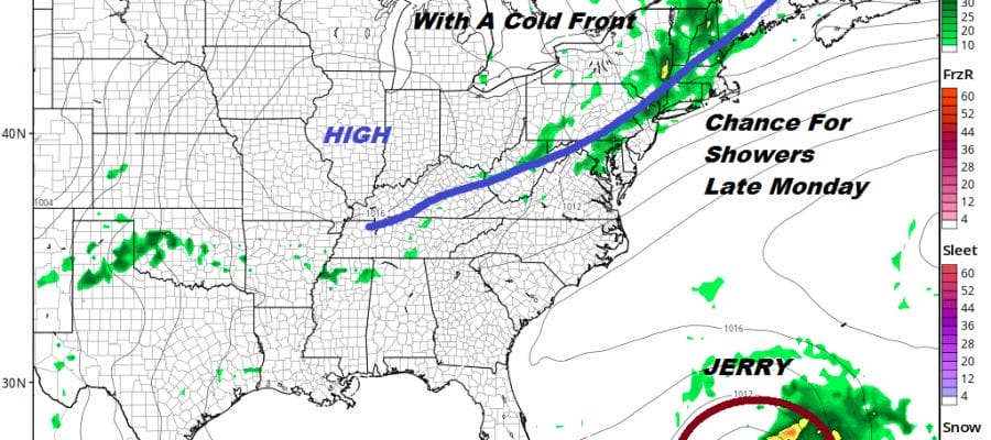
Autumn arrives Monday with a cold front. It will be warm and humid ahead of it with highs in the low to mid 80s. Late in the day and evening we see a chance for showers. Then the front passes offshore followed by high pressure and dry seasonal conditions for Tuesday and Wednesday of next week. Hurricane Jerry will be making its way to between the Bahamas and Bermuda on Monday. The front will keep Jerry away from the east coast and Jerry will likely make a close pass to Bermuda next Tuesday. This will be the second hurricane in a week to impact the island. The upper air pattern is not favorable for this hurricane to threaten the East Coast of the US.
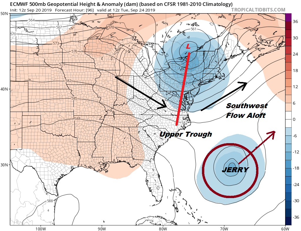
Southwest winds in the Western Atlantic ahead of an upper trough moving through the northeast is going to drive Jerry northeastward. The trough extends far enough south to pick Jerry up and send it on its way out to sea. That upper flow over the US will be changing over the next couple of weeks as a Autumn pattern eventually takes hold. We may warm up again for a few days late next week or next weekend before a series of cold fronts start to move into the Eastern US. The overall pattern remains a dry one until the full change takes place which will be toward the end of the month or early October. Last year if you remember late September and early October was oppressively humid at times. It took until mid October to break that pattern down. This year looks different and autumn may gain a foot hold a few weeks earlier.
MANY THANKS TO TROPICAL TIDBITS FOR THE USE OF MAPS
Please note that with regards to any tropical storms or hurricanes, should a storm be threatening, please consult your local National Weather Service office or your local government officials about what action you should be taking to protect life and property.


