
Last Day of Winter First Day of Spring 70s Friday Chilly Weekend
We continue to see improving weather conditions tonight as low pressure offshore moves away to the northeast and drier air comes in from the northwest. Skies should at least partially clear if not go completely clear overnight with most lows in the 30s. This will lead us into Wednesday which is the last full day of the winter season. Radars are all done as far as precipitation is concerned.
SATELLITE

REGIONAL RADAR

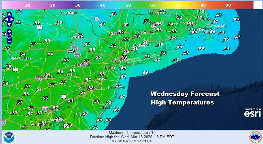
Wednesday should be a nice day all the way around with plenty of sunshine though some high clouds should start to arrive Wednesday afternoon. Temperatures should be no worse than average for this time of year as highs reach up into the 50s in most places.
Wednesday night we begin to see the next round of changes as the new spring season begins on Thursday. Also the weather will be changing with an onshore flow and rain coming in late Wednesday night and for the first part of Thursday. Then we sit back and wait for the warm front to pass through Thursday night.

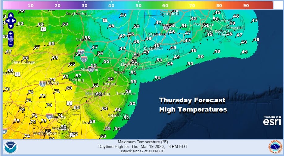
A second round of rain will move through Thursday evening until the warm front passes. This is going to create a wide range in temperatures on Thursday with highs from NYC north and east barely reaching 50 while temperatures could reach 70 in Southern Pennsylvania and even into Southern New Jersey.
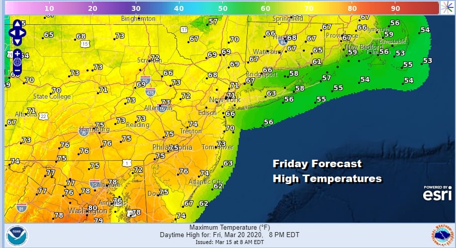
Friday will be a very warm first full day of spring as we wait for a cold front to pass through later in the day. Some sun and clouds will take temperatures up into the 70s in most locations. There is the chance for a shower or even a thunderstorm when the front passes but it appears that moisture will be rather lacking on Friday as the warm front may wind up taking most of it out of the atmosphere.
The weekend will be colder and dry with sunshine for Saturday and sunshine and arriving late day clouds on Sunday. Highs Saturday will be in the upper 40s and lower 50s and Sunday’s highs will be just in the low to mid 40s. A cold rain arrives with the next weather system on Monday.
BE SURE TO DOWNLOAD THE FREE METEOROLOGIST JOE CIOFFI WEATHER APP &
ANGRY BEN’S FREE WEATHER APP “THE ANGRY WEATHERMAN!
MANY THANKS TO TROPICAL TIDBITS FOR THE USE OF MAPS
Please note that with regards to any severe weather, tropical storms, or hurricanes, should a storm be threatening, please consult your local National Weather Service office or your local government officials about what action you should be taking to protect life and property.


