Labor Day Weekend Great Weather Through Saturday
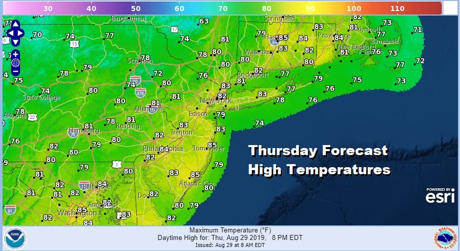
This summer has featured good weekend weather overall with a couple of spectacular weekends in the mix. This Labor Day holiday weekend which is the last vacation weekend of the summer looks to be a good one overall. If you are on vacation this week the next 3 days look absolutely terrific and Sunday and Monday look okay, just not picture perfect. We are seeing clear skies on the satellite today for much of Southern New England down to the Middle Atlantic states. Humidity will not be an issue at all through Sunday. Enjoy the tons of sunshine today with highs reaching into the 80s.
SATELLITE

Much of the rain from yesterday is now over Maine and east of Southeastern New England and moving away. Skies are clearing out there in case you are Eastern New England bound this weekend. Overall the Northeast and Middle Atlantic states should enjoy a relatively tranquil stretch of weather into next week.
REGIONAL RADAR

Tonight will be nice, clear, and comfortable with lows in the 50s inland and in the low to mid 60s in warmer urban areas and along the coast. HIgh pressure will be moving off the South Atlantic coast and a cold front approaches Friday but that front is very weak. Friday will be mostly sunny with highs mostly in the range of 80 to 85. Other than a few clouds Friday night when the front passes we have no issues.
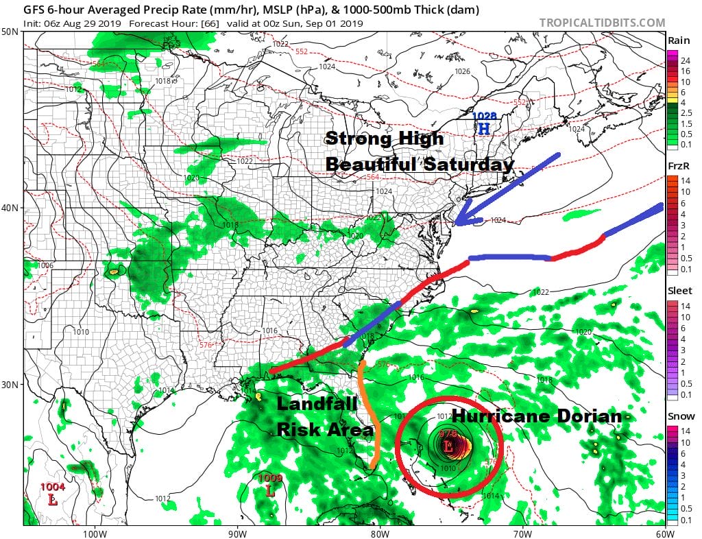
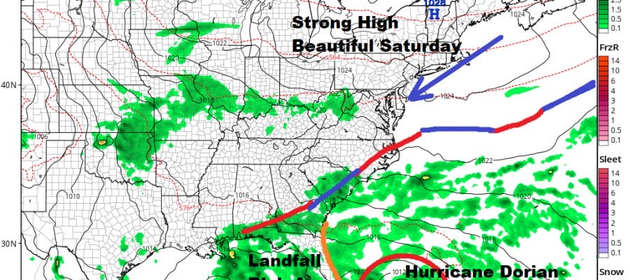
While Hurricane Dorian will be closing in on the Northern Bahamas and Florida with a Florida landfall probable Monday morning, the area of landfall is still in flux and hinges on high pressure building in the Southwest Atlantic. We on the other hand have no worries for Saturday which will be a beautiful day with lots of sunshine, low humidity and highs mostly in the 70s. The high moves out but it seems to be holding on a bit longer so I think Sunday will be no worse than partly sunny with highs in the 70s thanks to an onshore flow. Monday brings clouds and some breaks of sun along with the risk for a shower as we start to see moisture coming back. We should emphasize that this is not a pattern where a hurricane can can come barreling northward up the East Coast. Hurricane Dorian is not a threat to our weather into early next week certainly not directly and right now even in remnant form it seems doubtful.
MANY THANKS TO TROPICAL TIDBITS FOR THE USE OF MAPS
Please note that with regards to any tropical storms or hurricanes, should a storm be threatening, please consult your local National Weather Service office or your local government officials about what action you should be taking to protect life and property.


