
Labor Day Weekend Continues Major Snow Storm Looms Rockies Tropicsl Revving Up Again
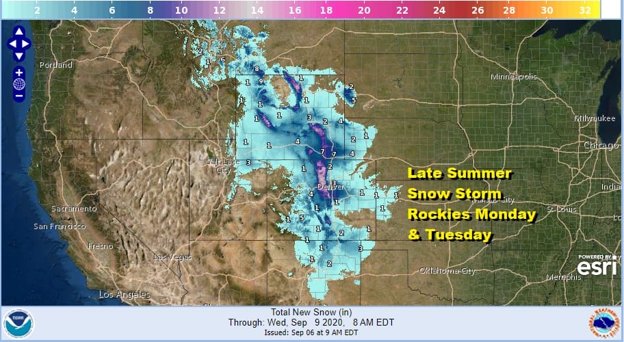
This is turning out to be an utterly strange Labor Day weekend but then again this is 2020 so if there were ever a year we would see an early September snow storm complete with 70 degree temperature changes in 36 hours, this would be the year. We are talking about the Northern and Central Rockies with Denver Colorado a great example. Today we will see another day there of highs of 100 degrees after hitting 100 yesterday. Denver set a record for the hottest and latest 100 degree high yesterday. By Tuesday they will be in the 20s and 30s with accumulating snow possible! I don’t ever remember seeing a snow storm anywhere in the US this early in September!
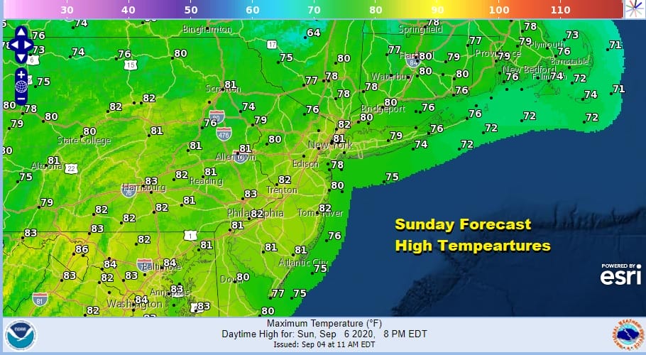
Meanwhile here in the Eastern US we are enjoying another beautiful day of sunshine and low humidity from Maine to Virginia. Temperatures this afternoon will top in the upper 70s and lower 80s. The satellite picture shows very little cloud cover, and the regional radar is silent.!
SATELLITE

REGIONAL RADAR

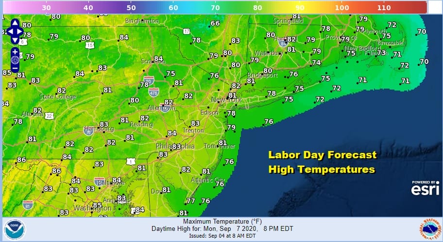
For us there are no issues tonight with clear skies and lows in the upper 50s to mid 60s. Monday Labor Day should be no worse than partly sunny with a breeze from off the ocean. That will help to hold temperatures down a bit with highs in the upper 70s and lower 80s. The humidity Monday will still be rather reasonable.
There are no important changes in the weather outlook for this week. It will turn warmer and more humid as the week progresses. Highs will be in the 80s with nights in the 60s to lower 70s. We might see a chance for a shower or a thunderstorm thrown into the mix along about Thursday as some tropical moisture gets involved a bit but for the most part the week will be rain free.
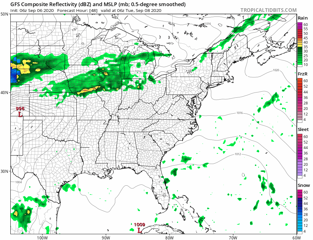
A couple of things to watch in the week ahead will be in the tropics. We have a number of disturbances that are showing potential for tropical storm development. The two waves off the African coast are getting better organized and both show signs of circulations developing
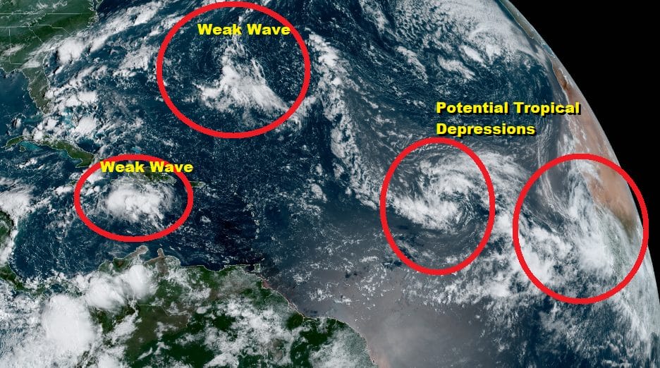
Two other weaker waves are on the scene as well. The one in the Caribbean is moving westward and conditions are not all that favorable. In fact conditions will get rather hostile as it moves westward. However there is a system near Bermuda that is worth keeping a watch on as it is under the strong high building off the Northeast coast and will likely move west or west northwestward. The moisture from this could wet up the atmosphere in the Mid Atlantic states late this week and it is the one thing that my throw a wrench into a rain free week ahead. We will be watching.
BE SURE TO DOWNLOAD THE FREE METEOROLOGIST JOE CIOFFI WEATHER APP &
ANGRY BEN’S FREE WEATHER APP “THE ANGRY WEATHERMAN!
MANY THANKS TO TROPICAL TIDBITS FOR THE USE OF MAPS
Please note that with regards to any severe weather, tropical storms, or hurricanes, should a storm be threatening, please consult your local National Weather Service office or your local government officials about what action you should be taking to protect life and property.


