June Gloom Weekend Forecast Into Next Week
June Gloom Weekend Forecast Into Next Week
You can see how tight the cloud line is on the satellite picture this afternoon. Low clouds are hugging Long Island and cover all of New Jersey except areas north of Route 80. Areas north of there are enjoying mostly sunny skies while everyone else is sitting in cloudy skies. That has impacted temperatures to a large degree. Areas getting sun are in the 70s to near 80 while those in the clouds are in the 60s along the coast with the 70s inland.
EASTERN SATELLITE

REGIONAL RADAR

Showers however aren’t anywhere close by. We are seeing some showers generating across parts of Virginia and North Carolina. They are mostly scattered in nature. There will be no rain issues into the early morning hours on Thursday. Clouds will be spreading northward. The onshore flow will keep temperatures overnight in the 50s and lower 60s.
LOCAL RADAR NEW YORK CITY

LOCAL RADAR PHILADELPHIA


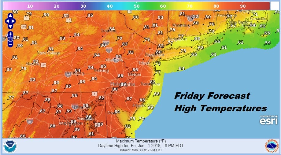
The onshore winds continue on Thursday but everyone will be sitting in clouds with some showers running around with most highs in the mid 60s to lower 70s. Areas to the south in Southern New Jersey & Southeastern Pennsylvania could see higher temps if the warm front gets by and the sun tries to break out. Friday brings a cold front so it will be a warm humid day with highs into the 80s. Some showers & thundertorms are possible on Friday especially late in the day and in the overnight as the cold fron passes through.
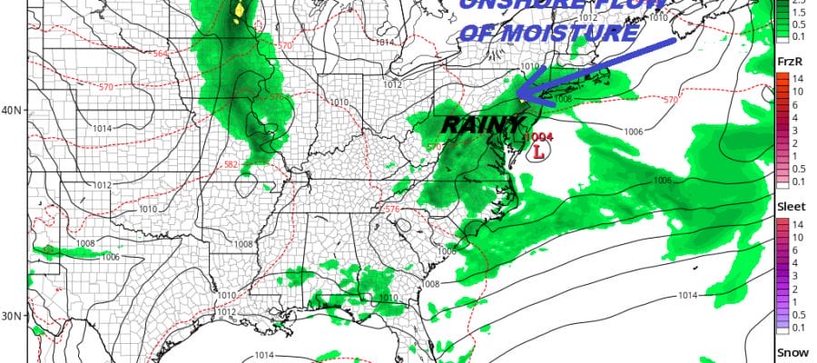
BLOCKING PATTERN ONSHORE FLOW ALL WEEKEND & INTO NEXT WEEK
Yesterday we discussed the long range blocking pattern that was taking hold and its impact on the weather for the weekend and early next week. There are no changes in the overall outlook for some June gloom beginning on Saturday. Clouds, an ocean wind, with on and off rain will be on the table for Saturday & Sunday. It will not be continuous but if you are looking for sunshine you will have rather long wait.
GFS FORECAST SATURDAY
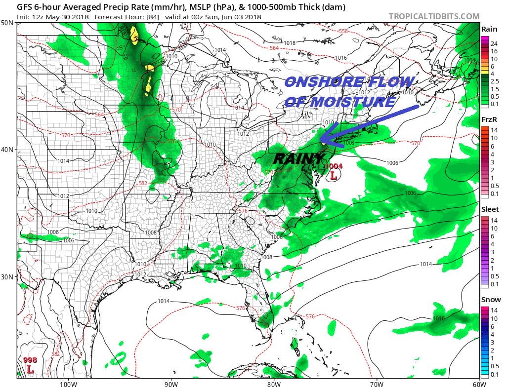
The problem is the blocking will continue to favor higher pressures to our north with lower pressures to our south. With everything at a relative standstill we will likely stay in an onshore flow into the first few days of next week. It doesn’t rain straight through. We are still dealing with the onshore flow into Tuesday night.
GFS FORECAST TUESDAY NIGHT

We may not see any real improvement until late next week when weather systems might start moving again and at least change the wind direction to one that is more westerly. Maybe then we can see something nicer weather wise.
 GET JOE A CIGAR IF YOU LIKE

FiOS1 News Weather Forecast For Long Island
FiOS1 News Weather Forecast For New Jersey
FiOS1 News Weather Forecast For Hudson Valley
NATIONAL WEATHER SERVICE SNOW FORECASTS
LATEST JOESTRADAMUS ON THE LONG RANGE


