July 4th Weekend Weather Outlook

July 4th Weekend Weather Outlook
FRIDAY GETAWAY DAY FORECAST HIGH TEMPERATURES

Looking ahead to what will be a long 4 day weekend for most, we can say at this point that Saturday & Sunday will be the hottest days and the most humid. The heat will be borderline with highs up around or just over 90 away from shore areas along with the chance for scattered afternoon thunderstorms beginning late Friday and again late Saturday & Sunday. Much of the time however for most it will not be raining.
SATURDAY & SUNDAY GFS MODEL CLICK TO ANIMATE

Monday doesn’t look too bad from this vantage point and I’m thinking a mix of sun and clouds and maybe no thunderstorms to worry about. The humidity and temperature could edge slightly lower on Monday though it will still be rather warm. The problem may be for Tuesday
4th of July Jet Stream Pattern
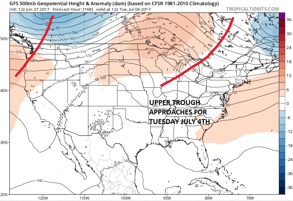
The jet stream remains very active as has been the case for the last 2 months. This is keeping the flow of weather systems on a regular 2 to 3 day basis and also keeping extreme heat from building here in the east. Looking at this upper air pattern it seems to suggest another system approaching for the 4th of July.
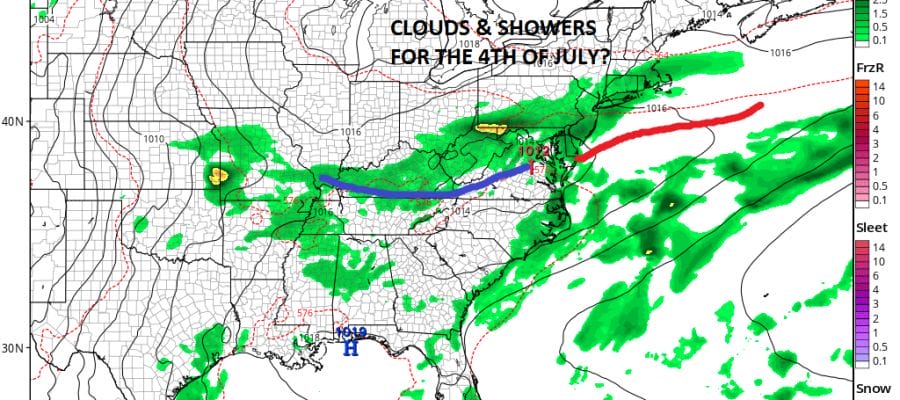
JULY 4TH SURFACE MAP 2PM TUESDAY
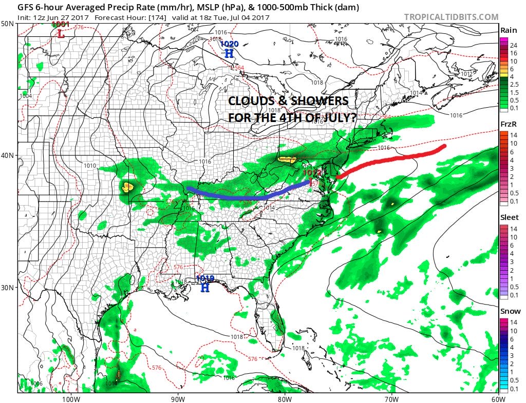
Late Sunday night into Monday morning a cold front will be moving through and stalling to our south. The upper trough generates a wave on that front and as a result it creates an area of clouds and showers over us. Now we are early in the game here and there are a lot of variables at play. The showers could very well be overdone in which case it may not be too bad. On the other hand we could see an area of rain and downpours that carry on for a good chunk of the day.
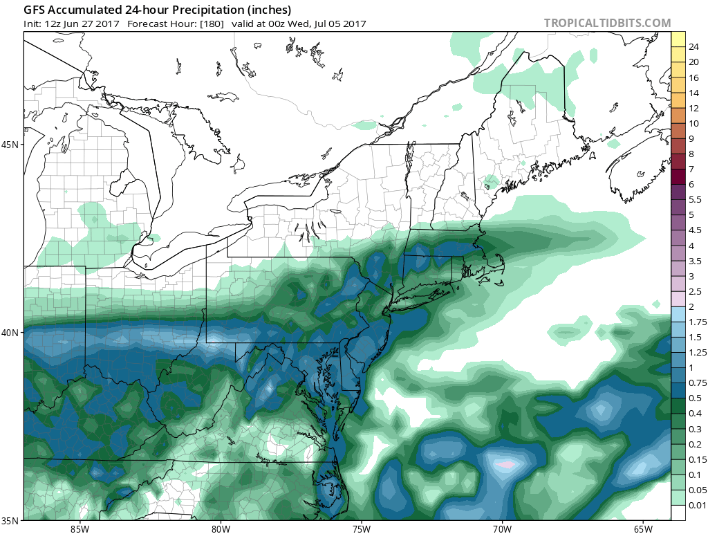
GFS RAINFALL FORECAST FOR TUESDAY JULY 4TH
What could also happen is a weaker trough might flatten this out and push it south. Let’s wait and see how models evolve over the next few days since it is still a week away. In the meantime summery weather is pretty much a lock for Friday through Sunday with the odd thunderstorm each day. Monday looks okay. Then we wait to see for Tuesday. Let us also wait for the latest European model to see what it has to say about next week.
MANY THANKS TO TROPICAL TIDBITS FOR THE WONDERFUL USE OF THE MAPS

GET JOE A CIGAR IF YOU LIKE!