
Joestradamus Weather Outlook More Blocking

MENTION JOE CIOFFI AND GET A 5% DISCOUNT
The blocking pattern in the atmosphere remains in full control over the weather in the Northeast United States and shows no signs of breaking down through early next week. This is going to lead to more days with cloudy damp conditions rather than sunshine. The good news is that given that we are now approaching May, at least the nice days will be reasonable temperature wise though on the cool side of normal. The sunny days should see temperatures warm up nicely though nights will be on the chilly side. Of course there is the ocean wind which will impact temperatures along the coast.
Joestradamus Weather Outlook More Blocking
GFS Thursday Surface Map
Joestradamus Weather Outlook More Blocking
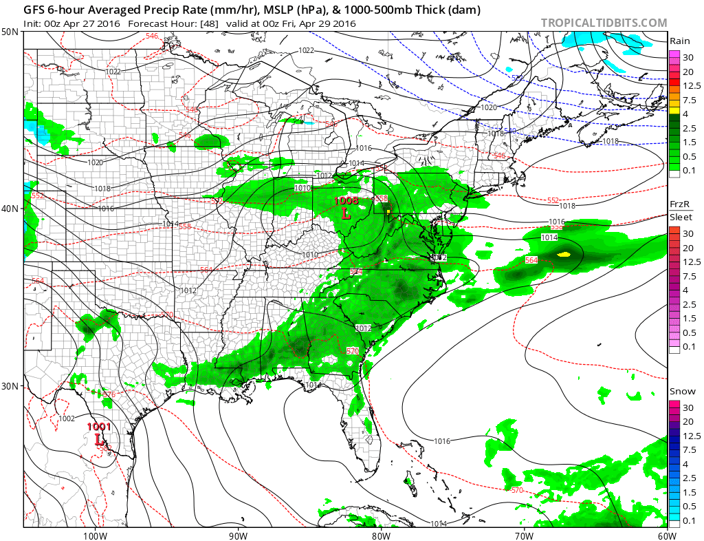
GFS Friday Surface Map Friday
The first stretch of deteriorating weather conditions will come later Thursday into Friday as low pressure moves out of the Rockies and Plains. The normal tendency is for these lows to head to our west toward the great lakes with warm ups ahead of cold fronts and some shower and thunderstorm activity. But with the strong block to the north these weather systems will be forced eastward rather than northward. Low pressure will find its way into West Virginia and redevelop along the coast. The onshore flow will be set in place which means lots of low clouds. Rain is indicated for Thursday night into Friday though from the standpoint of total rainfall it isn’t going to be anything to write home about.
JOESTRADAMUS WEATHER OUTLOOK MORE BLOCKING
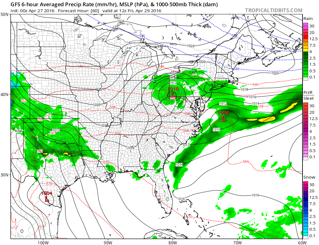
GFS UPPER AIR FRIDAY
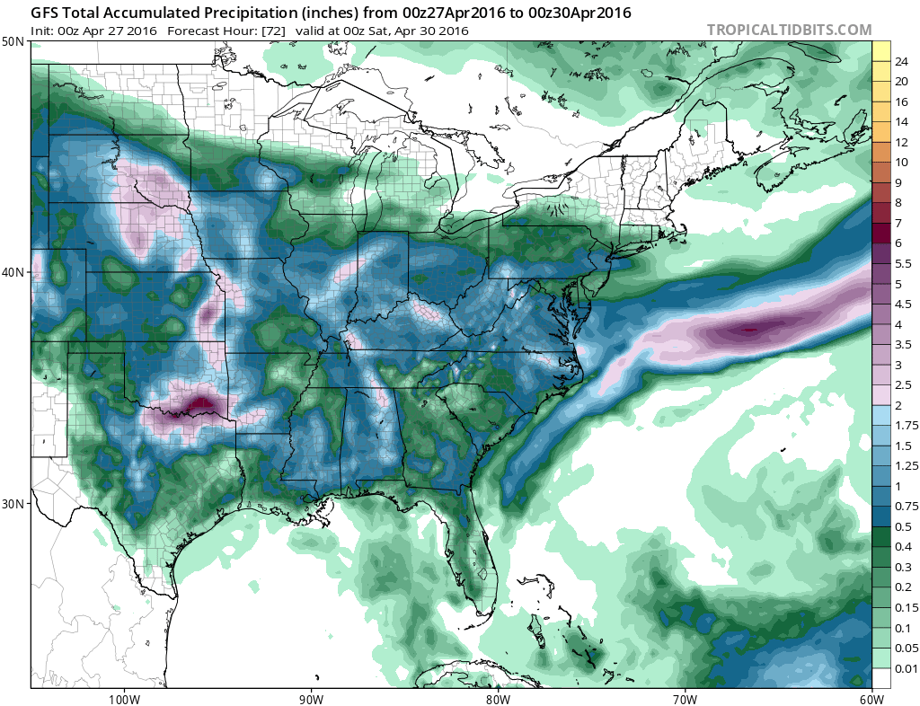
When you look at the upper air pattern there is a kink in the flow with the disturbance that moves east but it is weak. Thanks to the position of the vortex to the north it gets squashed to some degree and the surface low won’t strengthen very much. The rainfall forecast map reflects this. The gfs produces about 1/2 inch of liquid (plus or minus a few tenths) and it cuts off to the north rather sharply.
Joestradamus Weather Outlook More Blocking
GFS Rainfall Forecast
Now once this moves out on Friday the onshore flow remains intact over the weekend so clearing could be a bit problematic. If more of the high builds south and the block is a little stronger we could dry out to some sunshine on Saturday. However the next weather system coming out from the west will be aiming for the east coast Sunday and Monday.
Joestradamus Weather Outlook More Blocking
GFS Model Monday Surface Map
Joestradamus Weather Outlook More Blocking
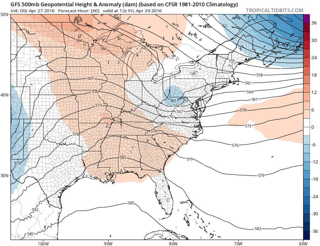
GFS Monday Upper Air
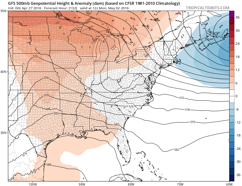
Models have been trending further south with this thanks to the vortex to the northeast off Nova Scotia. There looks to be little room for this to lift as far north. If this is the case there is hope for some drying of skies Sunday into Monday rather than another couple of days of damp and dismal weather.
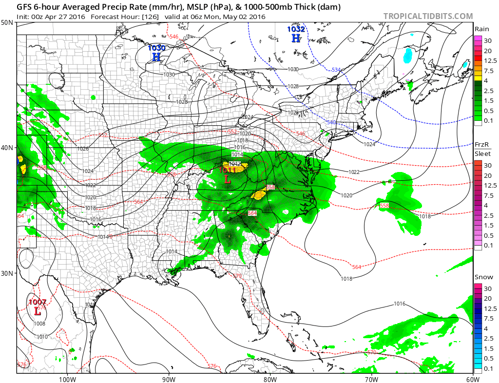
JOESTRADAMUS WEATHER OUTLOOK
GFS MODEL SURFACE MONDAY MAY 2 2016

The flow still remains onshore going into Monday so even if the rain never gets here clouds may wind up being a problem. Overall it is a chilly pattern as we head into the start of May. Nuisance systems and onshore flow will be the theme going forward. That recent 10 day stretch of sunshine doesn’t look to be repeated anytime soon.
FiOS1 News Weather Forecast For Long Island
FiOS1 News Weather Forecast For New Jersey
FiOS1 News Weather Forecast For Hudson Valley
NATIONAL WEATHER SERVICE SNOW FORECASTS
LATEST JOESTRADAMUS ON THE LONG RANGE

NOMINATED FOR AN APPY AWARD FOR BEST WEATHER APP!!
Weather App

Don’t be without Meteorologist Joe Cioffi’s weather app. It is really a meteorologist app because you get my forecasts and my analysis and not some automated computer generated forecast based on the GFS model. This is why your app forecast changes every 6 hours. It is model driven with no human input at all. It gives you an icon, a temperature and no insight whatsoever.
It is a complete weather app to suit your forecast needs. All the weather information you need is right on your phone. Android or I-phone, use it to keep track of all the latest weather information and forecasts. This weather app is also free of advertising so you don’t have to worry about security issues with your device. An accurate forecast and no worries that your device is being compromised.
Use it in conjunction with my website and my facebook and twitter and you have complete weather coverage of all the latest weather and the long range outlook. The website has been redone and upgraded. Its easy to use and everything is archived so you can see how well Joe does or doesn’t do when it comes to forecasts and outlooks.
Just click on the google play button or the apple store button on the sidebar for my app which is on My Weather Concierge. Download the app for free. Subscribe to my forecasts on an ad free environment for just 99 cents a month.
Get my forecasts in the palm of your hand for less than the cost of a cup of Joe!
![]()

