JOESTRADAMUS Warmer Long Range (Hopefully)?

MENTION JOE CIOFFI AND GET A 5% DISCOUNT
JOESTRADAMUS Warmer Long Range (Hopefully)?
LESS BLOCKING MORE PROGRESSION
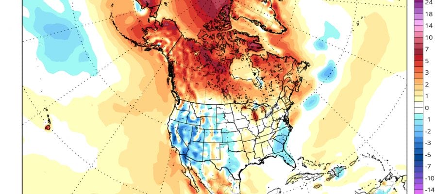
WARMER LATE MAY?
Whenever I look at the long long range I always get a little nervous because we know how volatile models can get once we push past day 7 on the weather models. And of course after day 10 we have seen flips back and forth many times over the course of any season. That said there appears to be a few things happening that could lead to warmer days as we head toward the last 10 days of the month. However before we get to that we have some issues for next week. Weather models both the GFS and the European have been having a struggle trying with whether the weather systems next week would go to our north or to our south. I’ve been leaning on the idea that a track to the south seems more likely than north. This is because we have seen that tendency over the last several weeks so persistence says to stay that course. Today’s model runs show that this indeed my be the case for next week. Once the coldest of the cold air pulls out Monday night, the next weather system begins its approach.
JOESTRADAMUS Warmer Long Range (Hopefully)?
GFS MODEL TUESDAY & WEDNESDAY OF NEXT WEEK
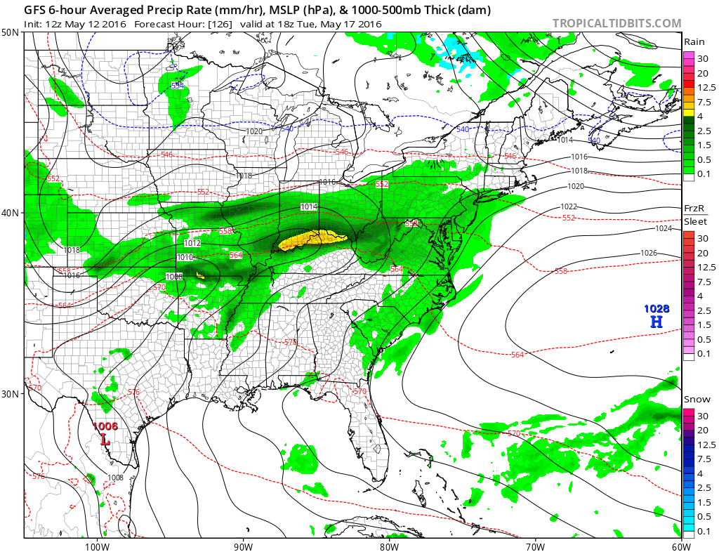
Today’s GFS model and Euro weather model take the next system and track it to our south for Tuesday and Wednesday. This sets up an onshore flow again for a couple of days. That means a cool marine influence with a northeast or east wind and some rain developing for Tuesday. The Euro weather model has on system coming through and done by Wednesday while the GFS model has it in pieces and brings another round of rain for Wednesday. In either case it does not look like a big deal either way and once that is done we should see some improvement for late week and into next weekend.
JOESTRADAMUS Warmer Long Range (Hopefully)?
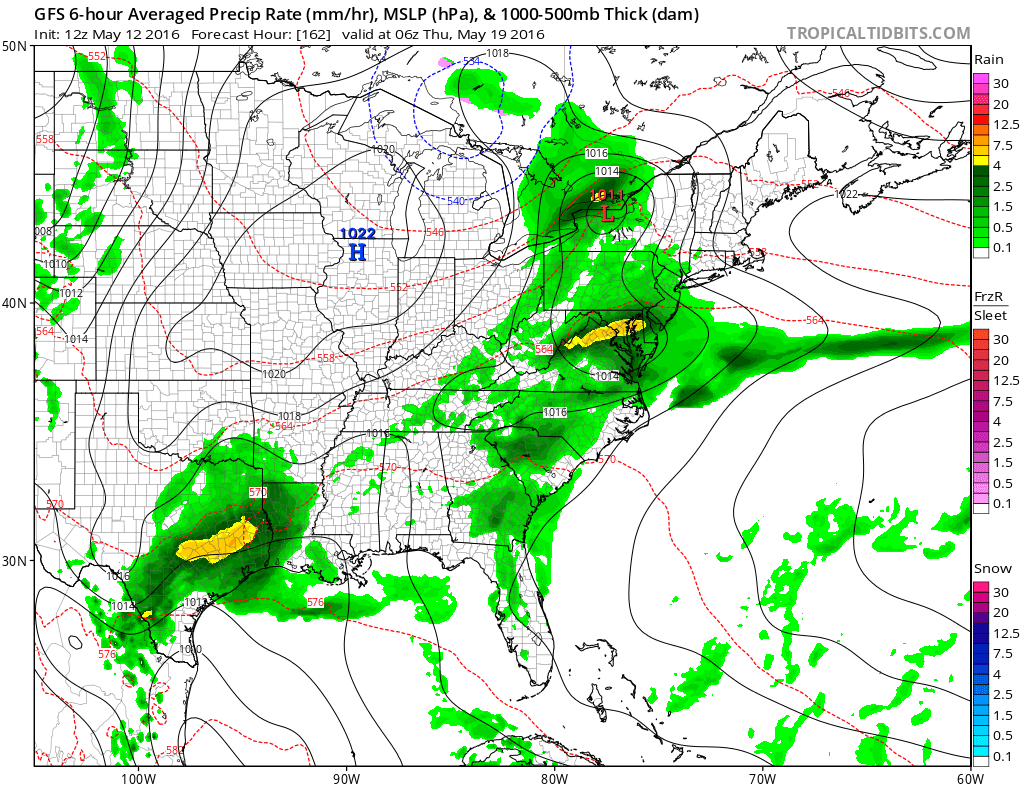
GFS & EURO UPPER AIR SUNDAY MAY 22
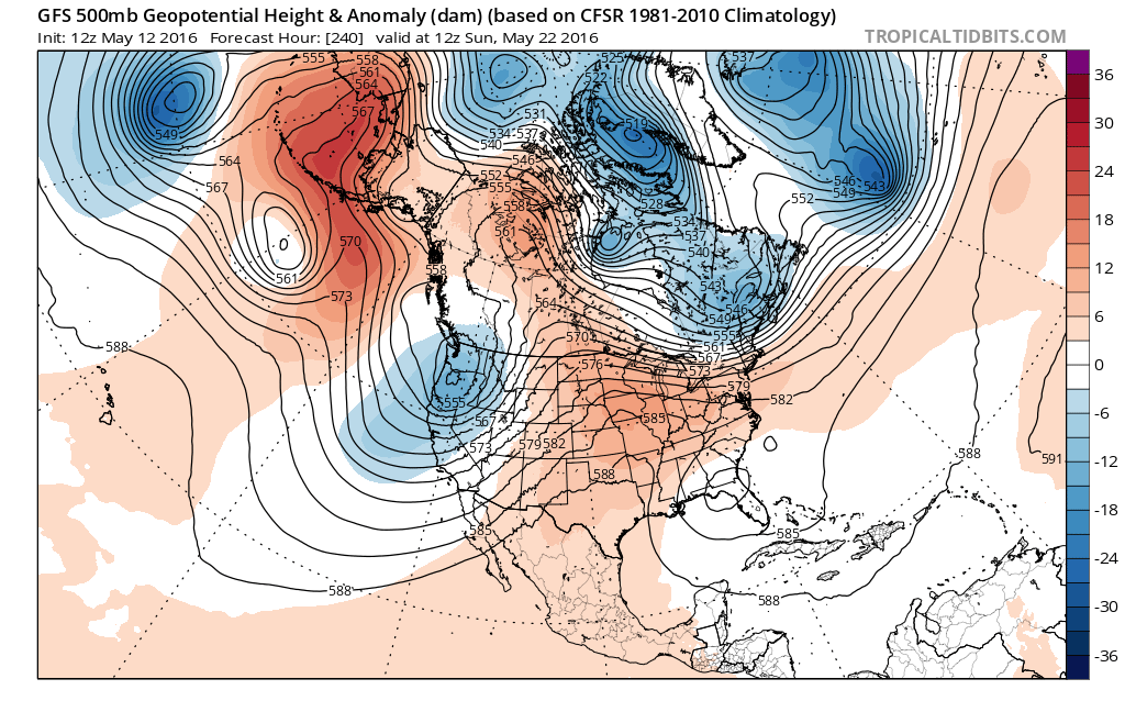

Beyond that time frame a lot is going to depend on whether the blocking influence is minimized. The GFS is not very promising on this regard though the Euro model is. So the question of warmer weather coming at the end of the month, remains indeed a question.
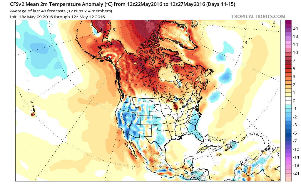
Climate models for days 11-15 show near normal temperatures which is probably the no brainer bet here since it really doesn’t commit in either direction.
LATEST SHORT RANGE MODEL ANALYSIS VIDEO
FiOS1 News Weather Forecast For Long Island
FiOS1 News Weather Forecast For New Jersey
FiOS1 News Weather Forecast For Hudson Valley
NATIONAL WEATHER SERVICE SNOW FORECASTS
LATEST JOESTRADAMUS ON THE LONG RANGE

NOMINATED FOR AN APPY AWARD FOR BEST WEATHER APP!!
Weather App

Don’t be without Meteorologist Joe Cioffi’s weather app. It is really a meteorologist app because you get my forecasts and my analysis and not some automated computer generated forecast based on the GFS model. This is why your app forecast changes every 6 hours. It is model driven with no human input at all. It gives you an icon, a temperature and no insight whatsoever.
It is a complete weather app to suit your forecast needs. All the weather information you need is right on your phone. Android or I-phone, use it to keep track of all the latest weather information and forecasts. This weather app is also free of advertising so you don’t have to worry about security issues with your device. An accurate forecast and no worries that your device is being compromised.
Use it in conjunction with my website and my facebook and twitter and you have complete weather coverage of all the latest weather and the long range outlook. The website has been redone and upgraded. Its easy to use and everything is archived so you can see how well Joe does or doesn’t do when it comes to forecasts and outlooks.
Just click on the google play button or the apple store button on the sidebar for my app which is on My Weather Concierge. Download the app for free. Subscribe to my forecasts on an ad free environment for just 99 cents a month.
Get my forecasts in the palm of your hand for less than the cost of a cup of Joe!
![]()

