IRMA WINDS ALREADY REACHING GALE FORCE SOUTH FLORIDA COAST
IRMA WINDS ALREADY REACHING GALE FORCE
SOUTH FLORIDA COAST
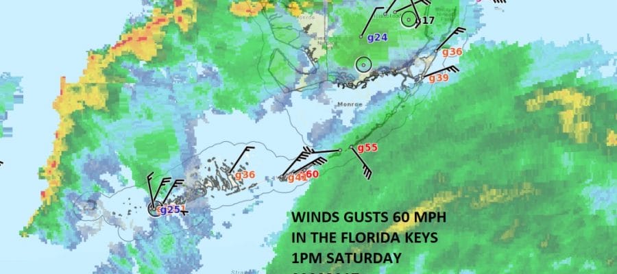
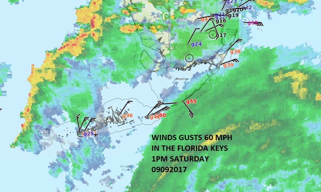
Irma Category 3 Hurricane 125 mph winds is continuing to move along the extreme north coast of Cuba over the barrier islands. The interaction with the land mass has weakened Irma which is no surprised. However we are seeing 2 things. First is the fact that gale force winds area already occurring the coastal areas of South Florida both on the east and west side. We have also already seen some gusts to 60 just off the coast near Miami & throughout the Florida Keys. This is only the beginning. Once the center emerges off the coast this evening it will have 12-18 hours to restrengthen over 90 degree water and a very favorable upper air environment.
SATELLITE LOOP

I’m going to be watching very carefully for an earlier turn to the northwest. There are some early hints that this me be happening as the enhanced satellite loop shows. It appears that the center may have starting to jog a bit more to the north. We will need that trend to continue for a few more hours. While I still think the threat is for West Flordia, it bring the center inland a bit further south. This of course would impact the weather on the East Coast of Florida as well so we will be watching closely. The Miami & Key West radars show the lead squalls moving in.
LOCAL RADAR MIAMI FLORIDA

LOCAL RADAR KEY WEST


in the southeast corner of the frame of the Key West radar loop you cane see the western side of the core of Hurricane Irma. Once it gets into full view late today we can get a better handle on the motion.
..100 PM EDT POSITION UPDATE…
…IRMA MOVING NEAR THE NORTH COAST OF CUBA …
Earlier today there was a report from a weather station in Ciego
de Avila, Cuba, of a wind gust to 159 mph (256 km/h).
SUMMARY OF 100 PM EDT…1700 UTC…INFORMATION
———————————————-
LOCATION…23.0N 80.0 W
ABOUT 75 MI…125 KM E of Varadero Cuba
ABOUT 160 MI…255 KM SE of Key West, Florida
MAXIMUM SUSTAINED WINDS…125 MPH…205 KM/H
PRESENT MOVEMENT…W OR 280 DEGREES AT 9 MPH…15 KM/H
MINIMUM CENTRAL PRESSURE…941 MB…27.79 INCHES
 GET JOE A CIGAR IF YOU LIKE

FiOS1 News Weather Forecast For Long Island
FiOS1 News Weather Forecast For New Jersey
FiOS1 News Weather Forecast For Hudson Valley