
Independence Day Sees Fewer Thunderstorms
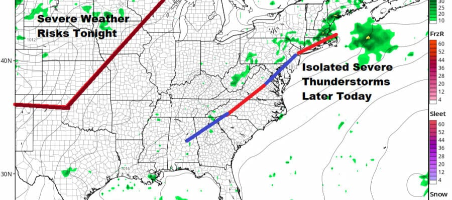
Isolated Severe Storms Possible New Jersey Southward
The last several days we have seen afternoon and evening severe thunderstorms up and down the East Coast. Not everyone has experienced these storms as some areas have gotten hit harder than others, and some not at all. Today we are at a place where thunderstorm activity should be less. A cold front is lingering near the coast and it will take another day to nudge it out further to the east.

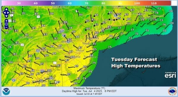
This will be a very warm and humid day. We will have clouds around as the satellite loop indicates and there will be some showers and thunderstorms around especially near the coast. However there will also be some breaks of sunshine an the mix. Temperatures will be in the mid to upper 80s for highs this afternoon.
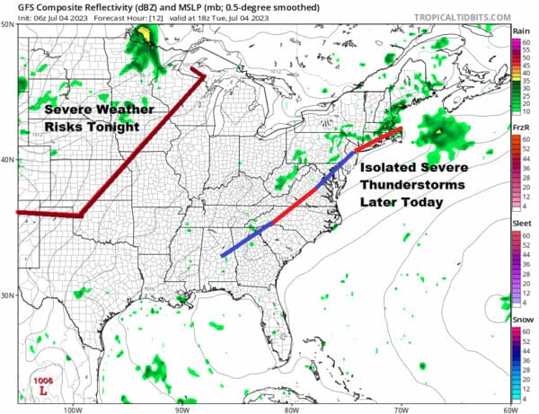
The atmosphere is still unstable enough that we could see some thunderstorms fire up in the afternoon and evening but they should be of the hit or miss variety and for most places it will be a miss rather than a hit. The Storm Prediction Center is indicating a marginal risk for severe weather mainly from New Jersey southward. This means thunderstorms will be scattered, disorganized, and that perhaps the odd cell or two could reach severe levels.
SATELLITE

WEATHER RADAR

Most thunderstorms as models indicate should be long gone after sunset so this means that fireworks shows should not have shower or thunderstorm issues to deal with and that weather conditions should be dry after 8 or 9pm. Warm and humid weather overnight will take lows down to the upper 60s and lower 70s.
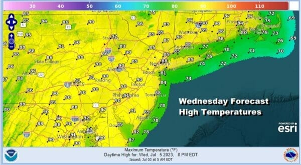
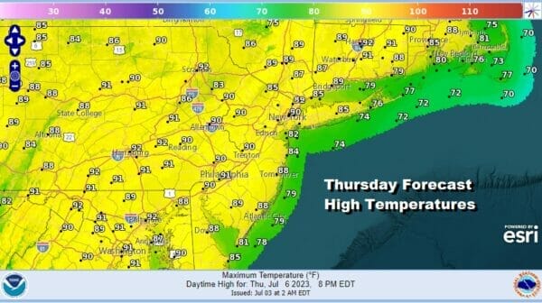
Humidity will not be coming down anytime soon in the Eastern US. Dew points are likely to live in the upper 60s to lower 70s much of the time Weddnesday through Friday. This could lead to an isolated thunderstorm chance Wednesday and Thursday. Otherwise both days will be very warm to hot with some sunshine. Highs both days will be in the mid 80s to around 90. Temperatures might be a little cooler at the shore.
Friday a cold front will approach so it will be very warm and humid ahead of it with highs in the mid to upper 80s and there is the chance for late day thunderstorms. Over the weekend we see chances for scattered thunderstorms late Saturday though much of the day will be dry and warm. Sunday probably sees a better chance for afternoon and evening thunderstorms as a stronger system comes in from the west.
Weather in a Minute Video
BE SURE TO DOWNLOAD THE FREE METEOROLOGIST JOE CIOFFI WEATHER APP &
ANGRY BEN’S FREE WEATHER APP “THE ANGRY WEATHERMAN!
MANY THANKS TO TROPICAL TIDBITS FOR THE USE OF MAPS
Please note that with regards to any severe weather, tropical storms, or hurricanes, should a storm be threatening, please consult your local National Weather Service office or your local government officials about what action you should be taking to protect life and property.
(Amazon is an affilate of Meteorologist Joe Cioffi & earns commissions on sales.)


