Increasing Sunshine Later Today Warmer Dry Wednesday Through At Least Sunday
No Rain Forecast

Weather in 5/Joe & Joe Weather Show Latest Podcast
Increasing Sunshine Later Today Warmer Dry Wednesday Through At Least Sunday
No Rain Forecast
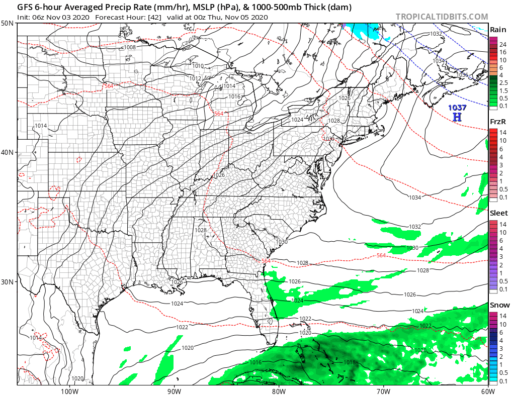
We are in for quiet times weather wise after this last upper air disturbance plays through today. The satellite shows a swirl of clouds in the Gulf of Maine. That is a developing storm with a trailing front that shows up as a narrow band of clouds moving southward. To the north and to the south of that band we see sunshine. Overall today the trend will be increasing sunshine once those clouds get out of the way. Or as far as areas to the south perhaps some clouds come into the mix at some point before moving out. Radars aren’t showing much from this other than some light scattered precipitation and most of it isn’t even reaching the ground. From NYC south highs will reach the low and mid 50s but where clouds are an issue in Southern New England and Long Island highs might only be in the 40s even with some sun breaking through this afternoon.
SATELLITE

REGIONAL RADAR

Tonight we will see skies clear with most lows in the 30s inland with 20s in cold spots while coastal locations and warmer urban areas will bottom in the 40s. Wednesday looks like a nice sunny day with highs reaching the upper 50s and lower 60s in most places.
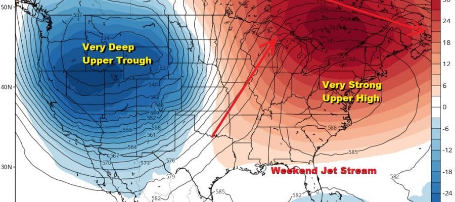
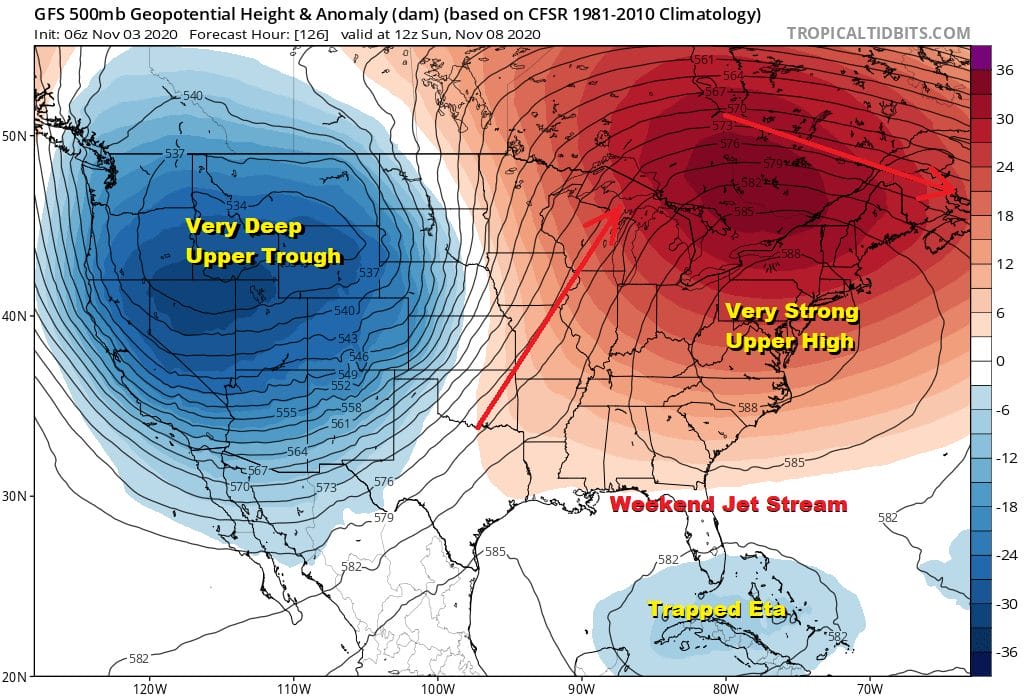
A strong upper ridge will be building in the east late this week and over the weekend which essentially locks in a warm and mostly dry pattern. Thursday through Monday look for sunshine during the day with highs climbing to the mid and upper 60s Thursday with some warm spots near 70. Friday through the weekend we are looking highs in many places in the upper 60s and lower 70s for the most part. The only issue to look for is whether a bit of a marine layer starts to take over at night and during the morning where some low clouds and fog develop especially along the coast. However we don’t expect this to be problematic like we saw over the last couple of weeks. No storms will threaten and no cold fronts of consequence will arrive here until late next week.
Hurricane Eta Making Landfall in Northeast Nicaragua
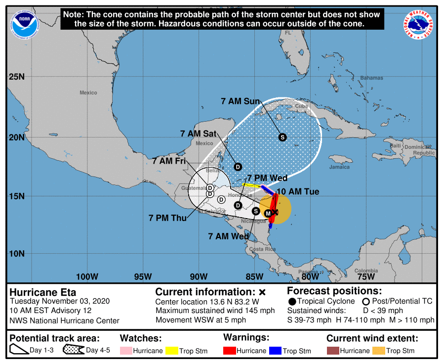
Category 4 Hurricane Eta is making landfall today in Northeast Nicaragua and will then move inland. This will create catastrophic conditions there with torrential rains measured in feet. The surviving core looks to emerge into the Northwest Caribbean on Friday and then restrengthen into a tropical storm over the weekend. The presence of ETA is essentially locking in the pattern across North America. Nothing is moving and won’t be until a trough moving into the Western US makes some eastward progress and a ridge of high pressure across Mexico to the East Coast begins to break down. It is similar to what happened with Epsilon a few weeks ago though the geography obviously is different.
Eventually all patterns break down as will this one probably later next week and it will implications regarding the next cold front, Tropical Storm Eta, and a few other issues in the long range. However nothing happens for the next 7 days at least so shall see what the future of Eta is and whether it makes it out of the Caribbean.
BE SURE TO DOWNLOAD THE FREE METEOROLOGIST JOE CIOFFI WEATHER APP &
ANGRY BEN’S FREE WEATHER APP “THE ANGRY WEATHERMAN!
MANY THANKS TO TROPICAL TIDBITS FOR THE USE OF MAPS
Please note that with regards to any severe weather, tropical storms, or hurricanes, should a storm be threatening, please consult your local National Weather Service office or your local government officials about what action you should be taking to protect life and property.


