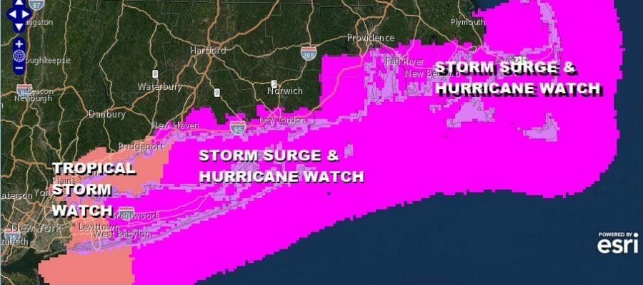
Hurricane Watch Long Island to Southeastern New England
Henri Forecast to Strengthen As It Heads Up The Coast

Weather in 5/Joe & Joe Weather Show Latest Podcast
Hurricane Watch Long Island to Southeastern New England
Henri Forecast to Strengthen As It Heads Up The Coast
Hurricane Watches & Storm Surge Watches have been posted for Southern New England, most of Long Island and Southeastern New England. Tropical Storm Watches border those back to about NYC. Tropical Storm Henri is continuing to nudge. Here is a summary from the 5am advisory.
A Storm Surge Watch is in effect for…
* South Shore of Long Island from East Rockaway Inlet to Montauk
* North Shore of Long Island from Kings Point to Montauk
* Kings Point New York to Sagamore Beach Massachusetts
* Nantucket, Martha’s Vineyard, and Block Island
A Hurricane Watch is in effect for…
* South Shore of Long Island from Fire Island Inlet to Montauk
* North Shore of Long Island from Port Jefferson Harbor to Montauk
* New Haven Connecticut to Sagamore Beach Massachusetts
* Nantucket, Martha’s Vineyard, and Block Island
A Tropical Storm Watch is in effect for…
* West of Fire Island Inlet to East Rockaway Inlet New York
* West of Port Jefferson Harbor New York
* West of New Haven Connecticut
LOCATION…30.2N 73.1W
ABOUT 370 MI…600 KM SSE OF CAPE HATTERAS NORTH CAROLINA
ABOUT 780 MI…1255 KM SSW OF NANTUCKET MASSACHUSETTS
MAXIMUM SUSTAINED WINDS…65 MPH…100 KM/H
PRESENT MOVEMENT…WNW OR 300 DEGREES AT 9 MPH…15 KM/H
MINIMUM CENTRAL PRESSURE…995 MB…29.39 INCHES
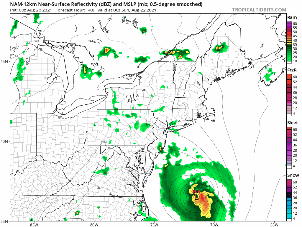
SATELLITE

Let’s first off make this clear to all that this is for Sunday. There are no weather conditions due to Henri that are in the forecast for today, tonight, Saturday or Saturday night. Today we are in the throws of a very warm and tropical air mass. An upper disturbance is creating some scattered showers and thunderstorms on the radar with more numerous showers and thunderstorms on the regional radar in Delaware, Maryland, and Northeast Virginia that are inching northeast. Most of that rain should remain in those areas and gradually weaken as we move through the day. Watch for scattered showers or thunderstorm elsewhere from Eastern Pennsylvania to Southern New England with highs today mostly in the 80s.
WEATHER RADAR


There are no issues for tonight and Saturday as it remains very warm and humid with lows in the upper 60s and lower 70s tonight and highs in the 80s on Saturday. Sometimes ahead of tropical systems we see nice weather the day before but an upper low that is part of this equation complicates matters and we will see clouds and some scattered afternoon and evening showers or downpours.
Sunday weather conditions deteriorate in the watch area described. The general rule is if you are to the west of the track of the center of Henri you will generally experience more rain and less wind while if you are to the east the opposite is true. Trying to knot down specifics is a bit difficult. We have a full moon Sunday which will mean higher than normal tides as it is. Right now a 2 to 4 ft surge is forecast and if this occurs at high tide it will at least create moderate coastal flooding in the storm surge watch areas.
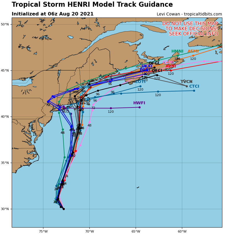
All but one of the hurricane track models shows a landfall somewhere from Long Island to Southern New England. If you in the watch area weather conditions deteriorate during the day Sunday with the worst of it late afternoon and evening. The storm will be transitioning at some point where we begin to see the impacts of the cooler ocean and the shifting of rain to the west side. The storm is forecast to move inland into Connecticut or Massachusetts Sunday night into Monday morning.
We will be have more specific coverage on my weather platform on Patreon. During hurricanes and tropical storms consult your local government officials or go to weather.gov or nhc.noaa.gov for more information.
BE SURE TO DOWNLOAD THE FREE METEOROLOGIST JOE CIOFFI WEATHER APP &
ANGRY BEN’S FREE WEATHER APP “THE ANGRY WEATHERMAN!

MANY THANKS TO TROPICAL TIDBITS & F5 WEATHER FOR THE USE OF MAPS
Please note that with regards to any severe weather, tropical storms, or hurricanes, should a storm be threatening, please consult your local National Weather Service office or your local government officials about what action you should be taking to protect life and property.


