Hurricane Nate 85 MPH Moving Northward New Orleans Biloxi Landfall
Hurricane Nate 85 MPH Moving Northward
New Orleans Biloxi Landfall

Hurricane Nate is continuing to move on a steady NNW course at 22 mph with 85 mph. Nate has strengthened overnight and conditions are favorable for further strengthening until landfall this evening. The forecast track would take Hurricane Nate near or just to the east of New Orleans but the structure of this hurricane is such that there really isn’t too much going on west of the center. Winds are stronger on the East side so the bigger impact perhaps be more toward Biloxi Gulfport Ms east to Mobile Alabama. There is time for Nate to reach category 2 status before landfall.

Radar is showing rains well north of nate moving north northwestward and onshore into Southeast Louisiana. This rain is part of the envelope of tropical moisture but it is not directly part of the circulatoin of Hurricane Nate. That will arrive later today.
…NOAA AND AIR FORCE RESERVE HURRICANE HUNTER AIRCRAFT FIND THAT
NATE IS A LITTLE STRONGER OVER THE CENTRAL GULF OF MEXICO…
SUMMARY OF 700 AM CDT…1200 UTC…INFORMATION
———————————————-
LOCATION…25.7N 88.0W
ABOUT 245 MI…395 KM SSE OF THE MOUTH OF THE MISSISSIPPI RIVER
MAXIMUM SUSTAINED WINDS…85 MPH…135 KM/H
PRESENT MOVEMENT…NNW OR 340 DEGREES AT 22 MPH…35 KM/H
MINIMUM CENTRAL PRESSURE…986 MB…29.12 INCHES
WATCHES AND WARNINGS
——————–
CHANGES WITH THIS ADVISORY:
None.
SUMMARY OF WATCHES AND WARNINGS IN EFFECT:
A Hurricane Warning is in effect for…
* Grand Isle Louisiana to the Alabama/Florida border
* Metropolitan New Orleans and Lake Pontchartrain
A Storm Surge Warning is in effect for…
* Morgan City Louisiana to the Okaloosa/Walton County Line Florida
* Northern and western shores of Lake Pontchartrain
A Tropical Storm Warning is in effect for…
* Lake Maurepas
* West of Grand Isle to Morgan City Louisiana
* East of the Alabama/Florida border to the Okaloosa/Walton County
Line.
A Hurricane Watch is in effect for…
* Lake Maurepas
* East of the Alabama/Florida border to the Okaloosa/Walton County
Line
* West of Grand Isle to Morgan City Louisiana
A Storm Surge Watch is in effect for…
* East of the the Okaloosa/Walton County Line to Indian Pass Florida
A Tropical Storm Watch is in effect for…
* East of the Okaloosa/Walton County Line to Indian Pass Florida
* West of Morgan City to Intracoastal City Louisiana
DISCUSSION AND 48-HOUR OUTLOOK
——————————
At 700 AM CDT (1200 UTC), the center of Hurricane Nate was located
near latitude 25.7 North, longitude 88.0 West. Nate is moving toward
the north-northwest near 22 mph (35 km/h), and this general fast
motion is expected to continue through tonight. A turn toward the
north is forecast on Sunday morning, followed by a turn toward the
north-northeast thereafter. On the forecast track, the center of
Nate will move across the central and northern Gulf of Mexico today
and will make landfall along the central U.S. Gulf coast tonight.
Reports from NOAA and Air Force Reserve Hurricane Hunter aircraft
indicate that maximum sustained winds have increased to near 85 mph
(135 km/h) with higher gusts. Some additional strengthening is
possible before Nate makes landfall along the northern Gulf coast.
Hurricane-force winds extend outward up to 35 miles (55 km) from
the center and tropical-storm-force winds extend outward up to 125
miles (205 km).
The minimum central pressure reported by the Hurricane Hunters is
986 mb (29.12 inches).
AS FAR AS NATE’S IMPACT ON OUR WEATHER HERE IS THE LATEST ON WHAT JOESTRADAMUS THINKS ABOUT RAIN FOR SUNDAY NIGHT AND MONDAY.
MANY THANKS TO TROPICAL TIDBITS FOR THE WONDERFUL USE OF THE MAPS
 GET JOE A CIGAR IF YOU LIKE
SHOP THE JOESTRADAMUS STORE
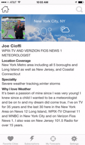
Weather App
Don’t be without Meteorologist Joe Cioffi’s weather app. It is really a meteorologist app because you get my forecasts and my analysis and not some automated computer generated forecast based on the GFS model. This is why your app forecast changes every 6 hours. It is model driven with no human input at all. It gives you an icon, a temperature and no insight whatsoever.
It is a complete weather app to suit your forecast needs. All the weather information you need is right on your phone. Android or I-phone, use it to keep track of all the latest weather information and forecasts. This weather app is also free of advertising so you don’t have to worry about security issues with your device. An accurate forecast and no worries that your device is being compromised.
Use it in conjunction with my website and my facebook and twitter and you have complete weather coverage of all the latest weather and the long range outlook. The website has been redone and upgraded. Its easy to use and everything is archived so you can see how well Joe does or doesn’t do when it comes to forecasts and outlooks.
Just click on the google play button or the apple store button on the sidebar for my app which is on My Weather Concierge. Download the app for free. Subscribe to my forecasts on an ad free environment for just 99 cents a month.
Get my forecasts in the palm of your hand for less than the cost of a cup of Joe!


