Hurricane Matthew Moving New GFS Forecast
Hurricane Matthew Moving New GFS Forecast
The latest satellite loop of Hurricane Matthew still shows a formindable hurricane with a well defined eye. The motion has been erratic in the last 24 hours after completing a counterclockwise loop. It has now begun what appears to be a wobbly slow motion to the northwest and we would expect that motion to continue tonight and Sunday. The current intensity is based on satellite estimates since there has not been a reconnaissance aircraft in Hurricane Matthew since early Saturday evening. No doubt an aircraft will be there Sunday so that we can get a true measure of intensity. Highest winds as of the 11pm advisory are 150 mph making this a strong category 4 hurricane.
If you click on the image it will show you the motion from days 5 to 7 in the long range which is for Thursday through Saturday evening. The difference in tonight’s model run from the more recent runs is that the GFS model swings the western trough to the east however the system never phases with the hurricane. The result is an offshore track to the northeast from off the Carolina coast never touching the mainland.
We have seen over the last several days models go in all sorts of directions. First it was out to sea. Then up the the coast, then out to sea, then up the coast, and now out to sea again. I want to see at least several runs or more into Monday for some sort of confirmation. Given the recent model volatility it is hard to trust one model run. We will wait for more runs Sunday and Monday. The key continues to be the strength of the trough in the west and how it interacts with Hurricane Matthew when it reaches the east coast. At least that part of this complex equation remains the same.
WINTER 2016-2017 PART 1 OCEAN WATER TEMPERATURES
WINTER 2016-2017 PART 2 ARCTIC SEA ICE AND SIBERIAN SNOW COVER
WINTER 2016-2017 PART 3 NEW JERSEY PREVIEW
WINTER 2016-2017 PART 4 EASTERN PENNSYLVANIA PREVIEW
FiOS1 News Weather Forecast For Long Island
FiOS1 News Weather Forecast For New Jersey
FiOS1 News Weather Forecast For Hudson Valley
NATIONAL WEATHER SERVICE SNOW FORECASTS
LATEST JOESTRADAMUS ON THE LONG RANGE
Weather App
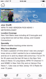
Don’t be without Meteorologist Joe Cioffi’s weather app. It is really a meteorologist app because you get my forecasts and my analysis and not some automated computer generated forecast based on the GFS model. This is why your app forecast changes every 6 hours. It is model driven with no human input at all. It gives you an icon, a temperature and no insight whatsoever.
It is a complete weather app to suit your forecast needs. All the weather information you need is right on your phone. Android or I-phone, use it to keep track of all the latest weather information and forecasts. This weather app is also free of advertising so you don’t have to worry about security issues with your device. An accurate forecast and no worries that your device is being compromised.
Use it in conjunction with my website and my facebook and twitter and you have complete weather coverage of all the latest weather and the long range outlook. The website has been redone and upgraded. Its easy to use and everything is archived so you can see how well Joe does or doesn’t do when it comes to forecasts and outlooks.
Just click on the google play button or the apple store button on the sidebar for my app which is on My Weather Concierge. Download the app for free. Subscribe to my forecasts on an ad free environment for just 99 cents a month.
Get my forecasts in the palm of your hand for less than the cost of a cup of Joe!


