
SUMMARY OF 500 PM AST...2100 UTC...INFORMATION
----------------------------------------------
LOCATION...13.0N 45.7W
ABOUT 1030 MI...1655 KM E OF THE WINDWARD ISLANDS
MAXIMUM SUSTAINED WINDS...80 MPH...130 KM/H
PRESENT MOVEMENT...WNW OR 295 DEGREES AT 10 MPH...17 KM/H
MINIMUM CENTRAL PRESSURE...990 MB...29.24 INCHES
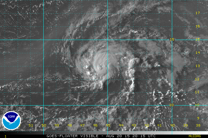
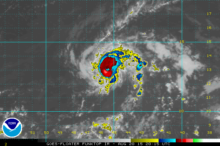
HURRICANE DANNY CONTINUES TO CRAWL ALONG TO THE WEST NORTHWEST AT ABOUT 10 MPH. Visible satellite pictures this afternoon show the hurricane holding its own and no sign of any shear around so the environment continues to remain favorable for some additional strengthening. Thunderstorms activity appeared to have increased this afternoon as the hurricane attains that more classic circular look. The eye appears on the enhanced satellite picture. Slow strengthening should continue overnight and into Friday.

Afternoon model plots are pretty tightly clusted with several of the models taking the hurricane directly over the Northern Leeward Islands and Puerto Rico while other take the system north of the island. All the plots are pretty tightly clustered as they respond to building high pressure aloft east of the Bahamas and south of Bermuda. Clearly the overland route will impact strength and it is likely the hurricane would be downgraded to a tropical storm at some point. Certainly the islands are going to on alert to the latest advisories.
 With regards to any threat down the road for the east coast please read my JOESTRADAMUS piece which addresses east coast hurricane threats and the meteorology behind it.