Humidity Rises As Warm Front Approaches,
Downpours Thunderstorms Thursday Night into Friday AM

Humidity Rises As Warm Front Approaches,
Downpours Thunderstorms Thursday Night into Friday AM
The next round of changes is getting underway and it is due to an approaching warm front that lies to the west. Clouds are over Pennsylvania back to Ohio and we are also seeing an area of rain and thunderstorms well to the west. Today will be a day of changeable sky conditions ranging from cloudy to partly sunny but we will also likely see the development of scattered downpours and the chance for an isolated thunderstorm.
SATELLITE WITH LIGHTNING STRIKES
WEATHER RADAR
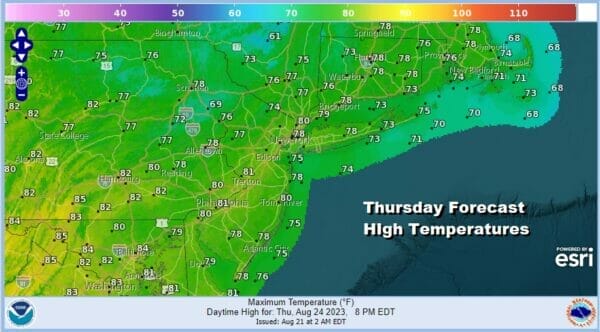
We are also going to see dew points coming up slowly today reaching the 60s from NYC west and south but holding in the 50s to the north and east. Overall it won’t be a bad day and actually in some areas it will be rather nice for awhile. High temperatures today will be in the upper 70s and lower 80s.
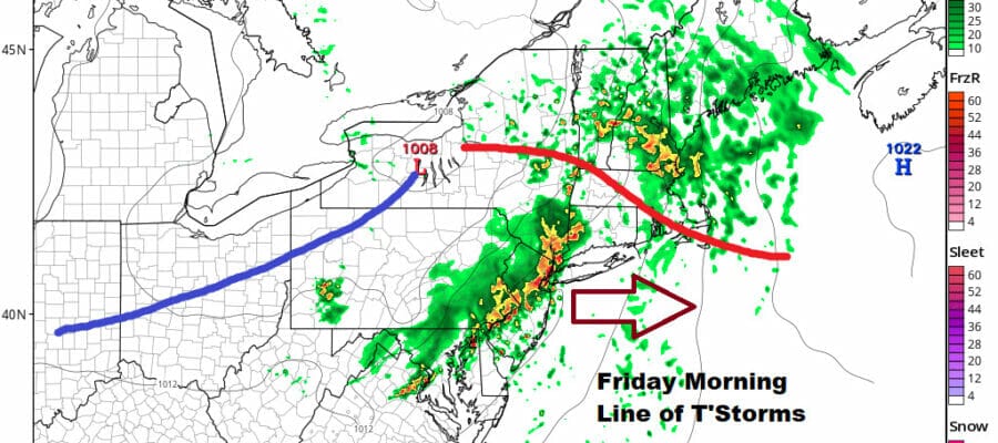
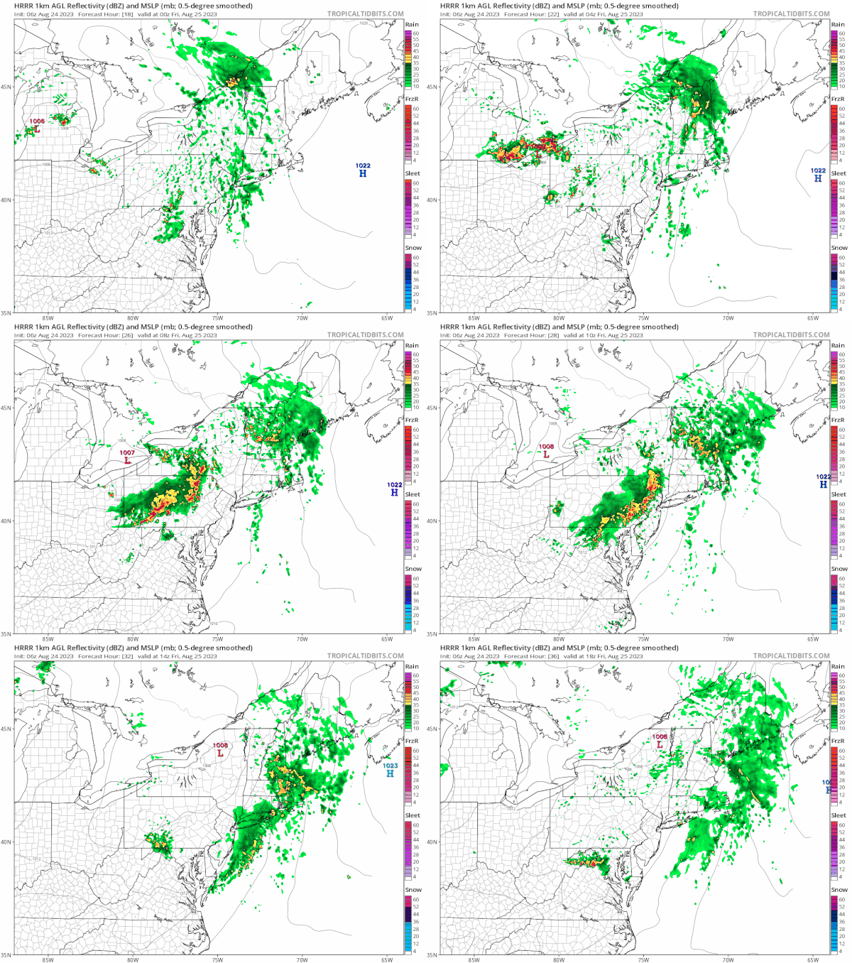
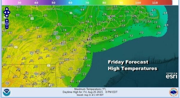
Tonight we have the warm front moving northward and it should set up a warm and humid sector from Southern New England southward to the Mid Atlantic states. The first part of tonight we won’t be see much other than scattered showers and thunderstorms but after midnight an advancing line of heavy thunderstorms will be moving southeastward, likely impacting much of the area from Eastern Pennsylvania to Southern New England during the Friday morning commute. I think we could see some isolated severe thunderstorms from this as it goes by. Once it clears, we will be left with clouds and the risk for another shower or thunderstorm later in the day Friday into Friday evening.
The outlook for the weekend has improved especially for Sunday. Saturday we will have to wait for the lingering cold front and upper trough to move through but overall it should be okay with a mix of sun and clouds and another chance for a scattered shower or thunderstorm. Highs Saturday will be in a range of 80 to 85. It will still be on the humid side for much of the day.
The front passes and weather conditions improve further from Sunday. High pressure from the Great Lakes builds in and that brings with it lower humidity arriving Saturday night. Sunday will be a very nice day of lots of sunshine, low humidity and highs in the upper 70s and lower 80s.
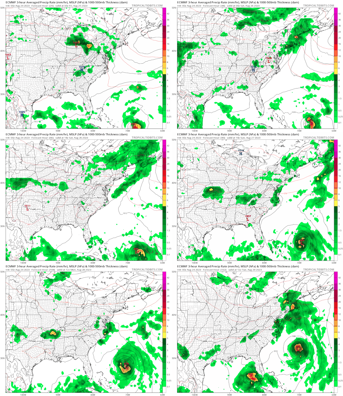
Early next week we see the next cold front making its move out of the Northern Plains and swinging east. To the south we have Tropical Storm Franklin which is forecast to strengthen to a hurricane and turn northwestward but well off the Southeast US coast. As the European model shows, this new cold front essentially creates a broad alley way for Franklin to move north, passing west of Bermuda and well east of the Carolinas, and then turning to the northeast. At the same time we have low pressures in the Caribbean and that could produce a tropical depression or tropical storm early next week that will move northward into the Eastern Gulf of Mexico This could mean issues for Florida though at the moment we are in the speculative mode regarding the potential of this particular system. Back to the Northeast the cold front coming in from the west will mean a dry Monday with slowly increasing humidity and then showers and thunderstorms being likely Tuesday as that next cold front passes. After Franklin passes to the east, it could make a close pass to Newfoundland later next week. It will also help to bring down a rather cool air mass for the second half of next week.
BE SURE TO DOWNLOAD THE FREE METEOROLOGIST JOE CIOFFI WEATHER APP &
ANGRY BEN’S FREE WEATHER APP “THE ANGRY WEATHERMAN!
MANY THANKS TO TROPICAL TIDBITS FOR THE USE OF MAPS
Please note that with regards to any severe weather, tropical storms, or hurricanes, should a storm be threatening, please consult your local National Weather Service office or your local government officials about what action you should be taking to protect life and property.
(Amazon is an affilate of Meteorologist Joe Cioffi & earns commissions on sales.)

