
Humidity Higher Thunderstorm Threat Late Today Summer Weather Continues All Week
Yesterday’s dry air has now given way to higher humidity. Clouds across the Great Lakes through Central New England mark the boundary zone so we will heat up to day to the upper 80s to around or just over 90 in some places. Sunshine will drive temperatures up and then as an upper air disturbance moves through late today into this evening there will likely be a band of thunderstorms to endure.
SATELLITE

REGIONAL RADAR

Regional radar is showing shower and some heavier downpours across Upstate NY & New England well north of I 90 and moving southeastward. Near by local radars are quiet at the moment.
LOCAL RADAR NEW YORK CITY

LOCAL RADAR PHILADELPHIA


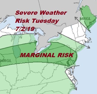
Weather models are mostly pointing to the greatest threat for thunderstorms today from NYC westward into New Jersey but I would suggest that all areas from Pennsylvania to Southern New England keep an eye to the sky for late day or evening thunderstorms. The Storm Prediction Center has increased the area of marginal risk for severe weather from New Jersey to Pennsylvania westward so we think it is wise to air on the side of caution.
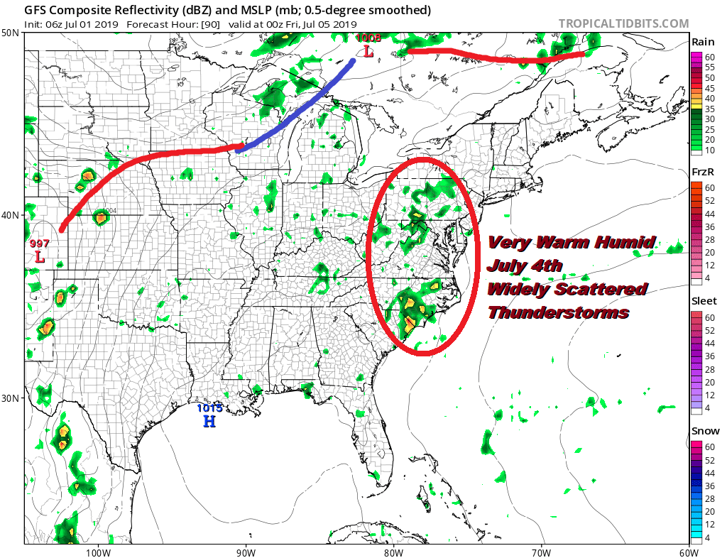
There are no changes in the outlook for Wednesday through Friday. We see very warm to borderline hot conditions each day with highs in the upper 80s and lower 90s. Humidity levels will be higher but shouldn’t get too out of hand. The chance for thunderstorms is low Wednesday and Thursday with no widespread outbreaks and just some scattered to isolated pop ups. The vast majority of you won’t see much and I don’t see any issues for 4th of July fireworks for the most part.
The next cold front approaches for Friday and Saturday so look for thunderstorm chances to increase on both days. There will still be a fair amount of dry time both days for outdoor activities. It will also still be very warm and humid into the weekend with highs in the mid 80s to some lower 90s.
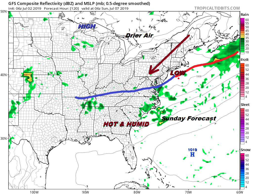
The next cold front will be moving through probably late Saturday with a weak wave passing to our south on Sunday. We are going to be fairly close to slightly drier air to the north and if we see enough sun, Sunday’s highs will be in the 80s. It also could be thunderstorm free. We will look at the weekend closely later today. If you are outdoors especially at the area beaches, just keep an eye to the sky in case thunderstorms start popping up late this afternoon.
MANY THANKS TO TROPICAL TIDBITS FOR THE USE OF MAPS
Please note that with regards to any tropical storms or hurricanes, should a storm be threatening, please consult your local National Weather Service office or your local government officials about what action you should be taking to protect life and property.


