
Hot Wednesday But A Shade Less Humid More Changes Late Week
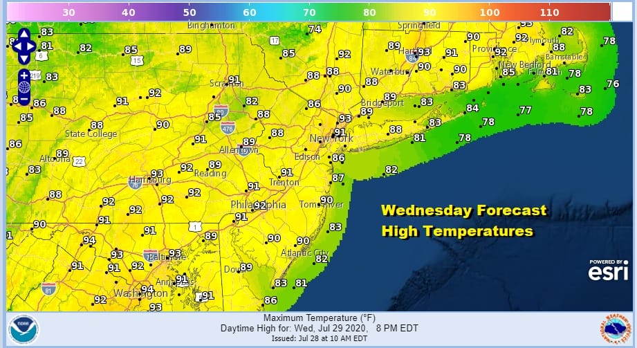
Yesterday was a perfect example of what happens when you get a weak cold front into a hot humid air mass. The answer is or was little or nothing as far as showers and thunderstorms were concerned. We are still in a hot air mass but we do catch one break today in that humidity levels will be taken down slightly this afternoon. That should make things a bit more bearable. The satellite doesn’t show much in the way of cloud cover and overnight showers and thunderstorms offshore are moving out to the east. Afternoon highs will still reach the upper 80s to some lower 90s.
SATELLITE

REGIONAL RADAR

Much of the radar activity today and for that matter the rest of the week will be along a frontal boundary that will be settling across the Middle Atlantic states. Until then we stay dry through Thursday. A warm night for tonight but temperatures should ease from oppressive nighttime levels of late. Lows will be in the upper 60s to mid 70s. Thursday look for sunshine and some clouds with another cold front late in the day. There is the chance for a shower or thunderstorm going into Thursday evening. Highs again will reach the upper 80s and lower 90s.
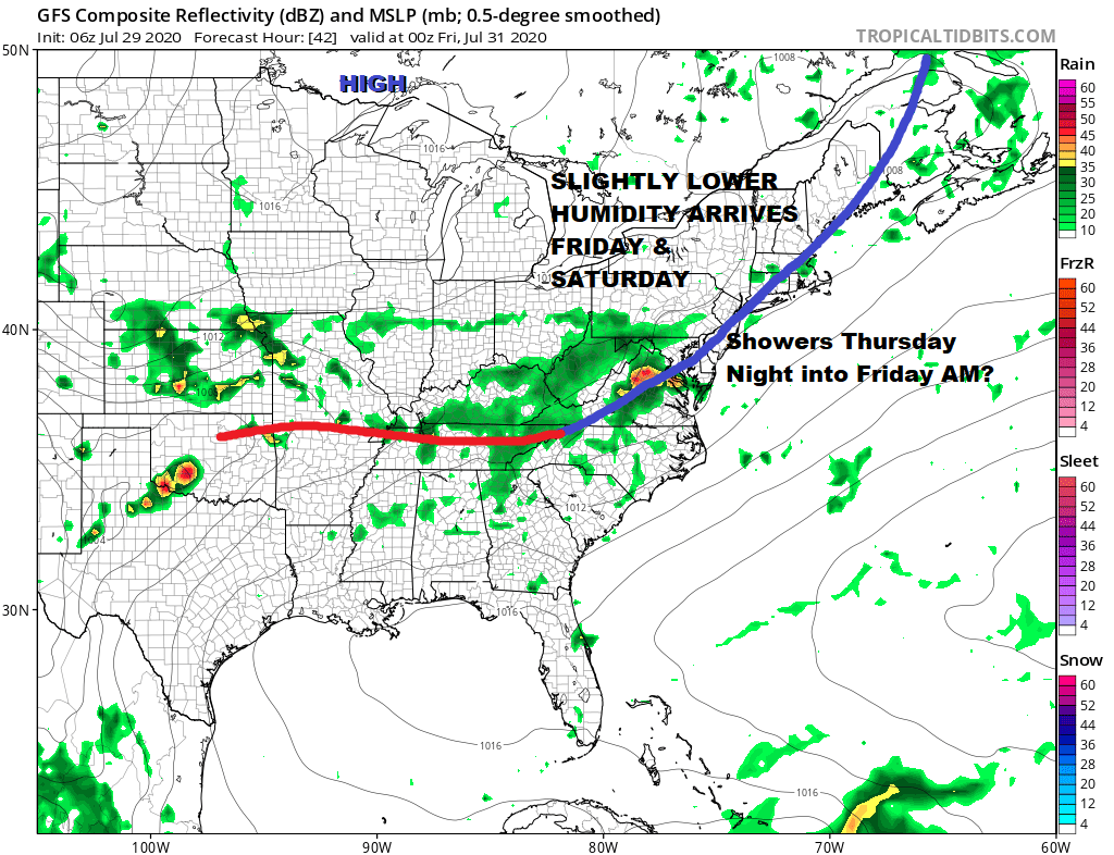
Thursday night into early Friday morning a wave develops on the front and carries through the chance for some overnight showers and thunderstorms into Friday morning before weather conditions improve later in the day. Dew points will be coming down with decreasing clouds and increasing sun for Friday. Highs will be in the 80s.

On to the weekend where there are developing big questions regarding that frontal boundary, a trough swinging across the lower Mississippi Valley and another trough coming around the Great Lakes. Let us also add the feature on the lower right which is Potential Tropical Cyclone 9 moving northwestward. There is still a lot of uncertainty regarding the long term on this system which today is moving through the Leeward Islands and heading for Puerto Rico. This could become a tropical storm today. We will be posting about this system later today and in that post we will discuss the long range weather implications (if any) in detail. We can say at this point that there are no issues Saturday with sunshine forecast and highs in the 80s. However we could see clouds and showers on Sunday as the land weather systems swing eastward regardless of whether a tropical system gets involved.
BE SURE TO DOWNLOAD THE FREE METEOROLOGIST JOE CIOFFI WEATHER APP &
ANGRY BEN’S FREE WEATHER APP “THE ANGRY WEATHERMAN!
MANY THANKS TO TROPICAL TIDBITS FOR THE USE OF MAPS
Please note that with regards to any severe weather, tropical storms, or hurricanes, should a storm be threatening, please consult your local National Weather Service office or your local government officials about what action you should be taking to protect life and property.


