
FLASH FLOOD WATCH NEW JERSEY EASTERN PENNSYLVANIA
HEAVY RAINS THIS AFTERNOON INTO TONIGHT
LINGERING SHOWERS EARLY SUNDAY
Last night we had thunderstorms well ahead of a cold front. Today we get the cold front. It will be another very warm humid day with temperatures in the 80s and then as the front approaches look for downpours and thunderstorms. The emphasis this time will be rain and flash flooding is certainly a possibility if thunderstorms decide to sit around over a given area for a period of time. Until then we will have clouds with some breaks of sunshine.
EASTERN SATELLITE

REGIONAL RADAR

Checking the radars there are some showers around this morning scattered about but the main areas of rain are to the north and to the southwest. We will start to see development to the northwest of us by early afternoon and then the area sinks southward from there.
LOCAL RADAR NEW YORK CITY

LOCAL RADAR PHILADELPHIA


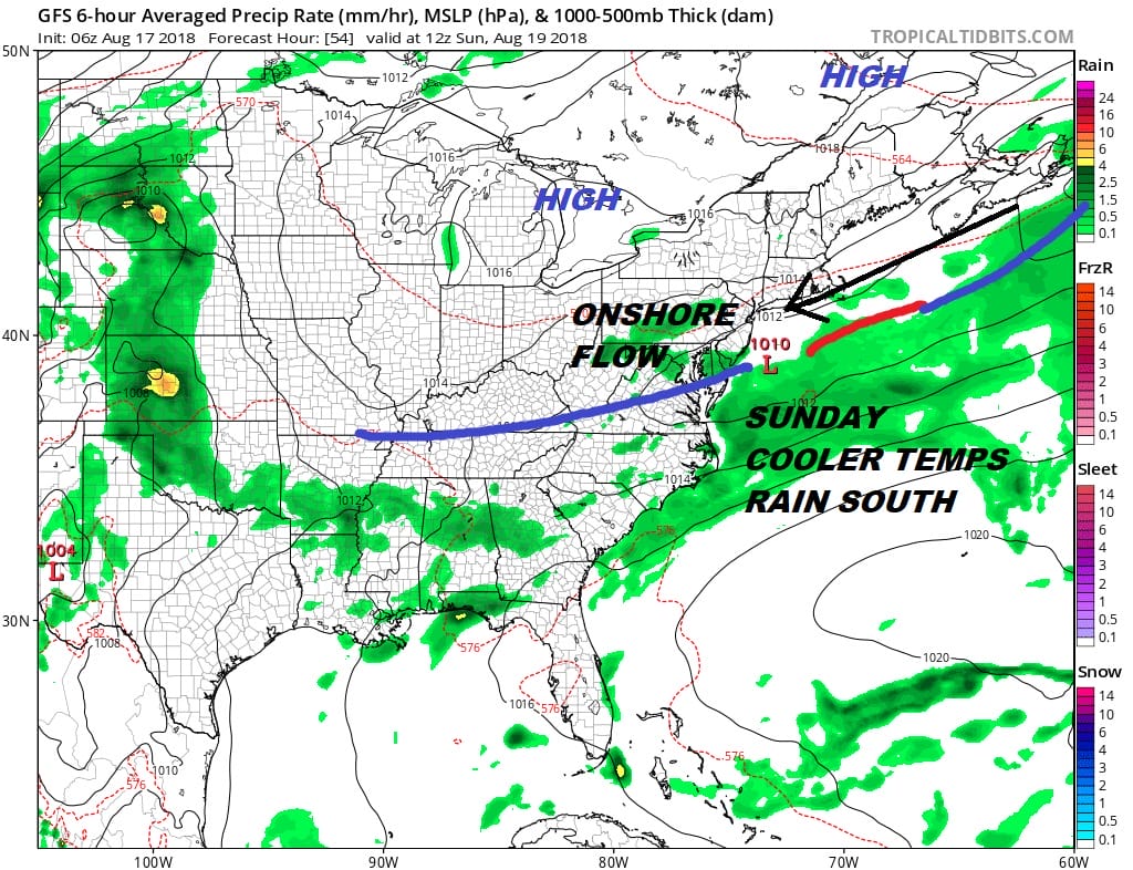
With everything moving so slowly we are likely to see showers linger around on Sunday morning early. With the front to the south and a wave offshore we will eventually see the front push further south. High pressure builds from the Canadian Maritime provinces so look for an onshore flow from the northeast. Temperatures on Sunday and Monday will be in the 70s. There is a chance we could see sky conditions improve a bit north and east of NYC later Sunday afternoon as dry air tries to come southward from New England.
The onshore flow continues into Tuesday which means clouds will dominate though rain is not likely to be an issue. Highs will be in the 70s to near 80 both days. We will start to see the front to the south come back as a warm front later Tuesday into Tuesday night so some showers and thunderstorms come back into the mix. Wednesday will be the one very warm and humid day with thunderstorms.
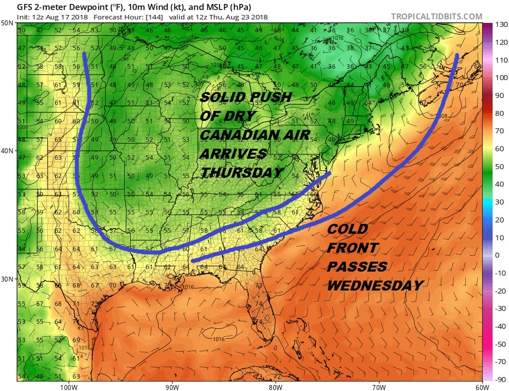
Solid humidity relief remains in the cards for Thursday and Friday. You can read more about this on JOESTRADAMUS and his latest on the long range.
MANY THANKS TO TROPICAL TIDBITS FOR THE USE OF MAPS
Please note that with regards to any tropical storms or hurricanes, should a storm be threatening, please consult your local National Weather Service office or your local government officials about what action you should be taking to protect life and property.
LATEST JOESTRADAMUS ON THE LONG RANGE


