
Heatwave Next Week Remains On Course

Heatwave Next Week Remains On Course
Regardless of what happens over the next 2 days, the heatwave weather models are indicating for early next week remains on course. In fact it may come in a little faster with 90 degree temperatures popping up on Sunday away from ocean locations. The weather pattern is flipping 180 degrees going from a deep trough in the East to a big ridge in the East.

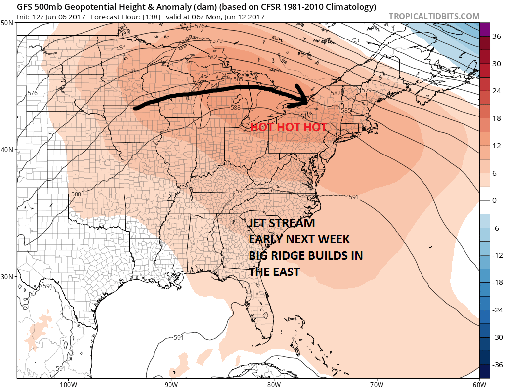
We have seen these extreme flips many times over the last 6 months or so. The difference now it seems is that the troughs in the East have been lasting longer and longer keeping it cool while the ridges seem to be lasting shorter and shorter. Right now it seems that we will be in the ridge position through Wednesday which will mean 3 or 4 days of 90 plus (depending on where you are). Of course there will be exceptions to this if you are along the shore particularly south facing shorelines like Long Island but the areas below 90 will probably be confined to the immediate coast.
HEATWAVE MONDAY FORECAST 2PM TEMPERATURES

HEATWAVE TUESDAY FORECAST 2PM TEMPERATURES
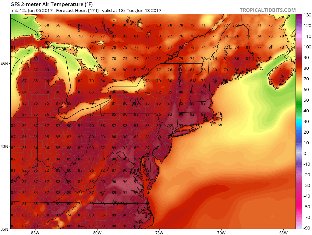
Monday and Tuesday look like the 2 hottest days with some spots hitting the mid 90s. Other than an isolated thunderstorm it should by dry until later Wednesday when we may have a higher chance for thunderstorms as the next weather front approaches. There are hints that troughing could return to the east in some form during the latter part of June but it is a bit too early to speculate on that prospect.
MANY THANKS TO TROPICAL TIDBITS FOR THE WONDERFUL USE OF THE MAPS

GET JOE A CIGAR IF YOU LIKE!
LANDSCAPE COMPANIES FOR YOUR SPRING SUMMER FALL NEEDS
LONG ISLAND ROCKLAND COUNTY Connecticut

![]()

ROCKLAND COUNTY TRI STATE SNOW REMOVAL JOHNSTOWN PA


FiOS1 News Weather Forecast For Long Island
FiOS1 News Weather Forecast For New Jersey
FiOS1 News Weather Forecast For Hudson Valley
NATIONAL WEATHER SERVICE SNOW FORECASTS
LATEST JOESTRADAMUS ON THE LONG RANGE
Weather App

Don’t be without Meteorologist Joe Cioffi’s weather app. It is really a meteorologist app because you get my forecasts and my analysis and not some automated computer generated forecast based on the GFS model. This is why your app forecast changes every 6 hours. It is model driven with no human input at all. It gives you an icon, a temperature and no insight whatsoever.
It is a complete weather app to suit your forecast needs. All the weather information you need is right on your phone. Android or I-phone, use it to keep track of all the latest weather information and forecasts. This weather app is also free of advertising so you don’t have to worry about security issues with your device. An accurate forecast and no worries that your device is being compromised.
Use it in conjunction with my website and my facebook and twitter and you have complete weather coverage of all the latest weather and the long range outlook. The website has been redone and upgraded. Its easy to use and everything is archived so you can see how well Joe does or doesn’t do when it comes to forecasts and outlooks.
Just click on the google play button or the apple store button on the sidebar for my app which is on My Weather Concierge. Download the app for free. Subscribe to my forecasts on an ad free environment for just 99 cents a month.
Get my forecasts in the palm of your hand for less than the cost of a cup of Joe!
![]()
