Heatwave Lasts into Sunday Excessive Heat Thursday Through Saturday

Heatwave Lasts into Sunday Excessive Heat Thursday Through Saturday
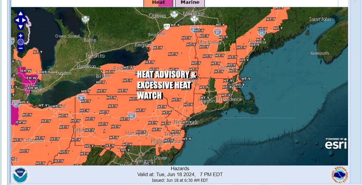
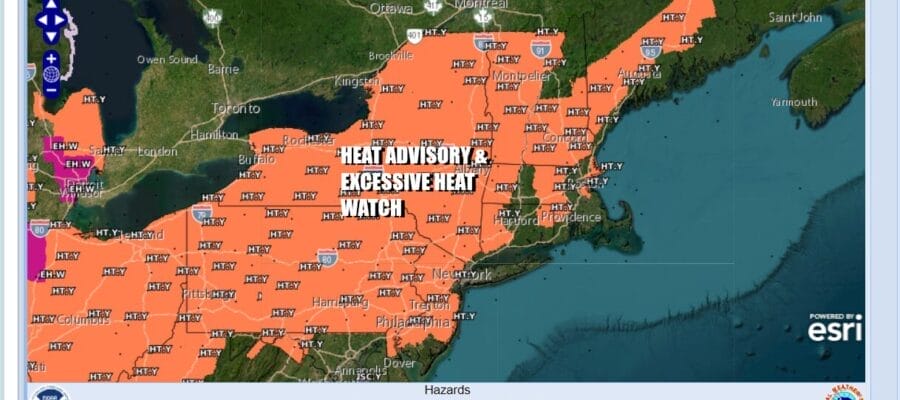
Heat advisories are up and we also have excessive heat watches up with the hottest weather from this heatwave being the stretch from Thursday through at least Saturday. it is a rather straight forward forecast for the next several days as we have a strong ridge of high pressure aloft building into the Eastern US and it will reach peak strength Wednesday and Thursday over the Northeast.
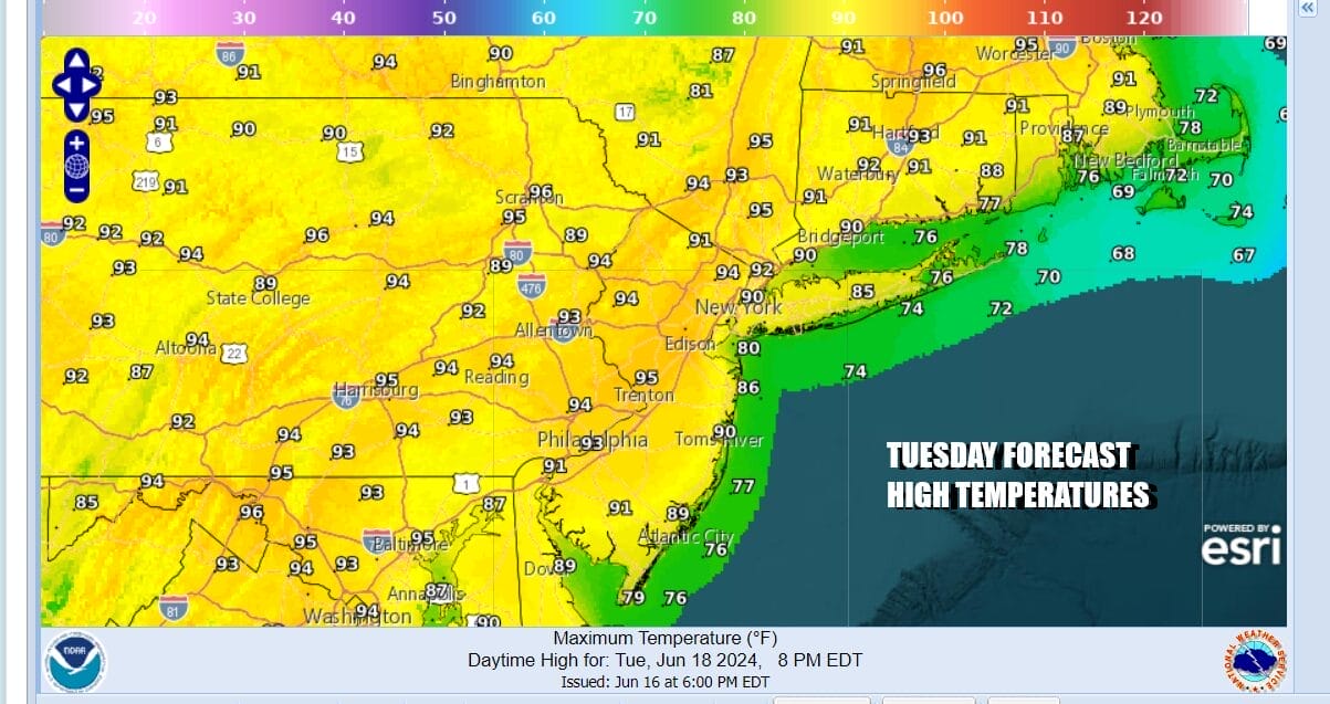
Skies are mainly clear on satellite loops. As for thunderstorm activity there may be some scattered thunderstorms late today into tonight but you will have to go north of Route 84 in the Hudson Valley and the Catskills to find them. We will see lots of sunshine and temperatures that will top out mostly in the lower 90s though 1 or two hot spots could push those numbers to 94 or 95, Humidity today is much higher than it has been in past days so there will be discomfort felt by most people.
SATELLITE WITH LIGHTNING STRIKES

WEATHER RADAR

The heat and humidity will build over the next several days and the humidity will be quite high as dew points reach the upper 60s to around 70. Tonight will be warm with most lows in the mid 60s to lower 70s except for the warmest urban areas which could bottom closer to 75. Wednesday will be a day of sunshine and hot temperatures with widespread highs in the mid 90s.
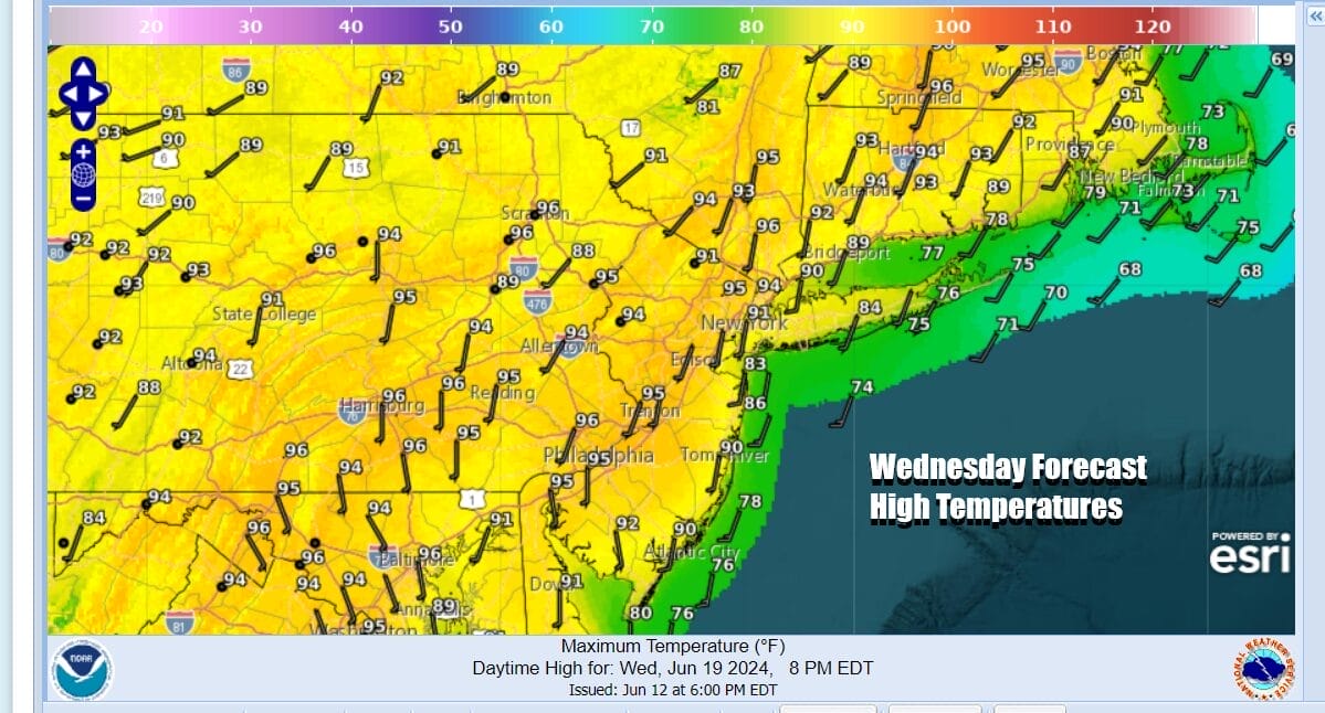
You will be able to catch relief along the shore as a south wind off the cooler ocean will hold temperatures down at the shore but those sea breezes will have a tough time moving inland. Thursday through Saturday we will be very hot and very humid. We will throw in the chance for some isolated thunderstorms developing from the daytime heating in the late afternoon and evening but they will be few and far between..
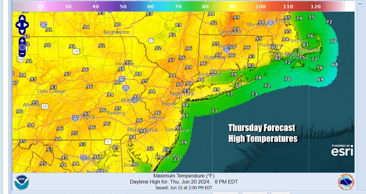
Starting Thursday we could see some hot spots reach the 100 degree mark but most highs will be in the mid to upper 90s. Temperatures will be a little lower on Long Island but it will still be hot there as well. Of course the beaches will offer sea breeze relief during the afternoon and evening hours.
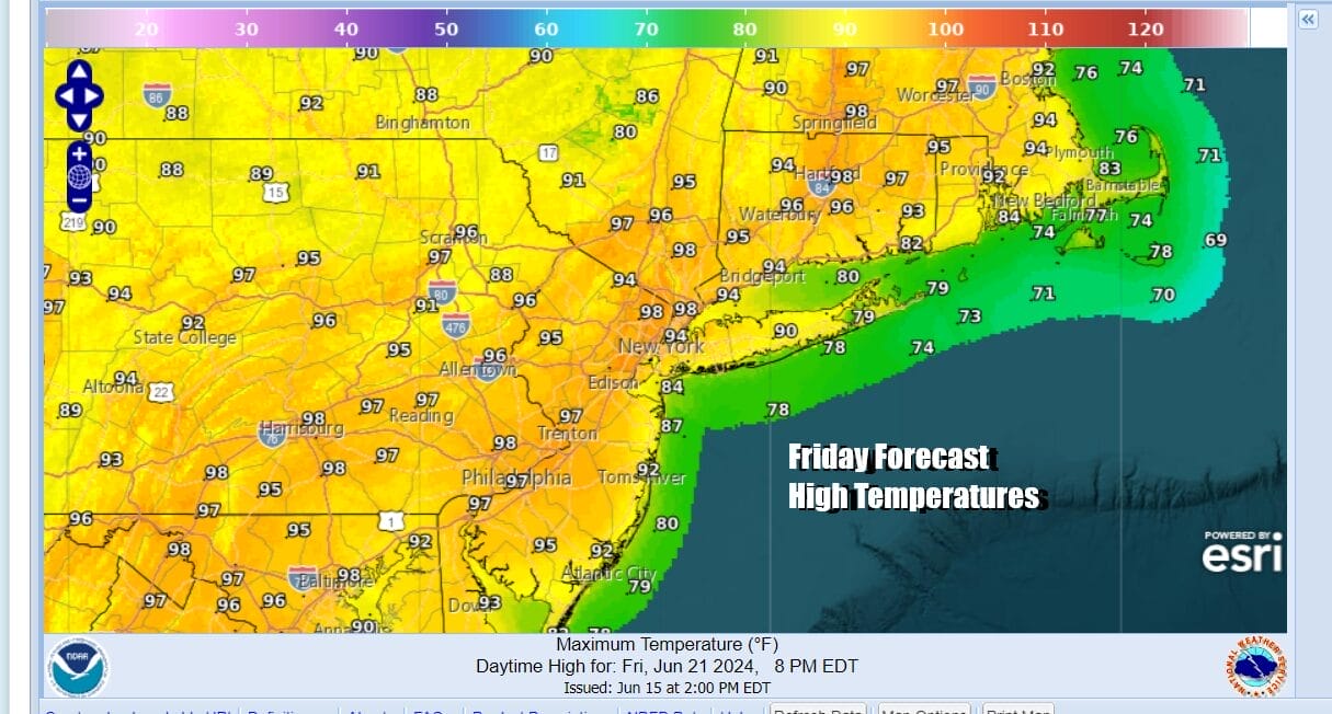

Sunday should be the last day of 90 degree plus highs as a cold front will finally be able to approach and we see the upper ridge breaking down allowing this to happen. Sunshine will be around into the afternoon but we see the increasing chance for showers and thunderstorms late in the day Sunday and Sunday night. If the approaching upper trough is supportive, we may see some severe weather risks with the approaching system. Next week we will see temperatures ease from the very hot levels but it will still be very warm and the humidity levels might ease for a day or two.
BE SURE TO DOWNLOAD THE FREE METEOROLOGIST JOE CIOFFI WEATHER APP &
ANGRY BEN’S FREE WEATHER APP “THE ANGRY WEATHERMAN!
MANY THANKS TO TROPICAL TIDBITS FOR THE USE OF MAPS
Please note that with regards to any severe weather, tropical storms, or hurricanes, should a storm be threatening, please consult your local National Weather Service office or your local government officials about what action you should be taking to protect life and property.
(Amazon is an affilate of Meteorologist Joe Cioffi & earns commissions on sales.)


