ANOTHER HOT BAD HAIR STRETCH INTO SATURDAY
SEVERE WEATHER RISK FRIDAY EVENING
ONSHORE FLOW DEVELOPS SUNDAY
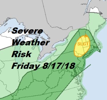
The Storm Prediction Center from the National Weather Service has raised the risk for severe weather Friday evening. We have a slow moving approaching cold front and another day ahead of us with hot temperatures and high humidity. The atmosphere looks to be very unstable Friday evening so bear this in mind if you have getaway travel plans for Friday. We should have no issues with thunderstorms through most of Friday and certainly no issues for the rest of Thursday and overnight.
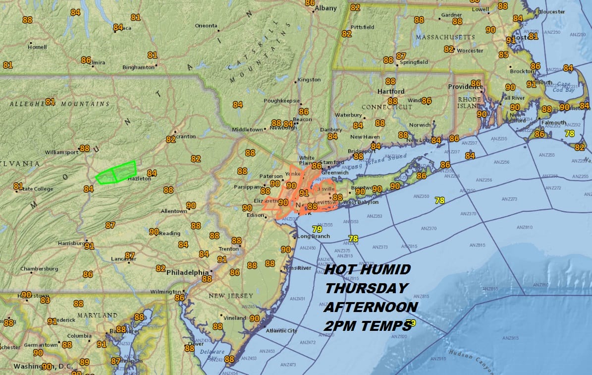
Temperatures are hovering around the 90 degree mark with plenty of sunshine making for another good beach day for all. Humidity levels are high however and it is rather uncomfortable outside. Look for a warm humid night with most lows in the upper 60s to middle 70s. Nothing more than a few passing clouds are forecast. Some high clouds have been streaming southeastward over parts of New Jersey and Pennsylvania as they blow off from thunderstorms in the Ohio Valley. Radars are quiet nearby and other than an odd pop up inland it should remain quiet.
EASTERN SATELLITE

REGIONAL RADAR

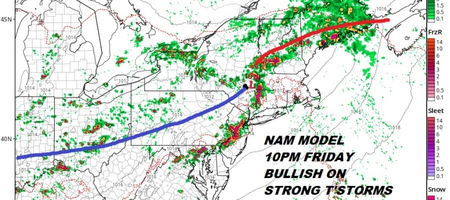
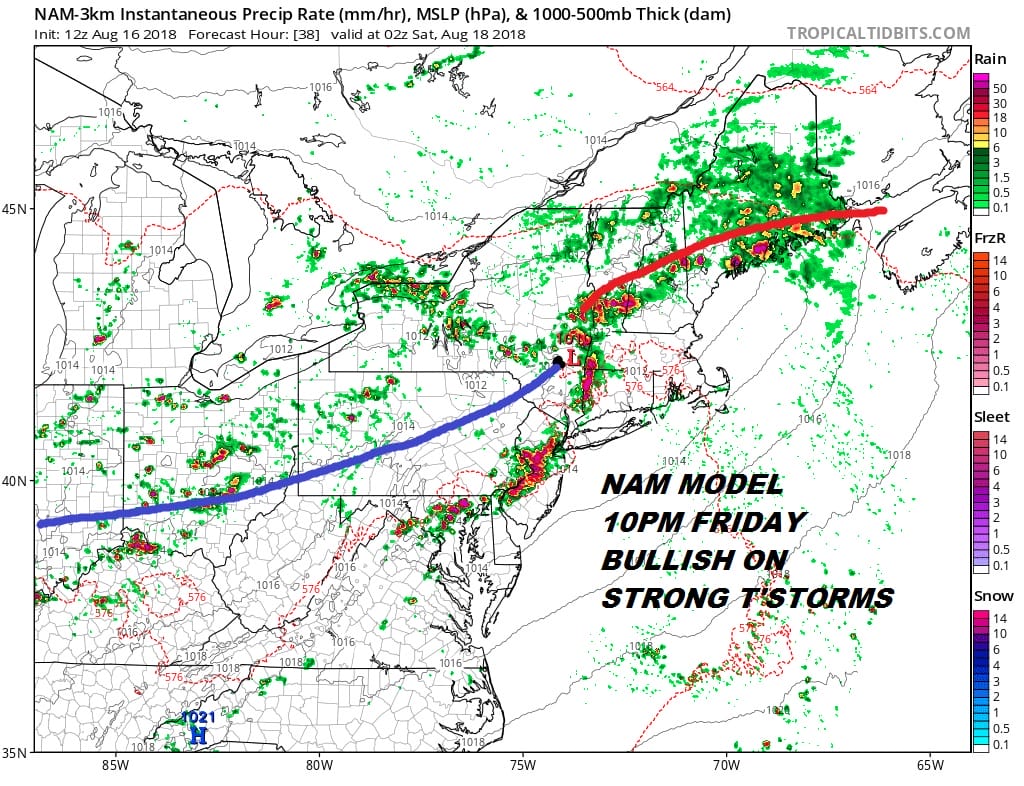
Late Friday afternoon and evening we will be looking for some thunderstorms to develop. The NAM models are especially bullish on strong cell development especially over Eastern Pennsylvania & New Jersey. The cells seem to weaken as they move eastward across NYC & Southern New England but the models certainly justify the risk for Friday evening.
The front slows down and will take all day to pass through on Saturday. That means another day of very warm and humid conditions and the likelihood for some thunderstorms later in the day into Saturday evening. Temperatures will be in the 80s to near 90 with high humidity. The front will slow further as it moves by. An onshore flow develops Sunday and that is going to put us in lots of clouds with temperatures in the 70s. A wave on the front will have some rain close by so we will need to watch it to see if it brushes some areas with rain Sunday. Right now we will lean against it but the onshore flow will continue on Monday with cloudy skies and highs again only in the 70s.
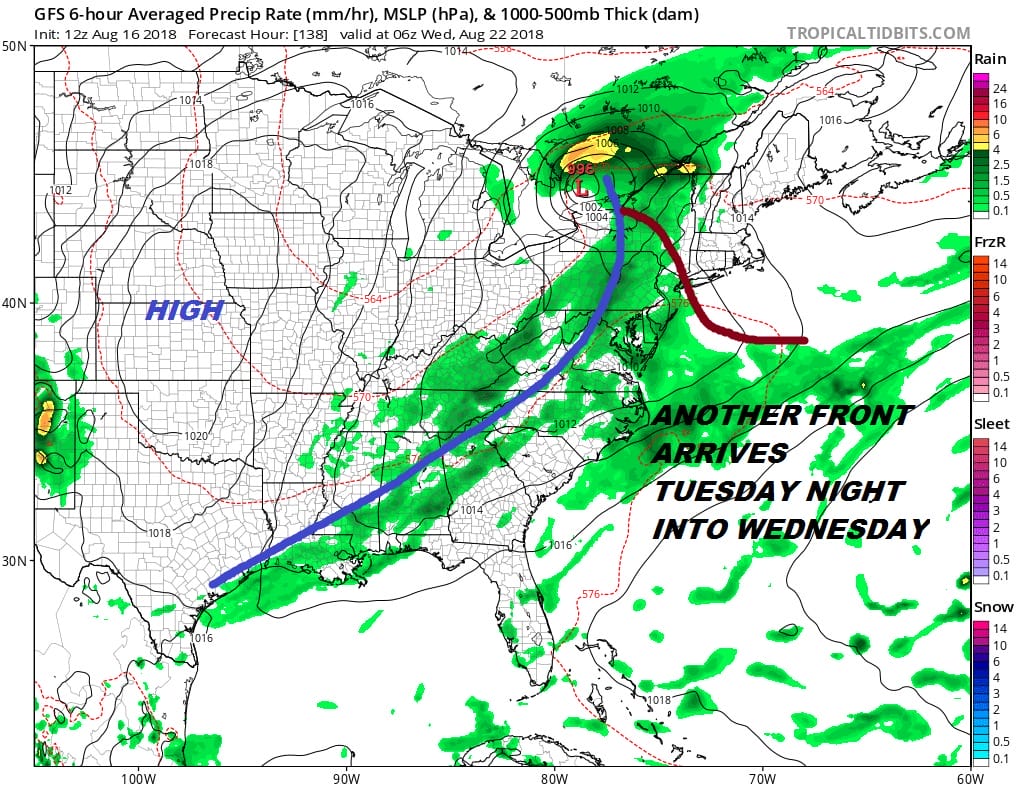
Another front approaches Tuesday with a warm front trying to push northward. We will transition to warmer more humid conditions and there will likely be some thunderstorms Tuesday night into at least part of Wednesday. Then high pressure builds in with a bit of a break in the humidity.
MANY THANKS TO TROPICAL TIDBITS FOR THE USE OF MAPS
Please note that with regards to any tropical storms or hurricanes, should a storm be threatening, please consult your local National Weather Service office or your local government officials about what action you should be taking to protect life and property.
LATEST JOESTRADAMUS ON THE LONG RANGE


