Happy Thanksgiving No Rain Until Sunday Night
Cold Friday Night Into Sunday Morning

Happy Thanksgiving No Rain Until Sunday Night
Cold Friday Night Into Sunday Morning
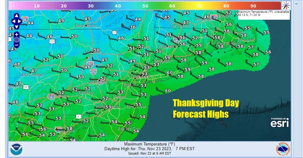
Happy Thanksgiving to all on what is a nice Thanksgiving day. We no storms and no rain or snow to worry about today and it will be dry from now until Sunday evening when the next cold front and storm system heads our way from the west and south. Other than some passing clouds we will have a good deal of sunshine this afternoon and afternoon highs will reach into the 50s in most places. Radars are nice and quiet and we have no issues whatsoever other than a west wind that will ease as the day wears on.
SATELLITE WITH LIGHTNING STRIKES

WEATHER RADAR

There is a cold front moving through the Great Lakes that will pass tonight and offer nothing more than a wind shift to the northwest. Colder air from Canada will be spreading east and that will take temperatures down for the next couple of days. Skies tonight should be mainly clear other than some passing clouds with most lows in the 30s.
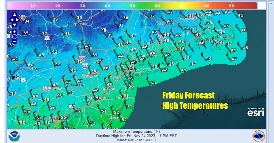
Large cold high pressure over the Plains will build eastward funnelling cold air southward from Canada Friday. We will have some sunshine and breezy conditions and it will be colder with highs mostly in the upper 40s to a few lower 50s. Then we head south temperature wise Friday night leading to a cold Saturday morning with lows in the 20s just about everywhere.

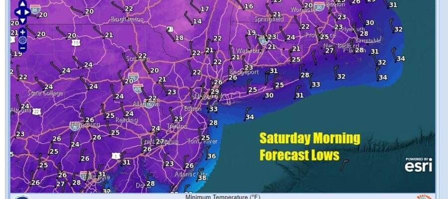
Saturday will be the coldest day of the autumn season so far with plenty of sunshine. However temperatures will struggle and many areas we will see high temperatures not get out of the 30s. This will lead to another cold night for Saturday night into Sunday morning and lows again will be in the 20s to around 30 or so.
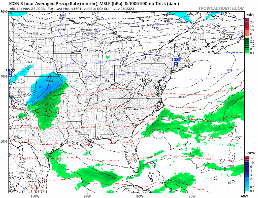
After a very cold start, Sunday we will see sunshine giving way to arriving clouds. We have a cold front swinging east from the Great Lakes and Ohio Valley and a developing low moving up the coast from the Carolinas. The dayside Sunday will be dry with highs in the 40s and we should see some rain Sunday night as the low develops offshore and the front passes through. The low strengthens in Eastern Canada and another cold dry air mass builds in for the fist half of next week. No major storms are on the horizon for the time being.
BE SURE TO DOWNLOAD THE FREE METEOROLOGIST JOE CIOFFI WEATHER APP &
ANGRY BEN’S FREE WEATHER APP “THE ANGRY WEATHERMAN!
MANY THANKS TO TROPICAL TIDBITS FOR THE USE OF MAPS
Please note that with regards to any severe weather, tropical storms, or hurricanes, should a storm be threatening, please consult your local National Weather Service office or your local government officials about what action you should be taking to protect life and property.
(Amazon is an affilate of Meteorologist Joe Cioffi & earns commissions on sales.)


