A Cold Weekend Rain Arrives Late Sunday into Early Monday,
More Cold Follows

A Cold Weekend Rain Arrives Late Sunday into Early Monday,
More Cold Follows
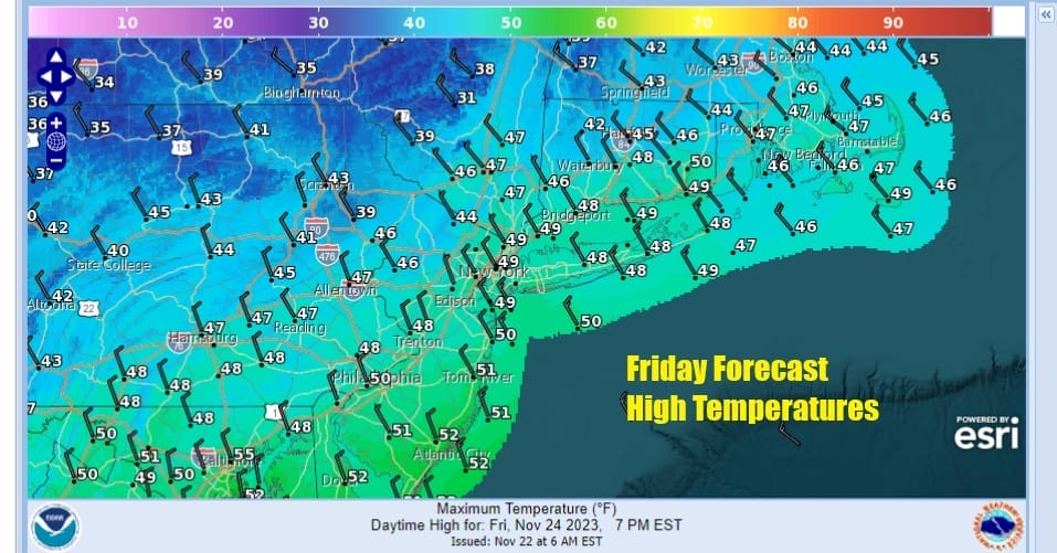
The Thanksgiving holiday weekend continues and that means travelers, tourists, and shoppers going from one place to another. We see a colder air mass building in from the Plains and Great Lakes and north northwest winds will put a cap on temperatures today. The colder air is not arriving in one big rush but rather it is a slow bleed down. Sunshine with some patchy clouds today and the wind will keep temperatures mostly in the 40s to perhaps near 50 degrees in the warmest spots.
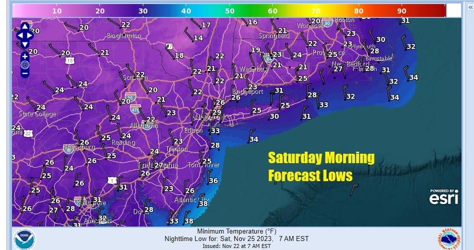
Tonight skies will become mostly clear and it is going to be the coldest night of the season area wide. Saturday morning lows will be in the low to middle 20s inland while the warmest urban locations will bottom in the mid to upper 20s.
SATELLITE WITH LIGHTNING STRIKES

WEATHER RADAR

Saturday will be a cold but dry day as high pressure continues to hold firm. In spite of all the sunshine we see Saturday it will be ineffective sunshine as temperatures will probably not get out of the 30s. Then with clear skies Saturday night, Sunday morning lows will once again be mostly in the 20s.


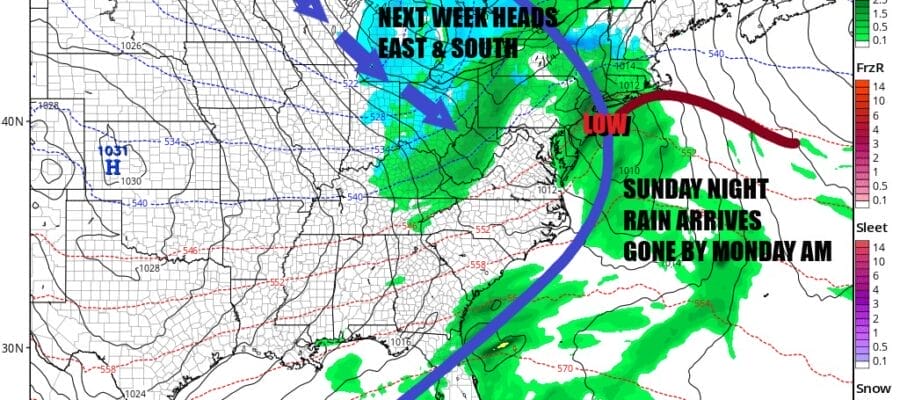
On to Sunday which will be a day of sunshine giving way to arriving clouds. We have a cold front moving eastward from the Great Lakes and Ohio Valley with colder air behind it. We also have a weak low that forms off the Carolinas and moves northeastward. Temperatures Sunday will be in the 40s for highs.

Rain will arrive from west to east Sunday evening. The cold front will see its showers enhanced by the coastal low as that low moves northeast and passes south of Long Island and east of New Jersey. The front is moving along at a good clip so that should sweep the low offshore and the rain should be mostly done by Monday morning.

Once the cold front passes, weather conditions will improve during Monday but we do have colder air coming for most of next week with below average temperatures. Monday we will see highs in the 40s to around 50 with some sunshine. Colder air will gradually bleed southeastward from Canada again so we will see a cold Tuesday morning in the 20s and a cold Tuesday afternoon with highs in the 30s. Tuesday will also be a day of some sunshine, Both days will feature a gusty northwest wind. Below average temperatures will be with us for much of next week but little if any rain or snow is forecast.
BE SURE TO DOWNLOAD THE FREE METEOROLOGIST JOE CIOFFI WEATHER APP &
ANGRY BEN’S FREE WEATHER APP “THE ANGRY WEATHERMAN!
MANY THANKS TO TROPICAL TIDBITS FOR THE USE OF MAPS
Please note that with regards to any severe weather, tropical storms, or hurricanes, should a storm be threatening, please consult your local National Weather Service office or your local government officials about what action you should be taking to protect life and property.
(Amazon is an affilate of Meteorologist Joe Cioffi & earns commissions on sales.)


